Eleanor Hughes explores the King Country and discovers a wealth of unexpected delights for fellow motorhomers and caravanners
In the remote King Country, 47km north of Taumarunui, we soaked in the views as we drove along the paddock-lined rural Ongarue Stream Road in Waimiha, on the way to our destination of Endean’s Mill.
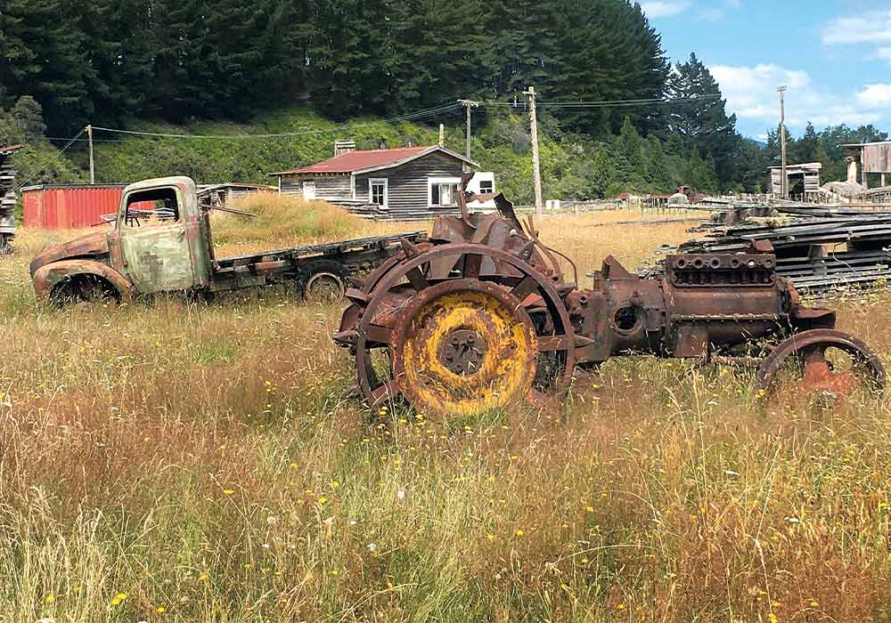
Greeted by a ghost town of acres of knee-high grassed flat land, scattered with weathered, wooden buildings and rusting vehicles, the sight was quite something and hinted at the history of this once prolific mill.
Apparently New Zealand’s last intact native timber mill, it’s situated on Ongarue Stream Road and was moved here from Matiere in 1927. It closed in 1996, when it was owned by George Ottaway who passed away in 2018.
The vast property is now owned by his brother, Ian Ottaway, and a neighbouring farmer Gerard Beeson. Ian worked in the mill as a yard hand growing up, so knows every inch of the property well. Gerard has lived next to the mill for more than 40 years and has farmland throughout the region. The pair run tours to help raise funds to maintain the mill and remaining cottages. Ian’s daughter-in-law Nickie Mouncey met us for our 10am tour, continuing a family tradition of honouring the legacy of this mill.
As well as attracting history buffs and tourists, it’s a popular site for photographers to showcase the landscape of patinaed vehicles, weathered wooden homes, and wildlife.
Wandering Endean’s Mill
The property is peppered with an assortment of tram lines and bogies, vehicles, drying sheds, mill worker houses, and stacked processed native timber, as well as the hulking steam engine that originally powered the mill.
Wooden skids head towards the road where trucks once dropped mainly matai, rimu, and totara logs. Corroding chains, once part of the pulley system that hauled the logs up to the two rusting, vertical circular saws give a glimpse into what life would have been in this mammoth operation. Despite the now wonky wooden platform, I could imagine logs screaming through them.
Sawdust litters the ground, trolleys used to convey milled logs stand on rusted tracks, and wood lies abandoned. Old photos of the mill in its heyday in the 1930s–1960s, the boom time for timber, show a changing landscape. Stacks of milled wood covered acres, and beyond this lay workers’ houses, tennis courts and even a school.
The now rusting, lop-sided furnace provided steam for the mill to run until electricity took over in the 1960s. Water drips from a water tank, still fed from a spring. An anvil remains in the saw doctor’s room where huge circular saws were sharpened. Between the mill and the road, a rusting mill truck’s chrome shines, the gearstick covered in lichen.
Over the road, we peered through the mill office’s windows – a safe door where wages were kept lies open. Yellowed paperwork covers a desk, 1950’s calendars adorn walls, and short planks of wood stacked, used to tally how much wood was in the mill, which was later translated onto paper.
Beyond the office a few homes remain, some windows broken, floorboards missing, some skewwhiff. We cautiously entered several. Dated wallpaper covers older layers, scrim showing in others; colour schemes are garish. Money raised from tours goes towards helping keep these buildings from deteriorating further.
Vehicles including a Bedford ute, Ford Prefect, and Hudson Terraplane sit abandoned. In fact, Mother Nature is slowly taking control, with a tree growing outwards from a Trader truck flatbed. The tractors now sit lopsided on metal wheels with their removable lugs still attached. Photographers apparently particularly love the winter scenes when green moss contrasts with red rusting vehicles.
A well-spent and well-informed two hours later, we return to SH30 and head through the rolling countryside for Te Kūiti, a further hour’s journey.
Te Kūiti
On the town’s main road, Carroll Street, a larger-than-life bronze sculpture of Colin Meads dwarfs me outside the isite, which is also home to The Gallagher Meads Brothers Exhibition.
Having grown up on a farm just south of Te Kūiti, it tells of Colin and Stan Mead’s All Black history, Colin playing from 1957 to 1971, Stan in the mid-1960s. Included are family, team, and rugby tour photos, letters from Colin while on tour, tour blazers, and rugby jerseys from around the world. Even as a non-rugby fan, I enjoyed it.
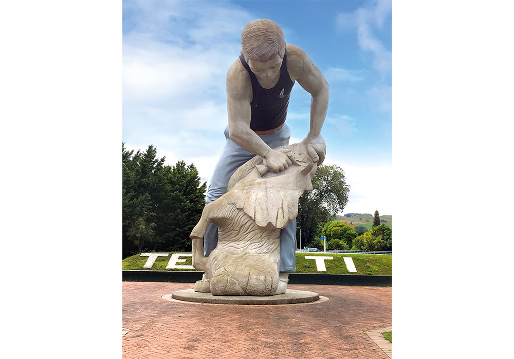
Equally iconic is the Te Kūiti sheep shearer statue, a nod to the town’s moniker as the world’s shearing capital and a proud recognition of being home to Sir David Fagan, one of New Zealand’s greatest shearers (having set 10 world records).
If you’re planning a visit, consider timing your arrival to take in the Great NZ Muster (held in April), which also aligns with the New Zealand National Shearing Championships – quite a sight to behold.
Piopio overnight
Late afternoon, we drove 20 minutes to Piopio to park at the Kiwi Cash camp in Tui Park. Staying there requires a $5 yellow tag and then loading funds onto the associated account. Having purchased the tag at Te Kūiti’s isite, we hooked into power at the camp’s shelter, which had a sink, table, and library. Camp fees were $5, hot water in the shelter 50 cents for five minutes’ worth, and showers $2. All were paid for using the tag on an electronic scanner.
A wander just before dusk along Piopio’s deserted main street brought us to a building housing a replica of New Zealand’s first school bus, along with photos of the original servicing Piopio District High School in 1924.
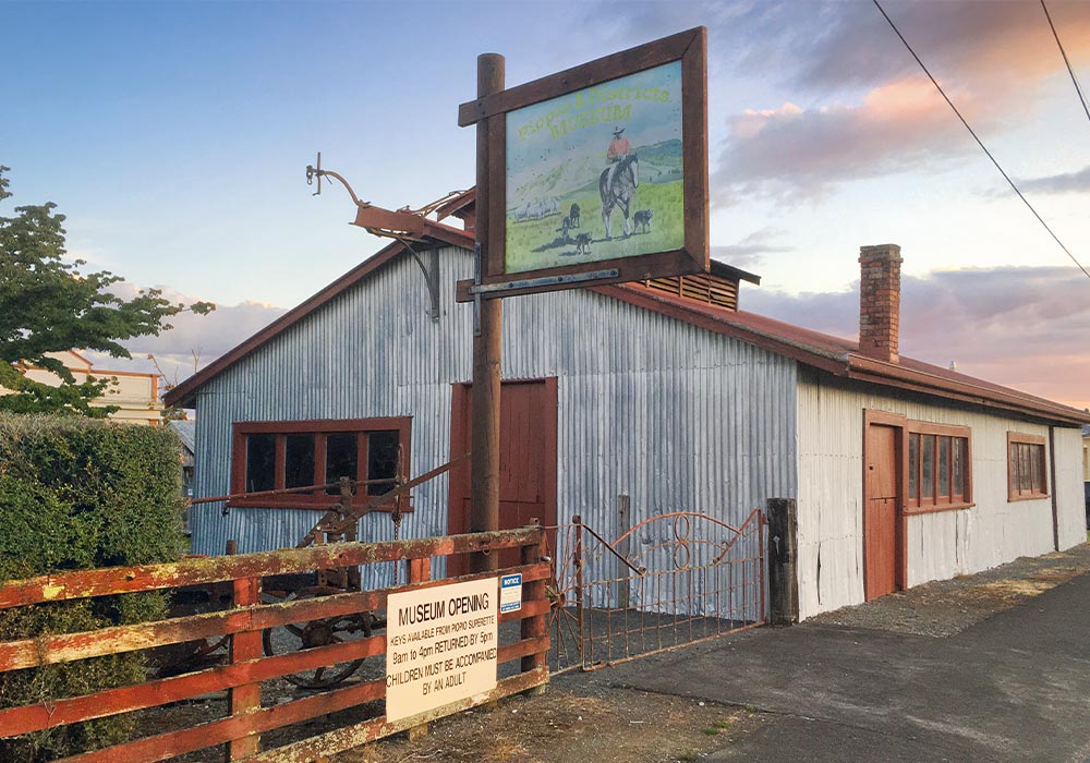
Piopio Superette, on the corner of Ruru Street, holds a key to Piopio and District Museum on the same road, which we collected the next morning. The museum consists of an original, corrugated iron blacksmith’s shop where a forge, tools, saddles, and wooden wagons are displayed. The two-bedroom, four-roomed, corrugated iron blacksmith’s cottage, curtains in place of doors, is furnished with household items from the 1930s to the 1970s, the kitchen table set for a meal. In contrast, the wooden Settler’s Hut is sparse: a bed, fireplace, and wooden boxes used for storage. The old Bank of New Zealand building displays early photographs of the area. A fourth building has a range of early 1900s items from crosscut saws to household implements.
Also worth visiting in Piopio on the main street is Fat Pigeon Café, with an amazingly mouthwatering menu and an unexpected offering of homewares and gifts.
Mangaōtaki Road
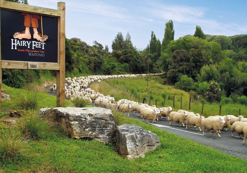
The next leg of our journey was Waitanguru Falls on Mangaōtaki Road, a 15-minute drive. Green rolling countryside was punctuated by bare, soaring limestone cliffs, large, scattered boulders, and karst-like formations. Hairy Feet, a Hobbit location tour, is run from a farm on Mangaōtaki Road. Scenes from The Hobbit: An Unexpected Journey were filmed there. Call ahead to book a tour as they don’t run every day. We hadn’t thought to, so missed out.
Farm owners Warrick and Suzie Denize are the third generation of the Denize family on this stunning property, which is dominated by enormous limestone cliffs. The guided tour includes the hidden valley location, which featured as Trollshaws Forest.
It’s also worth making time to explore the tiered Waitanguru Falls Walk, an easy 225-metre walk on a bush track and viewed from a platform. Check the DOC website however for any updates about conditions or erosion.
Return to Te Kūiti
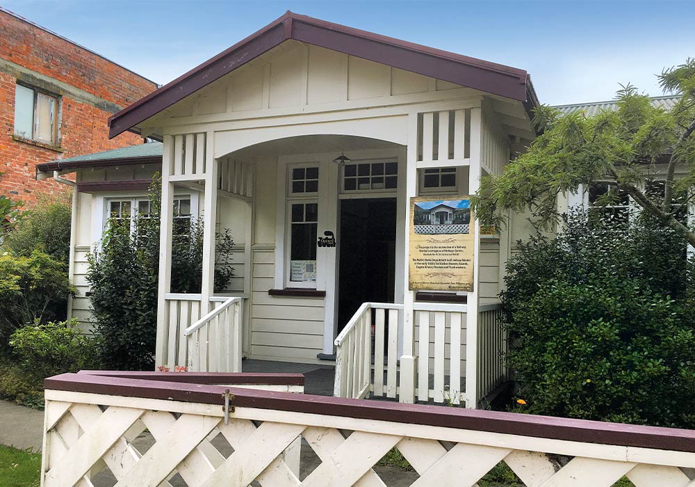
On returning to Te Kūiti’s main street, we wandered the restored Railway Worker’s Cottage, built in 1928 from native timbers. The cottage, with a verandah, is larger and more elegantly furnished than Piopio’s blacksmith’s cottage, with a scullery, separate kitchen, sitting room, and dining room.
Down the road, Te Kūiti Museum is packed with displays. Mini shopfronts with items sold in the early 1900s represent businesses long gone: R Fenton – jeweller, J M Albrechtsen – butcher, grocer, and chemist. There’s information on the timber, shearing, and Waitomo limestone industries, local entertainment memorialised in photos of highland pipe bands, silver bands, and orchestras, local Māori history, a returned serviceman’s story, details of the railway line from Ōtorohanga to Te Kūiti opened in 1887, and more.
Ōtorohanga
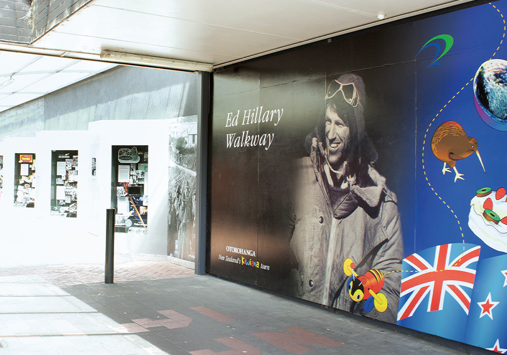
The next town on our itinerary was northwards to Ōtorohanga, where we arrived late afternoon. The Ed Hillary Walkway, an arcade off its main street, evoked many memories, and for almost 30 minutes, we perused panels displaying New Zealand icons such as the pavlova, Weet-bix, and Chesdale Cheese. There’s Sir Peter Blake and the America’s Cup, Sir Ed Hillary, the All Blacks, Silver Ferns, Kiwi slang, early school days, New Zealand music, and plenty more to reminisce over.
Ōtorohanga also offers the Ōtorohanga Kiwi House, dedicated to conserving this special native bird of New Zealand. Interestingly, this experience also includes a native bird park and New Zealand’s largest free-flight dome aviary, as well as the chance to see the tuatara, a native reptile (which pre-dates dinosaurs).
Waitomo
Backtracking south on SH3, we turned westwards to spend the night at Waitomo Top Ten Holiday Park, located in the heart of Waitomo Caves Village.
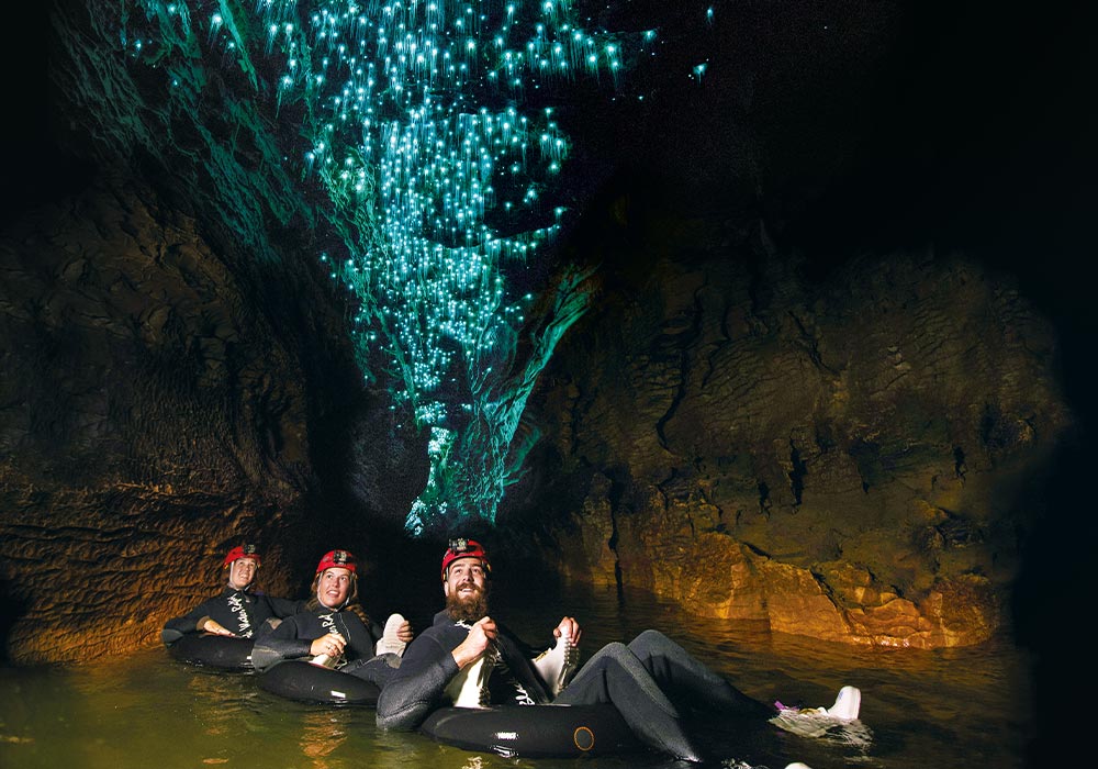
Just across the road the next morning, an hour easily disappeared at Waitomo Caves Discovery Centre, where we learned about the area’s geology, caves, landscape, caving, glowworms, and cave tourism, which started back in 1889.
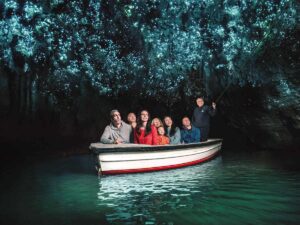
Waitomo is, of course, renowned for its caving and glow worm ventures and it’s easy to see why it’s such a drawcard for visitors.
The Waitomo Walkway to Ruakuri Scenic Reserve begins almost opposite the Discovery Centre. A side trail leads past moss-covered rocks and intriguing nooks, reminding me of Mayan ruins, to a lookout. Views encompassed the iconic, but closed, Waitomo Caves Hotel, zipline, and surrounding bush and farmland.
We continued back past the Waitomo Caves complex, then alongside a bush-lined stream. Emerging into the open, we followed farm fence lines and land sparsely dotted with outcrops of rocks. The narrow trail was overgrown with long grass which, after a wet evening, left our shoes and trousers drenched.
Reaching Ruakuri Scenic Reserve, we followed the rather confusing (there were loops off the main loop) bush trail to find spectacular scenes. From a boardwalk, I peered down over a narrow, thundering river disappearing into dark crevices with carved holes and sculpted cliff sides.
A narrow rock tunnel had columns and interesting formations: two deep, dim caves sported arches, stalagmites, and stalactites.
We returned to Waitomo Information Centre/Museum via quiet Ruakuri and Tumutumu Roads, the entire walk taking three hours. You can also drive to Ruakuri Scenic Reserve.
Heading west on SH37, we passed the unusual sight of boots tied to fence lines near to Tawara Tramping Tracks, before stopping roadside to walk an easy five-minute bush walk, with a few stairs, to Piripiri Cave. More stairs led down into the extremely dark cave where far below running water could be heard. Take a torch to appreciate the interior and forming stalactites.
A kilometre on, the 10-minute return trail to 43-metre-high Marokopa Falls descends gently. Heard long before they’re seen, the falls can still be viewed despite the viewing platform being closed off. Cascading down a cliff, they reminded me of an array of bridal veils. A brochure describes them as New Zealand’s most beautiful falls. As with many spots like this, take the time to quickly check the DOC site as conditions frequently change and occasionally the Marokopa lookout is closed.
Kawhia beckons
The final stop on our trip was Kawhia, where we enjoyed a bird’s-eye view from up high before descending into the township, passing a fence line adorned with bikes opposite Oparau Roadhouse, 10 minutes before town.
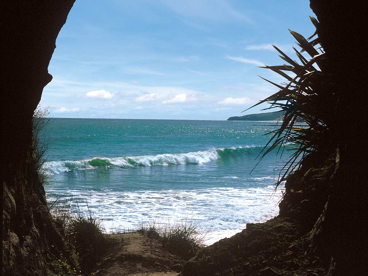
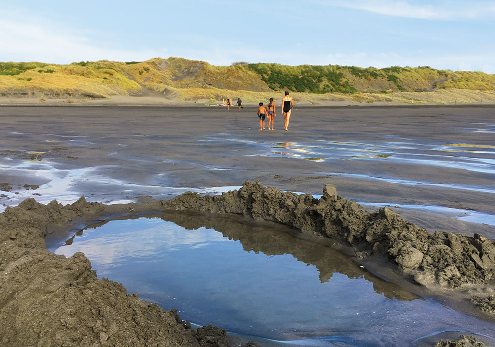
It was late afternoon, with fishing boats anchored in the harbour, and the museum was closed. We headed for Ocean Beach where from the car park, the beach is accessed via a steep climb up sand dunes between spinifex grasses. Fair to say, it warmed us up. Even more warming is digging a hole in the sand just above the low tide and bathing in waters heated by underground Te Puia Hot Springs, in line with where the dune trail emerges onto the beach. There were blissful hot spots to be enjoyed by burying our feet and hands deeper into the warm pool – the perfect end to a road trip.