 |
|
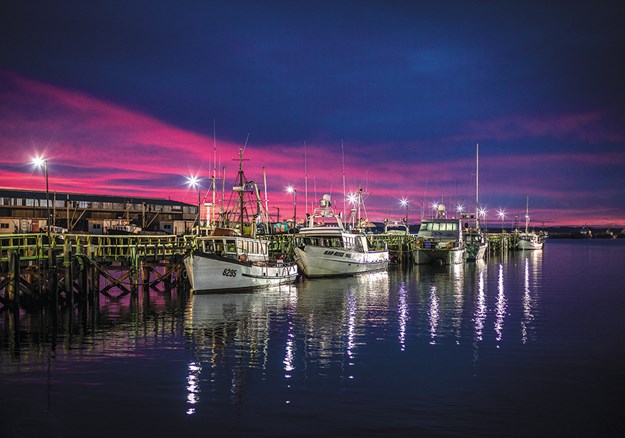
Bluff harbour
|
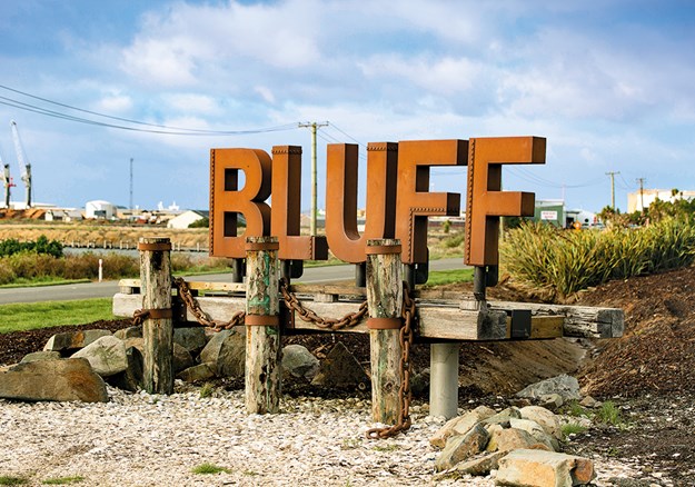
The brown BLUFF letters on the road into the town looked hardy. Something I think you need to be in Bluff, if the wind I encountered at Stirling Point was anything to go by. It was probably also a contributing factor to the many shipwrecks I read about there.
 |
|
Welcome to Bluff!
|
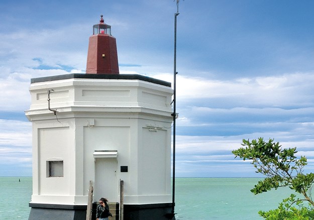
The site, where a signpost marks how far it is to various places in the world, is named after William Stirling. He was a whaler – managing the whaling station in the cove below – and the Bluff area’s first pilot. A short walk along the water’s edge (where I looked out onto a fishing boat, so tiny in a churning sea) took me to Pilot Reserve. Watchmen once kept a lookout for vessels from the 1912-built pilot station before it was closed in 1984. Its lantern is still lit at night to guide ships. In the 19th century, 21 vessels were lost, with two wrecks per decade up until 1939.
 |
|
Pilot Station, Bluff
|
On distant Dog Island, at the narrowest part of Foveaux Strait, a white and black-striped lighthouse stands. Apparently it’s New Zealand’s tallest, at 35 metres. On one of the numerous information boards, which include details on whaling, muttonbirding, piloting and shipwrecks, I read that the first European ships through Foveaux Strait were sealing vessels in the late 18th century; whaling stations were established along the coast in the 1830s. Bluff is apparently the oldest European settled community in New Zealand, founded in 1824, with early settlers arriving in the mid-1800s.
On my way back through Bluff, I drove past the old Post Ofice. Built in 1900, it’s now the yellow-painted Bluff Lodge, next door to the Club Hotel, a Category 2 building, on Marine Parade. They’re both part of the Bluff Heritage Trail, which commemorates the life of Sir Joseph Ward, prime minister in the early 1900s, and Bluff-born.
BLUFF MARITIME MUSEUM
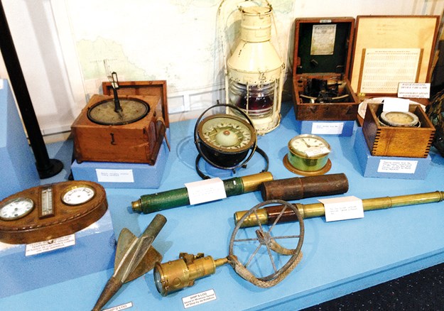
Also on the trail is Monica, an oystering boat, which Bluff Maritime Museum visitors can climb aboard. The museum is small but packs in a lot of information. Bluff’s oyster and whaling history is on display, with equipment used in the industry. Whale baleen, vertebrae, skulls and jawbones are also on show. There are ship clocks, telescopes, sextants, logs, lanterns, model ships and photographs of vessels listing after having struck rocks. I read of England’s Glory, which sailed from Great Britain and ran aground, breaking up on nearby rocks in 1881. A list notes 33 shipping disasters from 1845 to 1973.
 |
|
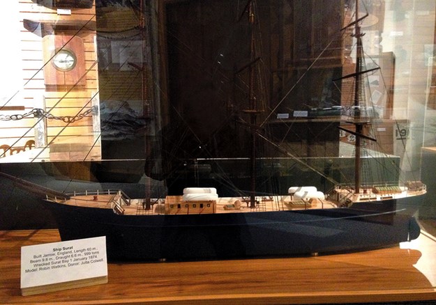
A model of the Surat
|
 |
|
Fascinating displays at Bluff Maritime Museum
|
The muttonbirding video is very interesting. Afterwards I got talking to Trish, the museum’s curator, who has been muttonbirding for 60 years; around 46 families do so during the season on islands near Stewart Island. Every year Trish brings back about 200 of the birds (sometimes referred to as ‘home birds’), to freeze, along with three buckets of muttonbird preserved with salt and fat.
A BIT MORE OF BLUFF
Motupohue Lookout, where gusting wind nearly knocked me over, gives views over the town, stretched between the coastline and foot of the 867-foot Bluff Hill. Information boards explain that Bluff was New Zealand’s closest port to Australia and serviced the farming and sawmilling industries; flax was the town’s first export cargo in 1823, and sealers introduced potatoes. On the other side of the lookout, distant Stewart Island loomed. I also visited Old Bluff Cemetery, on the Heritage Trail, and one of New Zealand’s oldest. This beautiful spot, with sea views, is the resting place of Joseph Ward and also a number of drowning victims.
 |
|
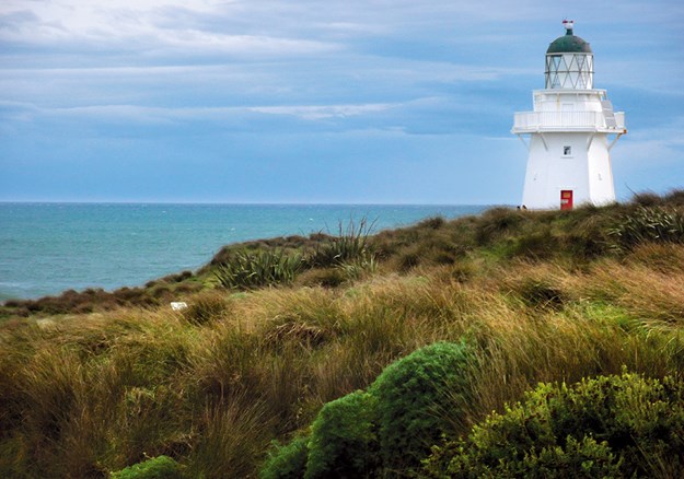
Waipapa Point Lighthouse
|
WAIPAPA POINT
Heading to the Catlins, I left the Southern Scenic Route and took the coastal road to Waipapa Point, where the last wooden lighthouse built in New Zealand stands.
The lighthouse began operating in January 1884, after the passenger steamer Tararua hit the Waipapa Reef in 1881 and sank. This deserted spot was once a busy little community, but houses and other buildings were removed when the lighthouse was automated in 1976. A specially created cemetery – a 15-minute return walk across paddocks – holds the remains of 64 of the 131 who lost their lives on the Tararua. Short on time, I failed to find the right direction to head in.
I took in the southernmost point of the South Island, blustery Slope Point atop steep eroded cliffs. The isolated coastline here is rugged. At Curio Bay, the camping ground was quiet, and accommodation along the main road in late September was mostly closed up. The yellow-eyed penguins which come ashore at dusk were a no-show, although sandflies were in abundance.
 |
|
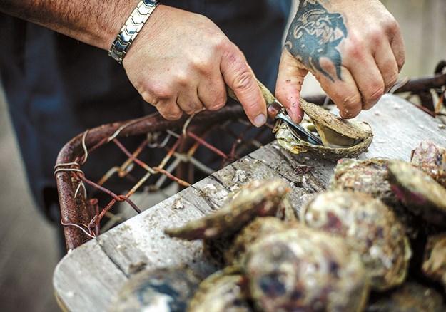
Bluff is renowned for its oysters
|
WAIKAWA
Waikawa appeared already asleep when I drove through in the early evening. It was once a whaling station in the mid-1800s, then a busy port serving sawmillers and gold miners. Housed in what was the Waikawa School building from 1912 to 1972, the museum has displays on whaling, sawmilling and gold mining. Whaling pots sit on the verandah, a jail, blacksmith and old farming equipment next door. Over the road, white, redroofed St Mary’s Anglican Church is picturesque. Holding services from 1932, it closed in 1994. Waikawa Cemetery further along the road looked out over the estuary, a pretty spot.
TAUTUKU MILL AND NEARBY WALKS
Rejoining the Southern Scenic Route, SH92, I drove on to Whistling Frog Resort, tucked in bush in the Catlins Coastal Rainforest Park, where a number of campervans were already parked up. It’s just 3km from McLean Falls, which I visited the next day, via a very pretty 20-minute bushwalk.
Six kilometres eastwards from the resort, along bush-lined highway, is a historic logging site situated in Lenz Reserve. The Tautuku Mill Trail starts about 200 metres from the off-road carpark. Weathered signposts mark where log skids and homes, built around 1936, once stood when the mill operated – one of 182 in the Catlins at the time. It burned down twice, apparently common with steam-powered sawmills, and logging ceased in 1952. A Traills logging tractor sits on the site, with information and photographs on sawmilling and life in the area.
A nature loop walk of about one hour took me steadily uphill on what was once the tramway, then downhill. If you’re short on time, there are more picturesque walks in the area than this one, such as the Tautuku Boardwalk. Reached from a gravel road off the highway, just over the bridge from the mill site, it leads through bush, passing a sawmilling site established in 1901. A narrow boardwalk then winds through orange rushes to Tautuku Estuary. Another lovely walk is the 30-minute loop around Lake Wilkie, a short drive east. The lake reflects the bush, which can be seen from a lookout five minutes in. The trail then leads down to the lake and a boardwalk.
FLORENCE HILL LOOKOUT
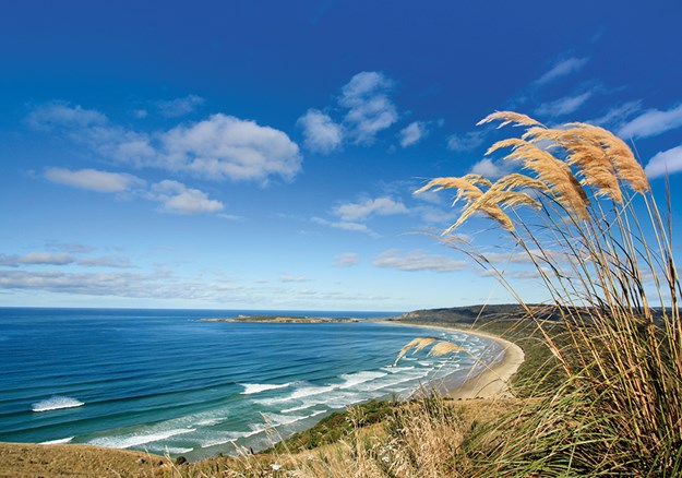
Back on the highway, I stopped at Florence Hill Lookout, which has sweeping views over Tautuku Bay. Boards informed me that in 1840 I might have seen a whaling schooner and hunting boats, and black smoke coming from boiling whale oil in trypots. In 1910, smoke would have drifted from sawmills, and I might have spotted flax drying at a flax mill. A plaque commemorates the SS Otago, which foundered 11km south-west in 1876.
 |
|
Florence Hill Lookout
|
OWAKA
I visited beautiful Purakaunui Falls – which resemble white icingflowing over a tiered cake – before arriving in Owaka. The museum incorporated within the Catlins Information Centre is fabulous. The Catlins were named after Captain Edward Catlin (1792-1856), who was involved in the whaling industry. There’s information on other identities, ship captains, shipbuilders and sawmillers; places I’d passed through bore some of their names. I wandered through early pioneering days, whaling, the sawmilling industry, and the coming of the railway. Shipwrecks feature in both displays and videos. The one on the Surat, an immigrant ship which ran aground on New Year’s Eve, 1873, is really well done.
Settled in the 1860s by timber millers, the town history is told and there are replica shop windows displaying goods from when the businesses operated. Original buildings still stand in Owaka, such as the A.B.C. Drapery store, now occupied by PGG Wrightson.
SURAT BAY
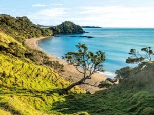
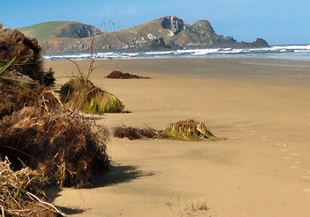
I took the gravel road to Surat Bay. Newhaven Holiday Park, at the end, looks out to the water. A walk along the estuary leads to a long, sandy, crescent-shaped beach with a rocky outcrop in the distance. At the opposite end, over the estuary, dark, dramatic cliffs were topped with bright green grass dotted with sheep. A signpost points to where the Surat was wrecked. I try to imagine what it would have been like to be shipwrecked in rough seas in this isolated bay in the middle of the night.
I left the Catlins intrigued by Southland’s history, especially its shipwrecks, and promised myself I’d learn more of this rugged region’s stories.
 |
|
Surat Bay, Owaka, where the Surat was wrecked
|
CAMPING
The Whistling Frog, Chaslands: whistlingfrogresort.com
The Bluff Camping Ground, Bluff: bluffcampingground.co.nz
Catlins Newhaven Holiday Park, Surat Bay: newhavenholiday.co.nz
Pounawea Motor Camp: catlins-nz.com
Thomas’s Catlins Lodge and Campground Owaka: thomascatlins.co.nz
Tumu Toka Curioscape Campground Curio Bay: curioscape.co.nz
DOC camping grounds and Park Over Properties: nzmca.org.nz
ATTRACTIONS
Bluff Maritime Museum: bluff.co.nz/museum
Owaka Museum: owakamuseum.org.nz
Waikawa District Museum and Information Centre: waikawamuseum@farmside.co.nz
Bluff Heritage Trail and Catlins Coastal Heritage Trail brochures are available from Visitor Information Centres.
Find motorhomes, caravans and RVs for sale in NZ

