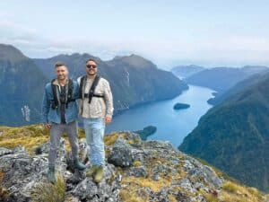
At the heart of Kaikōura ranges runs the Clarence River. While Kaikōura is well recognised for its many attractions, from whale watching to its new EcoZip venture, Eleanor Hughes opts for the experience of a rafting journey along the beguiling river, which winds its way seaward among rugged high-country landscapes.
Wisely deciding on professional guidance from the team at Clarence River Rafting Waiau-Toa, we decided to make the most of this opportunity and booked a four-day rafting adventure.
Rafting the grade 2/3 Waiau-Toa (Clarence River) usually begins at its confluence with the Acheron River, within Molesworth Station, but the water level was low when we visited earlier this year and advice from experienced guide Ben Judge of Clarence River Rafting revealed that we’d likely spend more time carrying or pushing the raft than riding it. So, with some clever thinking, the original plans were changed.
Following a morning pick-up from Hanmer Springs, we were driven approximately two hours to Kahutara River Bridge car park, on SH70, to meet other rafters driven from Kaikōura, around 25km away. A map in the car park showed hikes and numerous huts scattered along the Clarence River and foothills of the Kaikōura Ranges. I took note for further adventures.
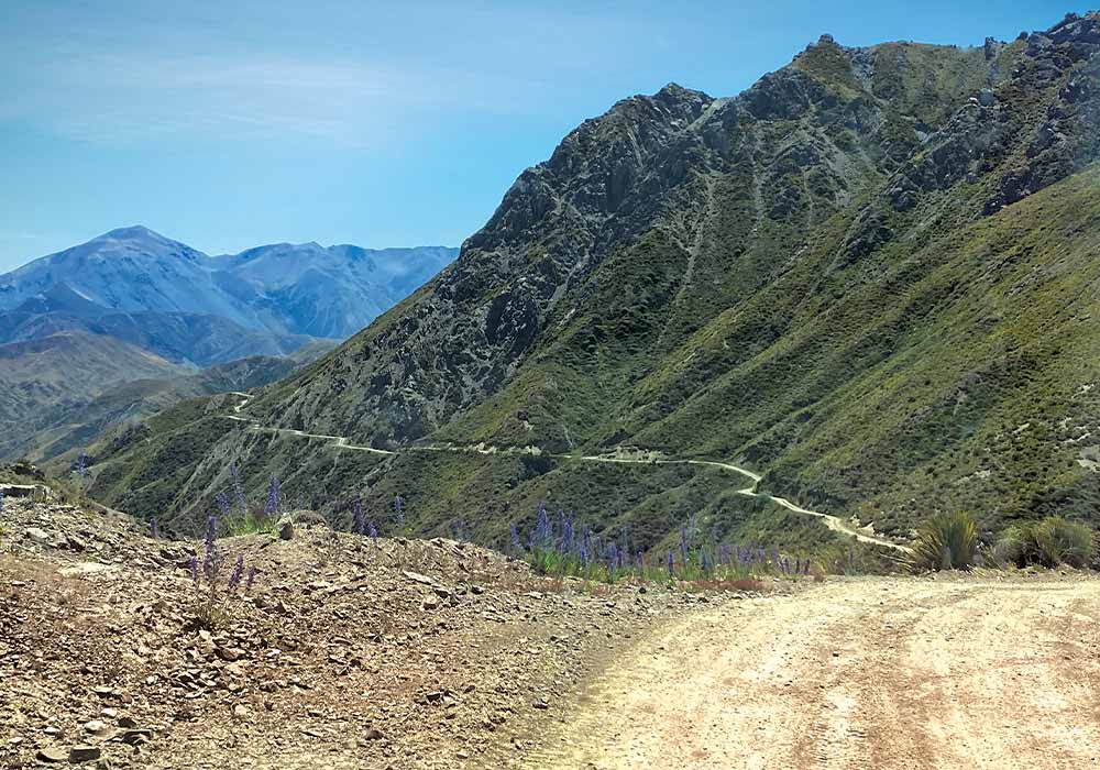
Next up was Blind Saddle Road, only accessible with permission from Muzzle Station’s owners, the high-country station it accesses. The 40km, one-lane, dirt road winds up into the Seaward Kaikōura Ranges where mountains soar to around 2600 metres. Steep drop-offs to our left were rather frightening but the views were amazing and worth the heart-pounding moments. The Pacific Ocean and Kaikōura lay distantly east; Tapuae-o-Uenuku, (Mt Tappy to locals), part of the Inland Kaikōura Range, towered at 2885 metres, the South Island’s highest mountain after the Southern Alps. A choppy ocean of ranges and shadowy, deep valleys spread before us as Bushy and Blind Saddles were negotiated amid short alpine vegetation.
Historic buildings on Blind Saddle Road
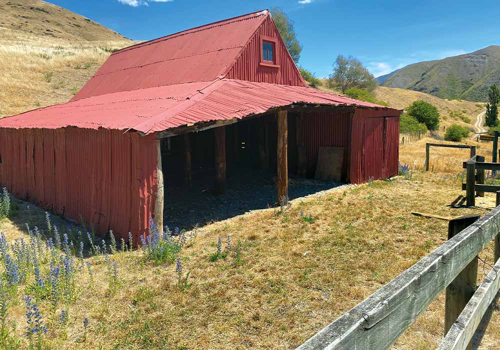
We wound down to historic Bluff Dump Hut, a corrugated-iron building built in 1928, and had our lunch next door in DOC’s Warden Hut, named after the 1857 sheep run in Clarence Reserve’s western part. A flattish drive followed Seymour Stream, forded several times before we arrived at Quail Flat’s Historic Farmstead.
Once serving as a musterer’s base, buildings include a cob cottage dating from the 1860s, later becoming the cookhouse and a 1950s outdoor brick bread oven.
Part of the deep red, corrugated-iron barn/woolshed, also dated from the 1860s.
The historic buildings, standing on a rise, are about a 20-minute walk from Clarence River, which we finally reached after a six-hour journey.
Quail Flat
After pitching tents behind a row of riverside poplars, I waded into the fast-running river, struggling to stay upright in rocky, clear shallows, where two inflatable rafts awaited our journey. Meanwhile, our two young guides, Reuben Kinny and Sienna Casbolt, cooked up a restaurant-worthy meal over an open fire: mussels, grilled salmon, potatoes, green beans in balsamic vinegar, and salad.
Black insects, possibly sandflies (but not too bitey) annoyed after sunset – a good reminder to always have some sort of insect deterrent on hand. A late-night visit between rustling and cracking bushes to the hole dug for a toilet was slightly scary, but I survived.
The 230km Clarence River is both Marlborough’s and Canterbury’s longest river. Beginning its journey from Lake Tennyson in Nelson Lakes National Park, it flows around 40km south before twisting east and northeast for 80(ish)km and forming the boundary between the two regions. Eventually heading southeast into Canterbury, it disgorges into the Pacific Ocean on South Island’s east coast at Clarence, a little settlement 40km north of Kaikōura. For our adventure from Quail Flat, we had around 120km to raft over four days – quite the expedition.
Day one
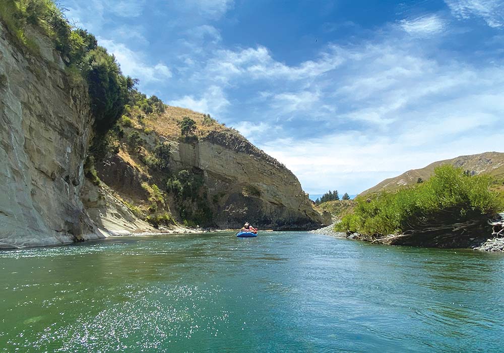
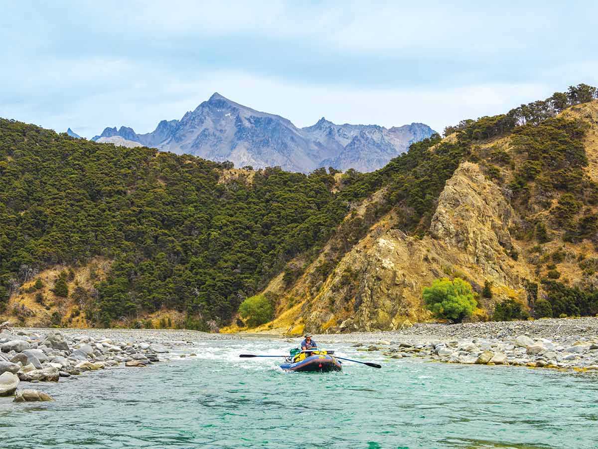
We didn’t set out until around 9:45am the following morning after breakfast, dismantling tents, packing up gear, and ferrying it down to the riverside for loading onto the gear raft. Reuben rowed the huge load, while Siena guided our group of six, steering our raft from the back. We paddled when needed – forwards and backwards, but mainly relaxed, drifting along the wide river. The day was hot, so we drank crystal-clear river water from a communal cup attached to a raft rope. Dehydration can be a problem when under the sun all day. Morning tea was a treat of fresh baking, nuts, and chocolate, enjoyed below shaded trees on the riverbank while fellow rafters cooled in the river.
Beyond sparsely vegetated hills, the occasional glimpse of a dirt road, and scree-covered ranges scarred with white, vein-like lines running down their slopes, there was much to take in around us.
Muzzle Station’s airstrip was spotted high on a flat rise. Water disgorging from a stream trickled at right angles to the river, like a mini waterfall over a drop in the riverbed. By early afternoon, a headwind forced us to paddle more. Instructions were clear and concise: ‘Forward. Stop! Left side back!’ It takes a few seconds for the brain to process left and right, but Sienna expertly steered the raft between rocks, like slaloming ski poles. She was out of the raft jostling it off jutting rocks when we went nowhere; we slid overboard twice to help.
Narrowing, the river took us in the shadows of layered sandstone cliffs and tilted rock and past fallen boulders, round like the Moeraki ones, which had left indents in bluffs. Goats clambered hillsides, ducks quacked, purplish-blue borage and yellow dock added colour to a greenish-brown landscape with few flat, or shady spots. Snow splattered the upper slopes of distant Mt Tappy.
Late lunch at another shady, riverside spot gave more swimming opportunities. Around 4pm, we stopped to camp at Stony Flat. Gear was lugged over rocks to a flat, grassy clearing with wild briar roses. The wind made for a slow descent into the fast-moving river to wash, but it felt good afterwards.
While we drank wine and ate nibbles, a watercolour landscape of ranges before us, our guides slaved over the fire, cooking sausages, chops, and pork strips. I felt lazy but they insisted they didn’t need help. An inquisitive cow and calf moseyed by. Later, the river’s wave-like crashes lulled me to sleep.
Day two
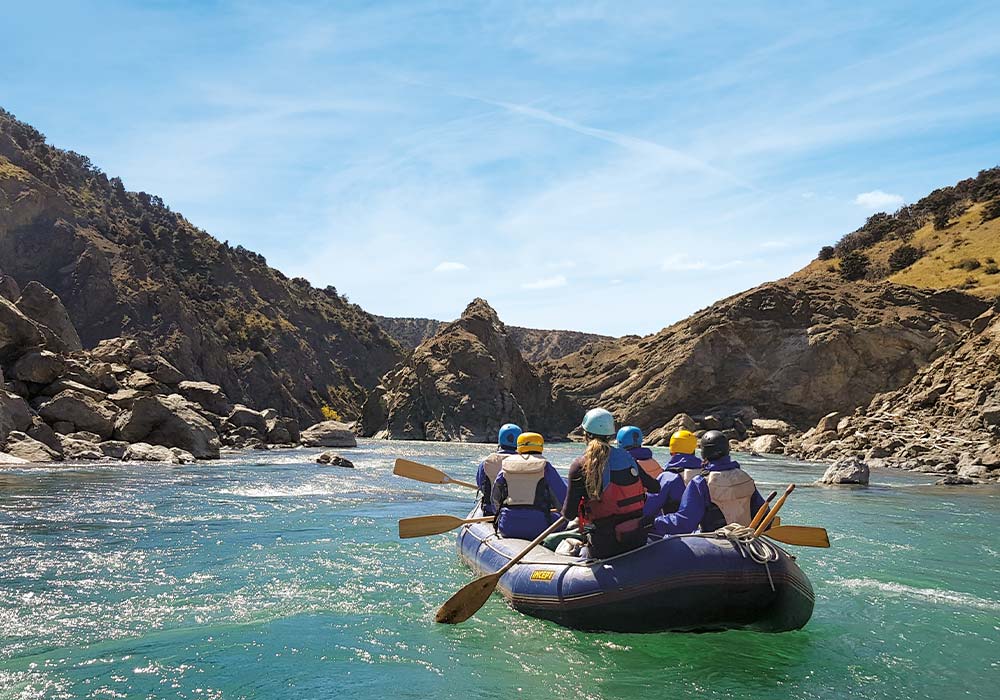
Morning arrived cool, the sun yet to appear over hillsides; ridge tops peeking through clouds. A merino top was required. I cringed when cold water doused my lower body as the front of the raft dipped over rocks or rapids splashed up. My right front position bore the brunt of the spray. I pulled on a splash jacket at morning tea.
More rapids than the day before made for a more exciting, faster ride. Rocks jutted up; the raft scraped over barely submerged boulders as we hurtled along. Blue water appeared deeper, churning white like a bubbling spa pool. Swept towards a rock ‘island’, Reuben swerved the raft at the last minute; we leaned left, right, and bounced up and down trying to release the raft off rocks it wedged on. We forward paddled and back paddled through choppy water, over eddies where the water swirled whirlpool-like and gripped the grab rope with helmets donned. Then we relaxed. Mt Tappy and Mt Alarm appeared closer. The gearboat became marooned, so Reuben abandoned us to help. We floated down the river, idiots with no idea what to do – the water quietened, the atmosphere serene… he soon caught up.
Damage caused by the 2016 Kaikōura earthquake is evident in the dwarfing cliffs we floated by, scarred by massive slips and rubble strewn at their base. We snaked our way between the high grey walls of three gorges; rock tilted vertically looking like giant fingernails had raked it. Layers of rock coloured other cliffs; gravel beds rose metres above us. Along cliff bases, half a metre of rock normally underwater was white. Friesians grazed; goats were glimpsed; swallows flitted above and banded dotterell strutted in the shallow waters of a braided section. Just north of Bob Stream, we camped beneath Manuka trees, a stag skull nicknamed Bob watched. I washed in the river and was spoiled with steak and mushroom sauce, courgette, blue cheese and walnut salad, pumpkin, and coleslaw. It’s a lovely, simple life.
Day three
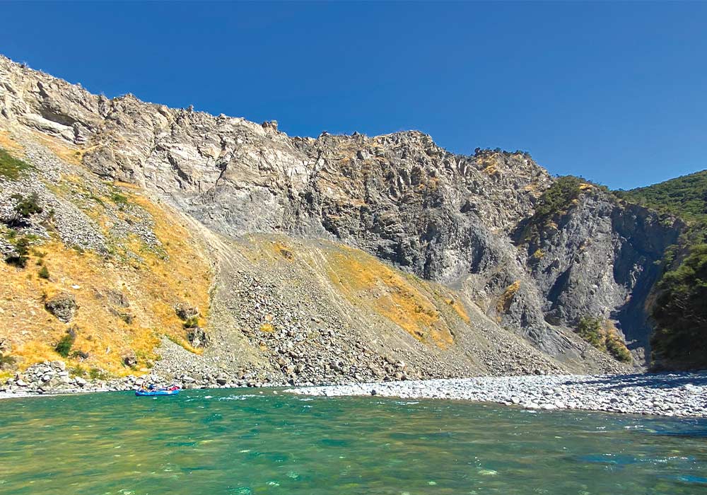
Awoken by a dawn chorus of birds and nature, I lay listening for ages. It was a beautiful experience. By now I’d lost track of time; it had become irrelevant. All I know is that we were on the water by the time it was already warm under a cloudless sky. Shade beneath high cliffs brought coolness while splashes from racing, gentle rapids shocked. Mt Tappy and Mt Alarm appeared within walking distance; several deer were spotted. On inside bends, we passed sandy spots where shallow water flowed over gravel to join the river.
Two biggish rock faces mark the Northern Gate where the river twists from north to wend its way south/southeast.
We smacked head-on into cliff faces, bounced off, spun, sped over rocks, crashed down, and slalomed between protruding ones. Usually requiring hard paddling due to headwinds, we then floated along ‘Mad Mile’ – a long, straight stretch where some of our group bobbed along in the water to cool off from the searing sun, keeping pace with the raft. As the wind changed, it was all aboard and we got to work.
Trees reflected in a medley of blues; white rocks in shallows gleamed like silver coins in a fountain. Surrounding hills were stark, others cloaked in totara and Manuka. We camped just north of Matai Flat. As the campfire died, I watched stars make their twinkling appearance in a darkening sky. The Milky Way painted a white strip.
The final day
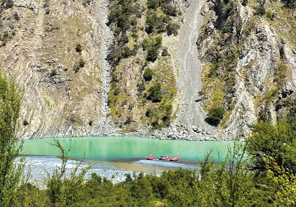
After breakfast, we rafted for around 20 minutes to stop at Matai Flat. A short walk into the bush led to a stand of 300-year-old, and younger, Matai. Saved from felling, the land they grow on was one of the first land parcels Forest and Bird purchased.
The remains of an earthquake-destroyed concrete bridge, which once crossed the Clarence, projected from a bank and lay in the river. I glimpsed a crooked farmhouse also damaged. The river widened; the landscape opened up; hills were lower and grassed. Fences climbed slopes; pine trees cut a deep green swathe across hills.
Our final two hours were rafted in warmer water, through some fun, fast rapids and perhaps the most stunning scenery of the trip. Startling white rock formations contrasted with the deep-blue river and sky. Huge blocks of concrete with jutting railway lines bordered a part of the riverbank, retaining it; concrete-filled coal carriages did the same. Black-fronted tern, oystercatchers, and shags probed and preened on gravel islands.
Unseen waves pounded beyond the riverbank; gulls screeched, swooping overhead. We passed under SH1, then the rail bridge, the air salt-laden, and reached the river mouth. The end of the journey.
Clarence River Rafting supplies splash jackets and pants, tents, sleeping mats, and dry bags for gear, although, I used my own tent. They transported our bikes from Hanmer Springs to their base at Clarence and then with us to Kaikōura at the end of the trip. They also held luggage not required for my onward trip, and I collected it a week later. The trip is suitable for all ages. We were a group of 50-, 60-, and 70-year-olds.

