Paul Owen found an historic trail with plenty of opportunities for cyclists and independent RV travellers on the South Island’s epic West Coast.
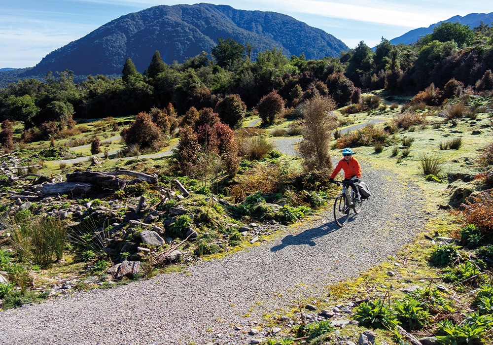
The extractive industries of the South Island’s West Coast might have been ecologically destructive when they were at their peak more than a century ago, but they created some excellent foundations for a 21st century cycle trail. The 133km West Coast Wilderness Trail links former bush tramways used by loggers and miners back in the 19th century with the access tracks used to construct water reservoirs and small hydro-electric schemes in the mid-20th century. This helps keep on-road riding to a minimum as the track zig-zags its way from Greymouth to Ross, some 30km south of Hokitika. The result is an easy Grade 2-3 ride all the way, mostly removed from the dangers of sharing a road, though a natural landscape that has certainly regenerated enough to earn the ‘wilderness’ tag.
There’s three ways of riding the trail – independently; self-guided with support; or in one of the many guided package tours that are available. The latter two tend to divide the 133km route into three or four 30-40km days with overnight accommodation located in the towns of Kumara and Hokitika.
Often a guided cycling tour is preceded by accessing the West Coast from Christchurch via KiwiRail’s scenic TranzAlpine Express, and this makes Greymouth the logical starting point. From there, you usually ride to the historic town of Kumara, which has a growing number of accommodation options to choose from – check out our Tiny Towns story on page 44 to find out more.
Then it’s on to the biggest ride of the tour, crossing the Kawhaka Pass over to Miltown and then on to Hokitika. By comparison the flatter journey from your overnight accommodation in ‘Hoki’ to Ross is a cruisy finale to the tour. You’ll be enjoying a well-deserved celebratory beverage at the destination’s Empire Hotel by early afternoon.
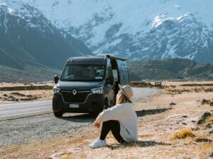
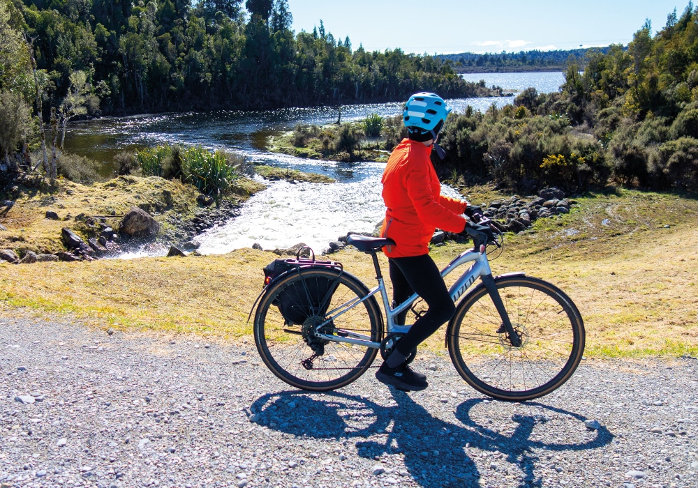
Having a campervan, caravan, or motorhome widens your options of riding the trail and you’re no longer restricted by keeping to a timetable determined by a tour schedule or accommodation bookings. There are some excellent places to plug in your RV near the trailheads of the ride, including the funky Top 10 holiday park in Ross created out of shipping containers. Worried that there’s a fair bit of pedalling to be accomplished between Kumara and Ross?
The Department of Conservation has the solution by providing a beautiful camping ground with toilets overlooking Lake Kaniere, midway between the two towns. Having an RV as your personal Wilderness Trail support vehicle also allows you to cherry-pick the best bits of the ride, avoid more of the on-road transits, and choose your own riding conditions if you have the time to wait out periods of bad weather. As any local will tell you, the West Coast Wilderness Trail could well have a further word starting with ‘w’ as a prefix in its title: it’s often a wet ride.
Here’s how our campervan-enhanced partial exploration of the best bits of the trail panned out:
DAY 1:
ROSS TO WEST COAST / SCENIC WATERWAYS / GRADE 2 / 50KM RETURN
From our camping site of the Ross Top 10, the trailhead is right outside the gate of the holiday park, allowing us to begin the ride free from road traffic. We quickly pedal down the former railway link between Ross and Greymouth, pausing to stop almost as soon as we began to admire the sturdy weathered-wood structure that is the old railway bridge crossing the Totara River.
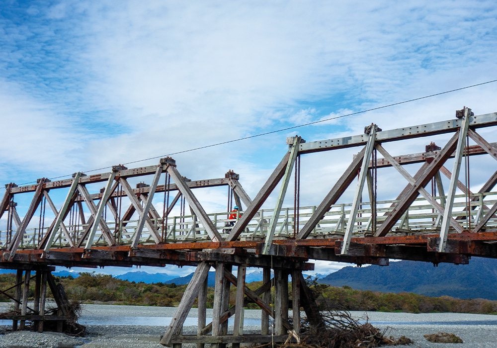
The railway was closed in 1980, and its arrow-like trajectory towards Ruatapu means there’s just two small kinks to negotiate in the trail for the next 12km, with few glimpses of the adjacent coast available. If it wasn’t for the birdlife and the regenerating native forest alongside this section of the trail, many would mark it as a test of their cycling endurance. You tend to keep your head down, skirt around the many potholes and patches of loose metal as you can, and pedal, pedal, pedal.
Approaching Ruatapu, you turn off the trail and head east along SH7 before turning onto the 80km/h road that links Ross with Kaniere. This leads you past the Treetops Walkway and it’s tempting café – both/either are worth stopping for: the former for the views from the towers and suspension paths located high above the canopy of an impressive stand of mature native forest, the latter because it offers some of the best food available on the trail.
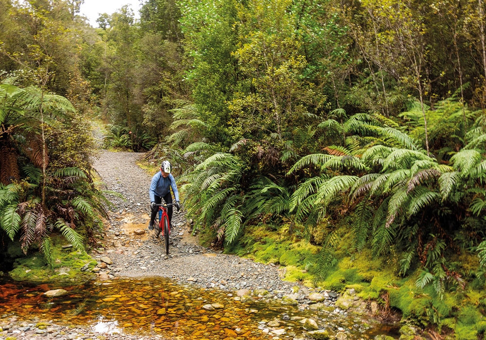
Around another 2km further towards Kaniere, the trail turns off the road and plunges into native forest, following an old bush tramway. There are sections where you can still feel the bumps of the sleepers that used to support the rails but it’s mostly a smooth ride made more enjoyable by the lush forest on either side. The bush blocks out any views of Lake Mahinapua, however there’s a sidetrack you can take to get a look at the large shallow lake that was left behind when the Hokitika River changed course. The other option is to enjoy views of the lake from the Treetops Walkway.
The lake and the many canal-like waterways of the area were the scene of a vicious battle between Ngāi Tahu and Ngāti Wairangi in the late 17th century. Many Ngāi Tahu rafts were overturned during the conflict and the bodies of several drowned chiefs were stacked up on the lakefront during the aftermath, an act that gave the battle its name – Tāwiri a Te Makō (heap of sharks).
Although the lake is full of eels, whitebait, and is a shooter’s paradise during duck season, Ngāi Tahu have declared it wai tapu (sacred water) and continue to refuse to eat any food taken from it.
DAY 2:
HURUNUI JACKS TO KAWHAKA PASS / GRADE 3 / 60KM RETURN
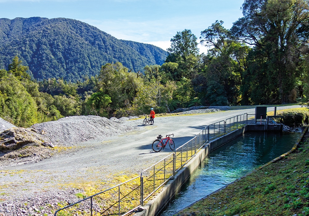
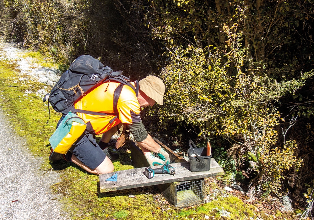
Call us ‘cheaters’ (as e-bike riders, we’re used to it) but we skipped the long road transit from the scenic waterways through Hokitika and Kaniere to Hurunui Jacks by simply driving there in the campervan the following day. It’s a great way to shortcut your way to one of the most enjoyable parts of the trail. You start the ride by pedalling alongside two man-made waterways, the first feeding a small hydro station before turning 90 degrees onto a narrower part of the trail built alongside a handmade water race hacked out by the pickaxes of gold miners in the 1880s. The Department of Conservation has done some great work here restoring and reinforcing the sides of the race, and giving riders a few engaging challenges, like the odd narrow bridge with an elbow-like turn in the middle. If that’s not challenging enough, there’s also a Grade 5 alternative track, but be warned: it’s an expert track. It might shave some distance if you’re a lycra legend, but the signage says that it takes twice as long to traverse.

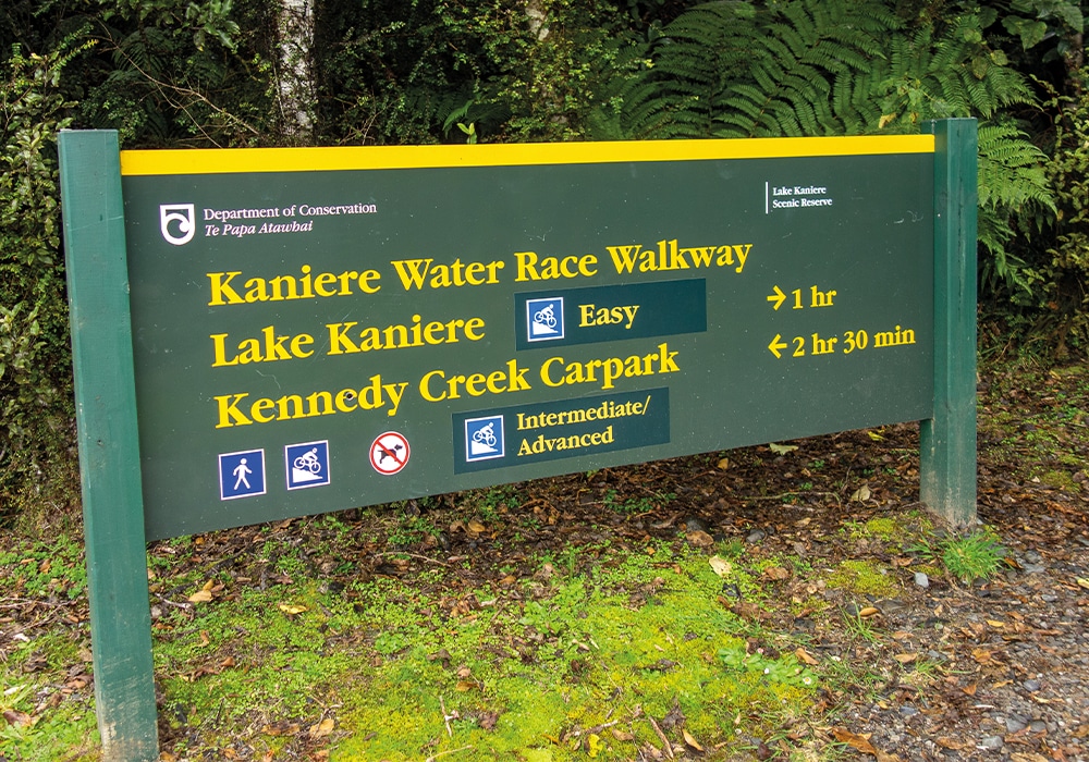
Meanwhile, we were so happy on the water race track that our cheek muscles started to protest at all the grinning. Native bird song accompanied by the trickling sounds of swiftly running water: is there any better cycling soundtrack? This section of the trail finishes where the water pouring down the race flows out of Lake Kaniere. There’s a lovely view over the lake to Tahua peak and the intersection with the road to Miltown is nearby, leading riders to the next offroad part of the trail. However, you may wish to check out the DoC camping ground at Hans Bay on the lakefront before proceeding. To us, it’s one of the best places in the country to park up for a night (or three).
Not this trip though; we headed onwards over the hill that separates the Hokitika and Arahura River catchments via Miltown. It might be a narrow gravel road but there’s scant four-wheeled traffic to disturb the dust, and you soon reach the parking area next to the Arahura that marks the next trailhead. Be warned that the sandflies here take no prisoners!
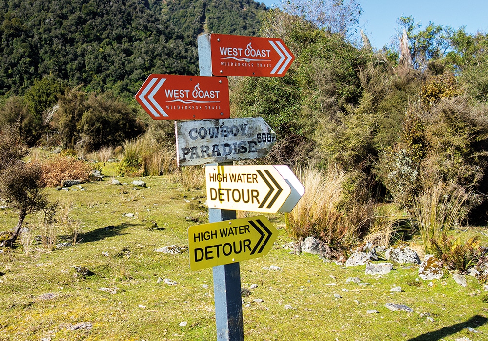
The clouds of pesky biting insects soon clear as you ride all the switchbacks of the climb to Cowboy Paradise. Keep a look out for deer on the ground, and kea in the air, as the altitude increases. We heard both during the ride but no sightings, alas. Ah well, we’ll be back; this part of the trail is too good to be a oncer.
Cowboy Paradise looks like the abandoned set of a western movie. You half expect Gary Cooper or John Wayne to step out from the verandahs of the buildings and challenge you to a gunfight. However, no such ghosts show themselves on our visit, so we keep on riding. The suspension bridge over MacPherson Creek is spectacular, the drop into the gorge below at least 20m deep. There’s a load limit of ten persons on the bridge at one time, but what if they’re all sumo wrestlers riding e-bikes?
From the creek, the trail climbs steeply upwards round some tight switchbacks. Then it flattens out onto a private gravel road built originally for forestry purposes then used to build another hydro scheme. You therefore pass weirs and water races on your way to Kawhaka Pass, at 317m above sea level, the highest point of the trail and our turn-around point for the day.
DAY 3:
KUMARA – KAWHAKA PASS / GRADE 2 / 58KM RETURN
Going north from Kumara to Greymouth wasn’t that attractive as there’s only the bridge over the Taramakau River leading to a part of the trail that hugs busy roads. Going south, back into the wildest part of the trail was a far better option. Perhaps we may even spot kea when we climb the Kawhaka Pass from the northern side. We set out from our campsite at Greenstone Retreat and we’re soon pedalling past the azure waters of Kapitea Reservoir and catching glancing views across the water to snow-capped Mount Turiwhate, the Otira Gorge, and Arthur’s Pass. Some 20kms later, we’re riding along a gravel road next to the water race that feeds yet another hydro scheme, towards the intake of the race at the bottom of the pass. There are paradise ducks, some of the 2400 whio (blue duck) left on the planet, and sight of all bird sightings: one of the rare kōtuku (white heron) trolling a trailside lagoon for food.
Then rounding a corner, there’s a flash of orange underwing feathers as a kea darts so closely across my face that I can feel the beat of its wings. It turns sharply, then quickly ascends above the trees, screeching out its own name. The close encounter with this increasingly rare, obsessively curious, native parrot is the highlight of my ride down the West Coast Wilderness Trail. It’s proof, if needed, that you really do get to ride in the wild.