Viv Haldane and her family visit a Wellington beach with a wild reputation and some interesting history.
The weather at Makara Beach has a reputation for being unpredictable. Sometimes it’s so breezy, all you can do is hang onto your hat and everything else when you brave this fickle area of the North Island. It’s actually quite like a moody teenager, I decided. Sulky and surly one minute, then sunny and happy in a nanosecond. Luckily the ‘teenager’ was happy today – just as well, because we wanted to make the most of the good weather and explore Makara and its beachside walkway.
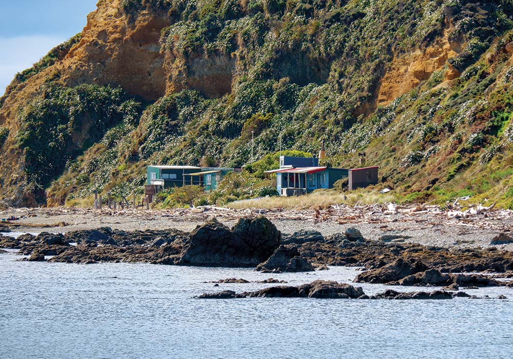
In the early 1900s, Makara was home to an Italian fishing community which later moved to Island Bay in Wellington. Makara is still a popular destination for fishing and diving enthusiasts, and is often busy at weekends, but midweek, there was hardly a soul around, apart from a few walkers and a man clad in scuba diving gear. To the right of the beach, looking out to sea, some scrappy little baches cling to the edge of the shoreline. No doubt they’ve had a long history of devoted owners.
Makara, along with Wellington and Karori and up to Cape Terawhiti, was part of the land believed to be filled with gold. Gold miners explored the hills on Terawhiti Station at Makara during the 1860s, but little came of their efforts. In the 1880s there were 24 operative gold mines; tunnels left from mining activity can still be found on the property.
There’s a café which is open only on the weekend, so if you’re here during the week, don’t count on getting coffee or a bite to eat. Instead, it’s best to bring a packed lunch and a thermos.
Roaming the coast
Makara Beach is reached from the Wellington suburb of Karori. The drive is only 12 kilometres, but can’t be hurried because of the narrow winding road. My partner Glenn, son Alex and I had only been travelling for five minutes when the windmills of West Wind Farm, near Makara, appeared on the horizon, their mighty white blades slicing the air.
West Wind is a wind farm owned and operated by Meridian Energy. There is public access from 140 Opau Road, Makara, with walking and biking tracks and a viewing platform that looks over the farm. Opau Road turns left off Makara Road, 3.5kms before Makara Beach.
We travelled along roads with sides lined with yellow-flowering gorse, past lifestyle blocks, the intriguingly-named Makara Model School, the church hall, and St Patrick’s Church. Now 148 years old, the church is a Heritage New Zealand listed building and is thought to be one of the oldest wooden churches remaining in the North Island. I fancied it to be a centrepoint of a very tight-knit community.
A walk on the wild side
The Makara Walkway opened in 1981. It’s a seven kilometre return walk, leading from the beach car park along a narrow coastal path before heading across farmland. (Note that part of the track is closed for lambing season between August 1 and September 30.) The walkway passes an ancient pā site – once the home of the Ngāti Ira people – which lies on the land that juts out at the western end of Fisherman’s Bay.
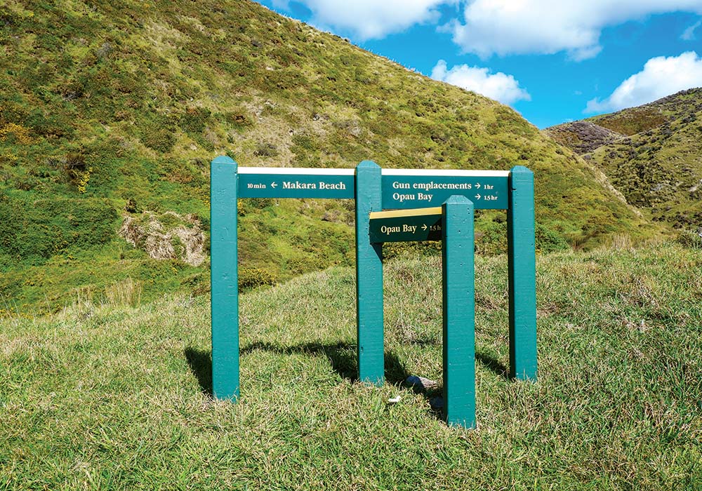
Further along, gun emplacements mark Fort Opau, where 100 soldiers were garrisoned during the Second World War. The soldiers who made up the Makara Battalion as part of New Zealand’s Home Guard were well-placed at Fort Opau, overlooking Cook Strait, to spot any approaching enemy. The fort was built in 1941 as part of New Zealand’s defence network during the war and was active until 1944. The Makara Battalion felt a little like a New Zealand version of the UK comedy, Dad’s Army. But although the 1970s TV show made light of such stuff, New Zealand faced a genuine threat from the Japanese who were flexing their military might in the South Pacific. The fort had two covered gun emplacements with a range of 19 kilometres, an observation post, a radar post with a large barracks nearby.
As we began our walk, we passed a simple wooden bench seat with a plaque inscribed in memory of a local man. It reads, ‘In loving memory of Michael Gordon Lyndsay, ‘Mike,’ 1954 – 2013. He raised his family here on the estuary. A loveable rogue’s home by the ocean.’
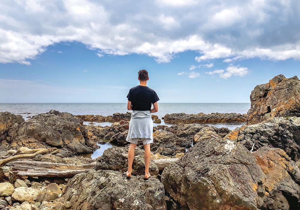
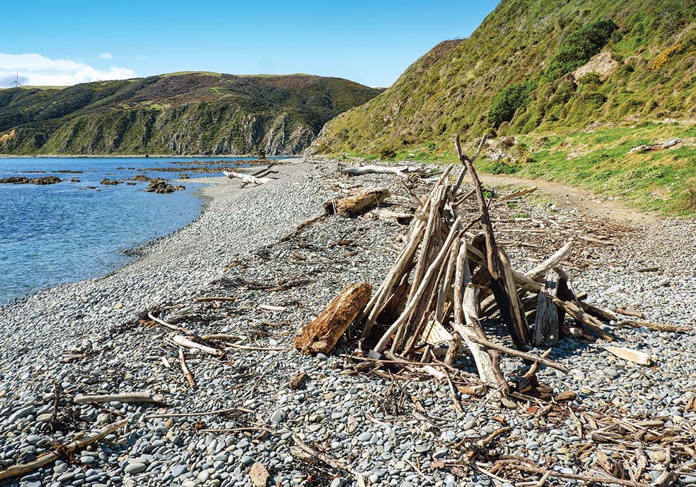
In a sign of our times, we encountered a walker coming towards us, wearing his face mask. We gingerly skirted around each other, keeping in mind our need to stick to social distancing rules, even out here. Driftwood of all shapes and sizes litters the rocky shoreline: straight, old, gnarled and twisted, large and small. These are probably the remnants of Cyclone Gita that pounded Makara in 2018. It created a trail of destruction that required a massive cleanup.
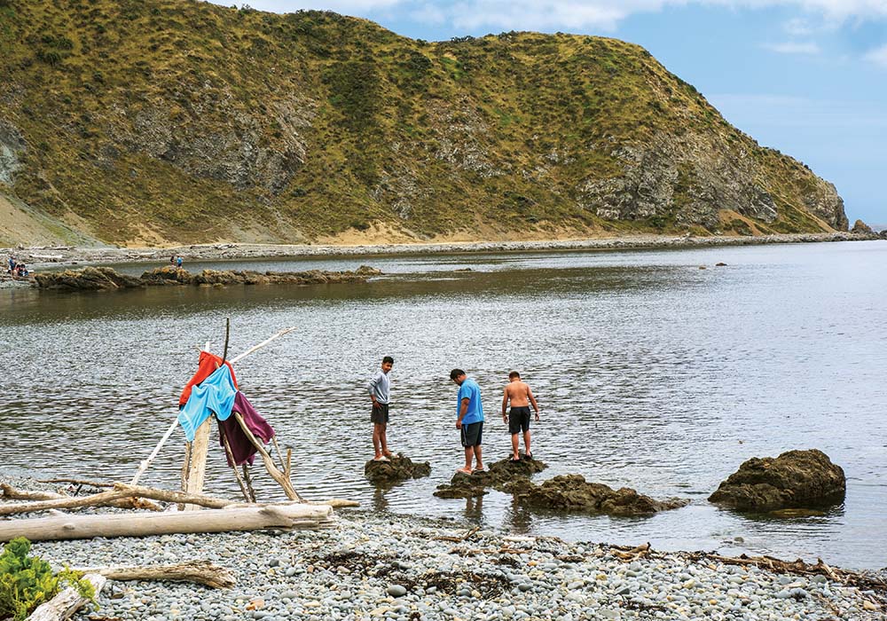
A bonus of the washed-up wood piles are various creative shelters that people have constructed on their day out; Glenn spotted a clump of silverbeet growing amongst the rocks; twittering oystercatchers waded to and fro in search of juicy tidbits.
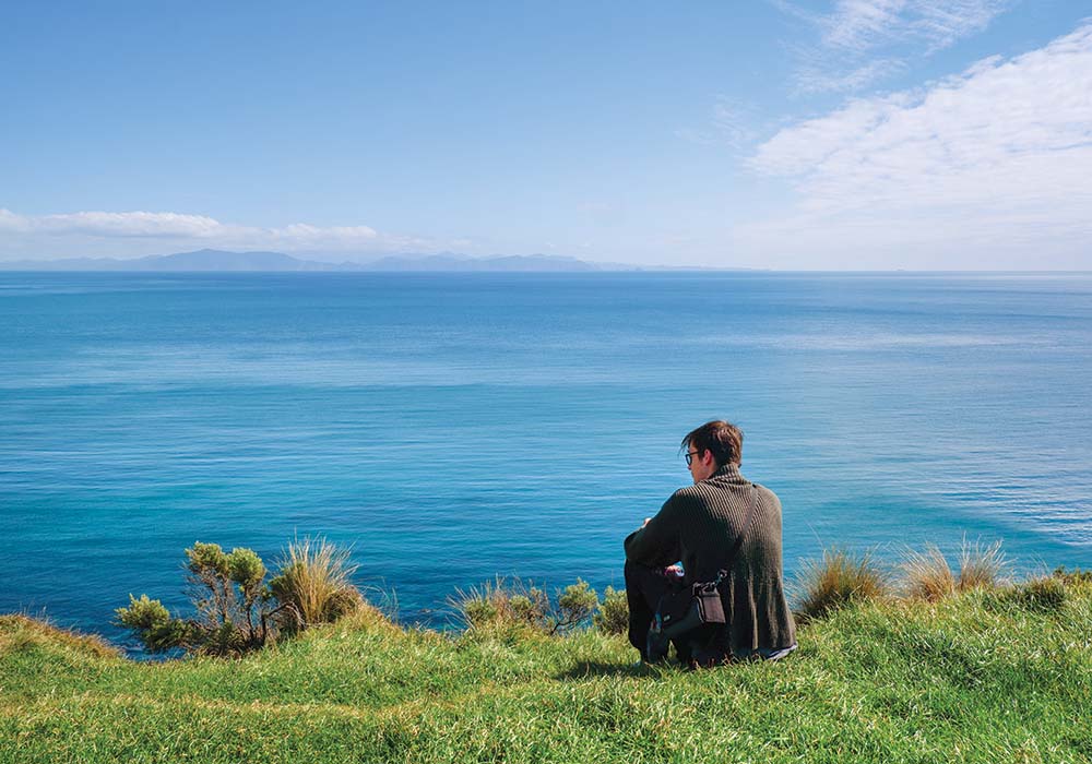
As we reached a grassy knoll, signs told us, ‘No dogs past this point’ and pointed the way to the gun emplacements and Opau Bay. As I puffed my way up the steep slope, a little bird twittered merrily from his spot among the flax bushes – I fancied he was encouraging my stop-and-start progress. The climb was worth the effort, and we paused to savour the moment; looking south, the view across Cook Strait and the South Island was superb, while Mana and the Kapiti Islands could be seen to the north. We gazed on tidal pools sparkling in the sunlight below; a fishing boat headed around the coast and out of sight.
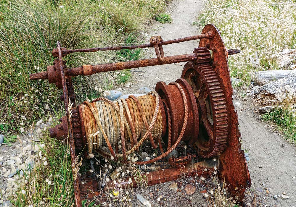
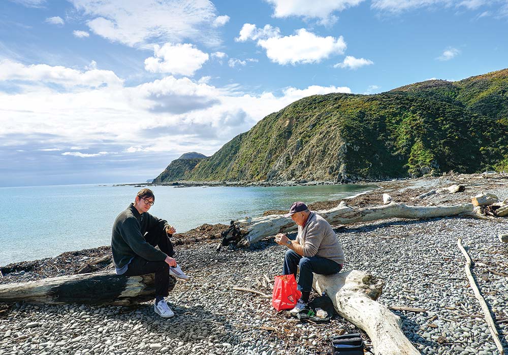
We decided to head back the way we came, enjoying the scenery and exploring washed-up debris on the beach as we went. Alex found a suitable flat stone to test his stone-skipping skills, and we pondered on a steel cable on the path that has long been rusted into place. It will, no doubt, have a story of its own, but for now it will have to remain an unanswered part of the history we’ve discovered at Makara. We were glad to have packed our lunch; we chose a driftwood log each to perch on and watched as wheeling seabirds rode the wind currents across the bay.
Makara Walkway
- 7km loop walk
For more information: wellington.govt.nz/recreation/outdoors/walks-and-walkways/beyond-the-city/makara-walkway - Dogs
The beach is an off-lead dog exercise area. No dogs are allowed on the walkway because it goes across farmland. - Toilets and changing facilities
Toilets are situated beside the car park. - Accessibility
The coastal walk can be uneven, and steep in places. Wear sturdy footwear and take warm clothing as the weather can change quickly. - Makara Beach Café
Open Saturday and Sunday 11am-4pm. - West Wind recreation area opening times
Summer: 1 October – 31 March, 9am-6pm; Winter: 1 April – 31 July, 9am-4pm; Lambing: 1 August – 9 October, closed. - The Makaracarpas
A dedicated group of conservationists working to restore the riparian zones of Makara and Ohariu waterways. Check them out on Facebook.