 |
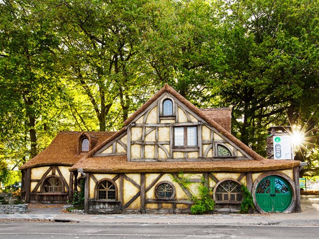
Matamata’s Tolkien-inspired i-SITE |
The little town of Matamata lies beneath the Kaimai Range, the mountains that separate the Waikato from the Bay of Plenty. We’d never spent time here so, on a recent trip, partner Malcolm and I decided to stay a while and explore the area.
Matamata has become synonymous with Hobbiton since trips to the film-set attraction leave from the town. You can’t ignore the Hobbit connection – pizzas at one restaurant include ‘Frodo’s Secret’ and ‘Sauron’s Fury’ – and the i-SITE is charmingly Tolkien-inspired in design.
But there’s more to Matamata than Middle Earth: the town’s history dates back to 1830 when Te Waharoa established a pā. Three years later, missionaries arrived, and a mission station was built, though warfare led to this being moved.
In 1865 an Auckland entrepreneur named Josiah Firth leased – and later bought – land, including the future site of the town. He called his estate Matamata, the name of the pā. Locals dubbed him the Duke of Matamata.
Exploring the past
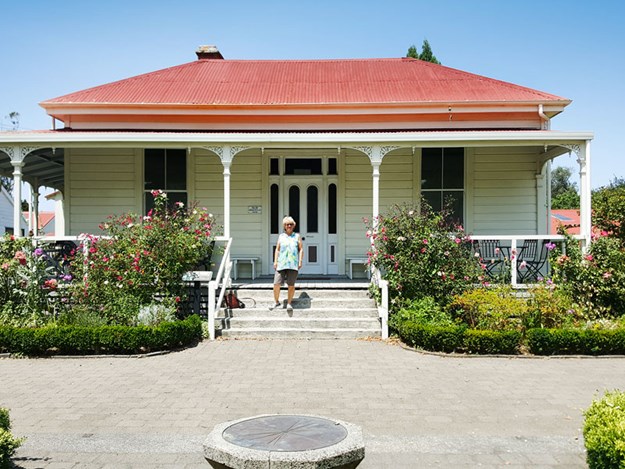 |
The McCaw homestead |
Curious to learn more about the history of the area, we visited the Firth Tower Historical Reserve on the outskirts of town. This was once the homestead and headquarters of Firth’s enterprise and today houses a variety of buildings, surrounded by gardens, lawns and mature trees.
The tower itself was built in 1882 to provide a lookout over the surrounding countryside. It is 16m high and is one of New Zealand’s earliest reinforced concrete buildings. The interior is now a museum that tells the story of Firth and his family, and of the developments he made in opening the land for agriculture and in the introduction of innovative agricultural machinery.
From the lookout atop the tower, we realised what an extensive estate this once was.
Josiah Firth eventually became bankrupt and lost his land. It was divided into 117 farms owned by the Bank of New Zealand and managed by John McCaw.
The McCaw homestead next to the tower dates back to 1902: the previous house was destroyed by fire. Stepping through the front door is like going back in time, the rooms furnished in the style of the late 1880s.
Heritage buildings
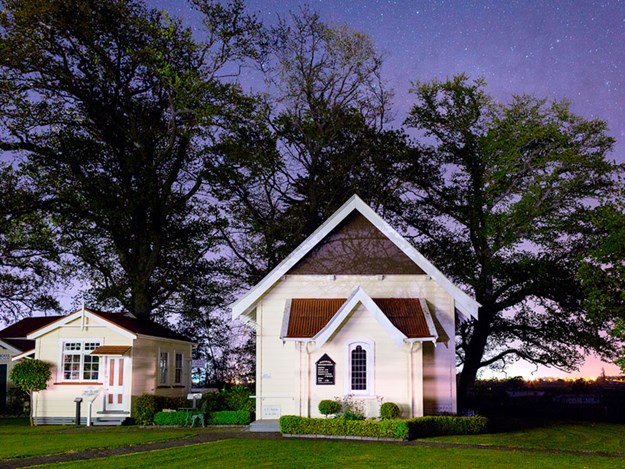 |
Firth Tower Methodist Church |
Grouped attractively around the tower are a variety of old buildings, giving the look of a rural village. We wandered around and peeped into the old Matamata Methodist church, the original Okoroire post office, an old schoolroom, a jail built in 1892 in Karangahake, and a settler’s cottage.
This cottage is shown with furniture and household objects from the early 20th century.
Around the back of the grounds are a group of large sheds, containing a history of agriculture in the area.
One shed has an exhibition of tractors; another has shearing gear, wool bales and fleece. Another shed’s exhibits illustrate the changes in agriculture from Māori times to early motorised machinery.
The dairy industry is represented in a shed that showcases milking and cheesemaking. Near the sheds, there’s a potager garden, orchard, and the original stables. We spent a couple of hours looking around and could have stayed longer – next time we visit we will because there is parking for self-contained motorhomes on the grounds.
Spectacular falls
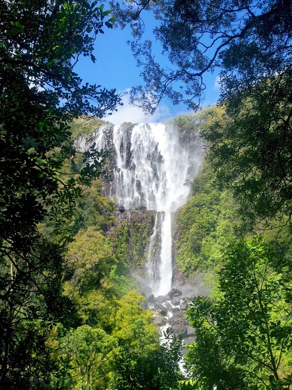 |
Wairere Falls |
For something completely different we headed further down the road, to the very edge of the Kaimai Mamaku Forest Park, for a hike to the top of Wairere Falls. At 153m in height, this waterfall is the biggest in the North Island, and the track covers some of the most varied and beautiful bush in the area.
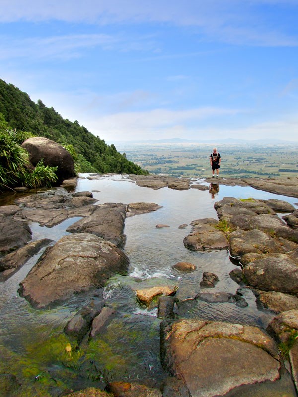 |
At the top of Wairere Falls |
The track up to the waterfall is part of an old trail from the Bay of Plenty. It was first walked, so the story goes, by Ngahue, an early voyager from Rarotonga, who killed a moa at the base of the falls. Later the track was used by missionaries and explorers.
Today the track first winds through an area of moss-covered rocks, tree ferns and ponga, before reaching the river. There’s a bridge here, and another further up the track, which goes steeply uphill.
There are plenty of steps and a set of wooden staircases that took us up beside a cliff face, which leads to the top of the gorge. After a short walk through a grove of nīkau, pūriri and kohekohe, we reached the viewing platform. This looks across to the waterfall and is the halfway point of the walk.
The second section took us up more steps and through more native forest until suddenly we were at the top of the falls. There’s a viewing platform beside the waterfall, but you can do as we did, and rock-hop across the water to where it cascades over a cliff. There are views across the Waikato Plains from the waterfall.
Thermal pools
Josiah Firth discovered the Ōkauia hot pools in 1886. He sold the land containing the pools to W J Aitkin in 1900, and his manager developed the site, establishing concrete pools and a camping ground.
One pool is called Ramaroa and, according to Māori legend, is named after a canoe that transported a chief and his wife up the Waihou River. They had been warned that if they were still in the Ōkauia area after dusk, they would be turned to stone.
Stopping to warm up beside a fire, the couple became petrified – the Ramaroa pool is said to be heated by the fire still burning under the bow of the canoe. Since 2000, Ōkauia has been known as Opal Hot Springs.
The holiday park is set in six hectares beside the river and has a range of accommodation, including motorhome sites. We called in for a soak in the thermal pools after our long walk to the top of Wairere Falls. Since it was a scorching day, we alternated between relaxing in the hot pools and cooling off in the large swimming pool.
Botanical beauty
Matamata township sprang up in 1885 after a railway line was constructed from Morrinsville. Surveyors drew wide streets and a central domain – the building lots flanked by a plantation reserve.
This reserve has been developed into the Matamata Centennial Drive, a botanical park with a huge variety of trees. The trees were initially planted in 1940, to celebrate the centennial of New Zealand, and further planting has continued.
We took an evening stroll along Centennial Drive and were impressed by the variety and stature of the trees. There were many native species but also a huge range of exotics, most of which we had never heard of – Pendulum Redwoods and the handkerchief/ghost tree, for example.
At the Tainui Street entrance, there’s a huge rock, surrounded by a lily pond with a fountain. A plaque on the rock commemorates the Māori, missionaries and early settlers of the district who laid the foundations of today’s Matamata. We finished our walk and went to find somewhere for dinner. We ended up having a great meal in the courtyard at the Horse and Jockey Inn – with not a Hobbit in sight.
Further information
- There’s parking for self-contained motorhomes at the Firth Tower. Full details at firthtower.co.nz
- Opal Hot Springs Holiday Park: opalhotsprings.co.nz
- The Wairere Falls track is 5km return and takes 3-4 hours, though some people choose only to walk to the lookout at the halfway point. More information at doc.govt.nz

