 |
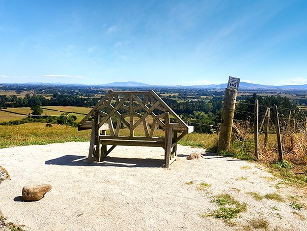
Paddock 66 has been preserved for generations to enjoy |
If you’re going to do something, do it properly, the saying goes. When I first hiked the Wairere Falls track, 25 years ago, I thought I had done just that. Along with two friends visiting from the UK, we puffed and perspired our way through the bush until we got to the end, then turned around and headed back again. As you do. From that day I had always believed we had ‘been there and done that’. So my heart dropped through the floor when a friend who lived in the area posted some photos on Facebook last year, of her and her family triumphantly posing atop the aforementioned Falls. This was nothing like the Wairere Falls I remembered! The view, the space – everything was vastly different than I had witnessed. Not only that, it was a thousand times more spectacular. Could it be, that maybe we hadn’t walked to the end of the track, the way we had thought all those years ago? There was only one way to find out. I had to do it again. It took almost a year of impatiently waiting, but days before the country went into lockdown, I finally got there.
What – and where – are Wairere Falls?
The Falls are located in the Kaimai Mamaku Forest Park, between Te Aroha and Matamata. At 153 metres high, it is the North Island’s highest waterfall and can easily be seen from the Te Aroha- Okauia Road. The track is 5km return and takes around 3 – 4 hours on foot. Having only arrived back in the North Island the day before, we had already been driving all day and it was well into the afternoon by the time we arrived but there was no way I was going to continue further until I had satisfied my curiosity.
I couldn’t believe it as we pulled into the enormous carpark. “This never used to be here!” I said, looking around. Still, I couldn’t imagine anything else would have changed here since 1995. As we set off along the path, it felt as though no time had passed at all.
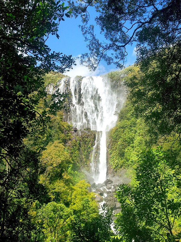 |
Wairere Falls |
The international seat of peace
It was a beautiful and sunny afternoon and we were going along at a good pace. The track is well formed and weaves its way through moss covered rocks and tree roots and over river bridges. “What’s this?” I frowned at a sign about 15 minutes along the track. ‘The International Seat of Peace’, a sign mysteriously pointed off the track and into an adjacent paddock.
This wasn’t here last time either! Curiosity well and truly piqued, we went to investigate. The International Seat of Peace – a large, handcrafted wooden bench – was placed here in 2017 by local farm owner Simon Bourke. He loved the view so much, he wanted to share it with others, not just his cows, and so closed off Paddock 66 and erected a seat, where people could come and have a rest along the way if needed, or just admire the surroundings and tranquillity.
I had no idea what we were going to encounter at the top of the hill but as the view appeared, all we could say was “wow!”. Gareth and I were the only people there. I sat on the bench and closed my eyes for a while and just listened to the birds all around. It truly was a seat of peace and I didn’t want to leave, but we had a long way to go yet.
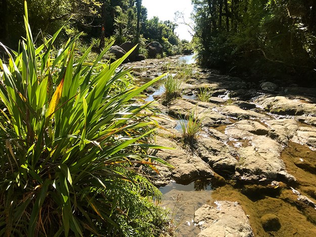 |
The track opens up at the top of the cliff |
From the bottom to the top
Back on the path we were soon making our way up the cliff, with the help of some stairs. On our way to the viewing platform we followed several others, who took photos and rested in the seating area, then headed back down the way they’d come. They didn’t appear to see the small sign behind them which continued on up the track – they thought this was the end. To my dismay, I realised what my friends and I had done all those years ago, and what all these people were doing now. We had only climbed as far as the bottom. This time however, I knew better.
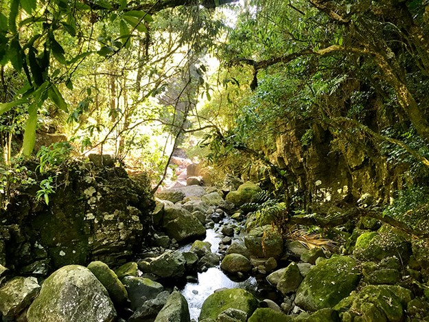 |
The track has lots of delightful nooks |
Here is where the real work began. The track was steep and challenging, in fact a real workout, but fun! The sweat dripped off us in the afternoon heat and we only saw one other couple making their descent as we clambered up, winding our way through nikau groves and a mosaic of native trees. Just as I began to think we would never get there, the track opened out and there it was, stretched out before us. We had reached the top of Wairere Falls and it was absolutely breath-taking.
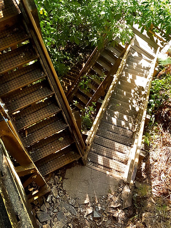 |
Be prepared to climb a LOT of stairs! |
The top of the falls is so huge, you can actually walk across and along them and that’s what we did. There are plenty of pools to paddle in and we wished we’d brought our swimming togs. The view stretched out across the Waikato Plains as far as the eye could see, I couldn’t believe I had missed all this the first time around. At least now I knew I wasn’t alone!
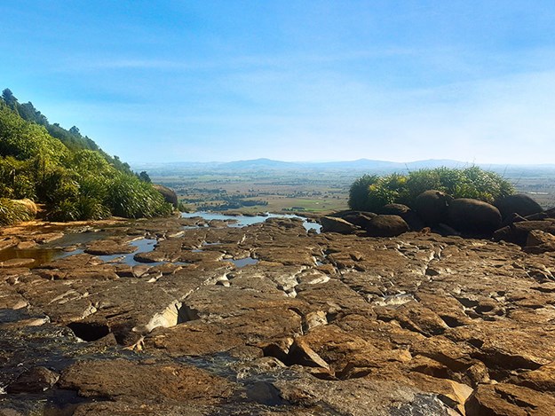 |
The REAL top of Wairere Falls! |
We stayed, just the two of us looking out from the top of the world, until the light began to fade and we reluctantly began the climb down. As we reached the viewing platform we’d passed on the way up, we finally permitted ourselves to stop and take a look. It felt incredible to see the immense falls cascading down the cliff and think ‘we’ve been to the very top of there’ The rest of the track felt like a breeze and at last we returned to the van, in a now empty car park. I hope it isn’t another 25 years before I get to visit this special place, but if I don’t at least I can finally say I’ve seen it properly.
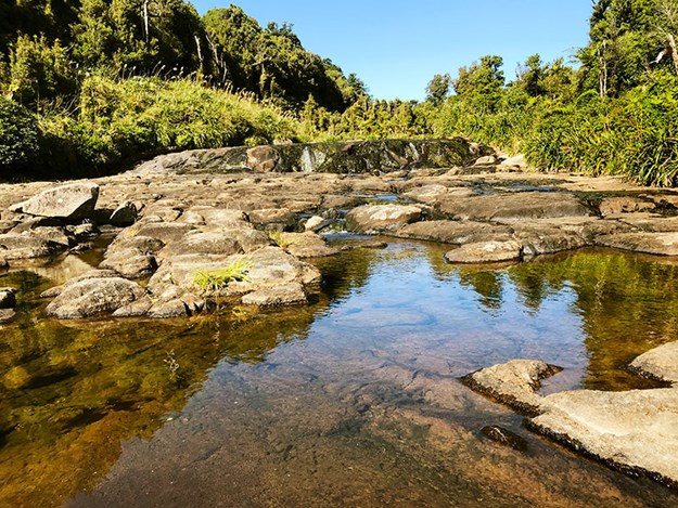 |
A perfect place for a paddle on a warm day |
More information
If you’re in the Matamata/Te Aroha area, be sure to pay a visit to Wairere Falls. Your efforts will be well rewarded. Here are a couple of things to note before you go.
- The falls can be seen from the Te Aroha-Okauia Road and are signposted from the Goodwin Road turn-off. If you’re heading there in spring, watch out for the apricot coloured flowers of the taurepo or sandpaper plant on the rocky valley walls.
- A reasonable level of fitness is recommended – especially if you want to get further than the bottom. The second part of the climb is challenging, so make sure you have strong, comfortable footwear with good grip, warm clothing, a raincoat and food and drink.
- There are several lovely small water holes, so if you’re going in summer take your swimming gear, a hat and sunscreen. You won’t want to leave!
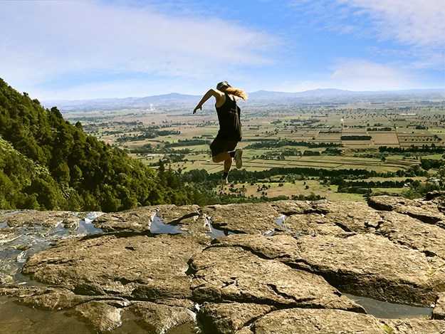 |
Kids don’t try this at home! |

