 |
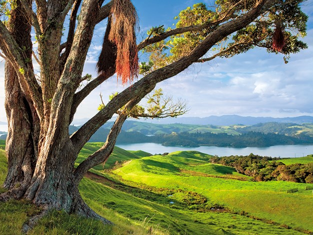
The beautiful Coromandel |
Most people head to the Coromandel Peninsula for its beaches, fishing, diving, and well-known attractions like Hot Water Beach and Cathedral Cove. But you can avoid the crowds and experience more of the peninsula’s natural beauty by heading to its forest.
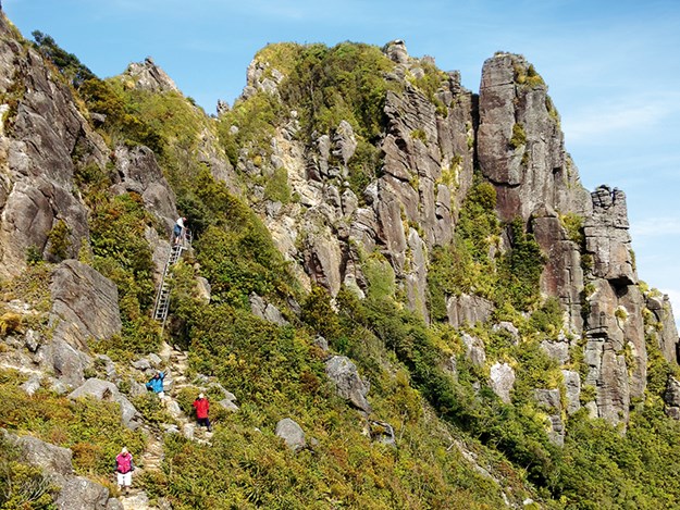 |
Walking up to The Pinnacles from Pinnacles Hut |
The Pinnacles Walk
Kauaeranga Valley in the Coromandel Forest Park has numerous trails. The Pinnacles Walk, also known as Kauaeranga Kauri Trail, follows an old packhorse route used in the 1920s by kauri loggers. The trail starts from the carpark at the end of Kauaeranga Valley Road, 9km past Kauaeranga Valley Visitor Centre, which is 13km from Thames. The centre supplies maps and you can watch a 20-minute film showing Kauaeranga Valley’s kauri logging history as well as see displays on historical and natural features.
A long day hike, we chose to turn the Pinnacles Walk into an overnighter and booked beds in DOC’s 80-bunk Pinnacles Hut well in advance. The hut has cold showers, solar lighting, gas cookers and a barbecue. Hikers need to carry in everything else.
With heavy packs, we followed the signs for the Kauaeranga Kauri Trail from the carpark. A short, flattish trail and a one-man swing bridge over boulder-strewn Kauaeranga River took us to Billygoat Landing. From there, it was pretty much uphill, sometimes moderate, other times heart-pumping due to many picturesque stone steps.
Built for packhorses to use during kauri logging times (apparently steps made it easier for the horses), for short humans some are quite a stretch for the legs; it’s a good workout for the glutes.
Having joined Webb Creek Track, we emerged at the Hydro Camp clearing and stopped for lunch perched on old logs before continuing ever upwards. The distant Pinnacles, spires of rock, came into sight, peaking well above everything else.
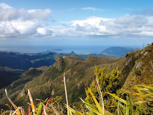 |
The spectacular view of Coromandel Peninsula from The Pinnacles |
Reaching Pinnacles Hut, around three hours from starting, the clean, compostable toilets were luxury. Sleeping arrangements included two rooms which each consisted of two levels of around 20 mattresses each.
Beds claimed, we set off unladen for The Pinnacles, a 1km (40-minute) trail. An easy gravel path led among low-growing yellow and bronze vegetation before turning adventurous. Steep metal stairs led to metal rungs drilled into vertical rock. They required a few tricky stretching manoeuvres to navigate.
It was fun, and worth it. On the wooden landing just below the peaks, 759 metres high, I huddled close to the rockface as the wind tore across. Crumpled greenish-brown hills and ridges shadowed by clouds were edged by the blue Pacific, from where three small islands rose. White blobs clustered the shore line, perhaps Tairua, along Coromandel Peninsula’s east coast.
Back at the hut, a five-minute walk took me to Dancing Camp campsite, where four flat, slightly raised gravel camping areas were sheltered in bush. It’s also the site of a partially-restored wooden dam built in 1924, once used to transport logs down the valley. According to a fellow hiker, Dancing Camp got its name from the 1900s gum diggers’ Saturday night buck dances, so-called as no women were present.
That night, I was relieved to find sharing a room with 39 others wasn’t so bad thanks to a sleeping tablet! I didn’t hear those who rose to view the sunrise at The Pinnacles.
Our return walk took us back to Hydro Camp and onto Billygoat Track, which ascended for around 30 minutes. After that, it was virtually downhill following rails here and there which once transported logs.
Information boards related the history. The trail overlooked Billygoat Basin, where I spotted Billygoat Falls, a sliver of silver slicing through green bush. At 180 metres, it’s officially the North Island’s highest waterfall.
Wading across shin-deep Kauaeranga River we reached Kauaeranga Valley Road, the carpark around 300 metres away. The return hike took about four hours.
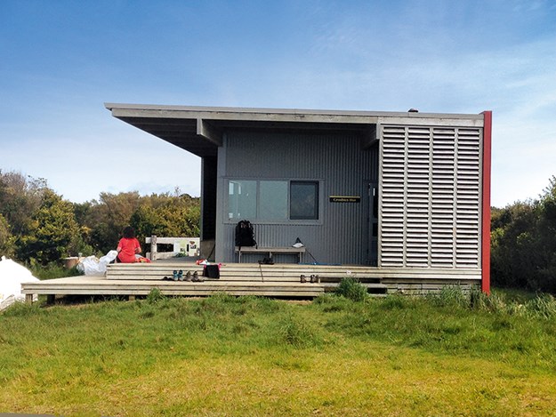 |
The 10-bed Crosbies Hut |
Crosbies Hut
Crosbies Hut, accessed via a number of trails, is another good overnight hike in Coromandel Forest Park. I walked Waiotahi Track, which joins Karaka Track, at the end of Waiotahi Road on the outskirts of Thames. The trailhead is marked by a sign ‘Waiotahi Block’. At 13km one way, the hike takes around five hours.
In November, the leaf-littered uphill trail was damp and cool, with stretches of slushy clay. Thick native vegetation – including tangled vines, punga, wispy beard-like juvenile rimu and lancewood – created dim, mystical surroundings with only a brief peek of the Firth of Thames. Except for a high-pitched ‘cluck-cluck’ alerting us to a quail, we had it all to ourselves.
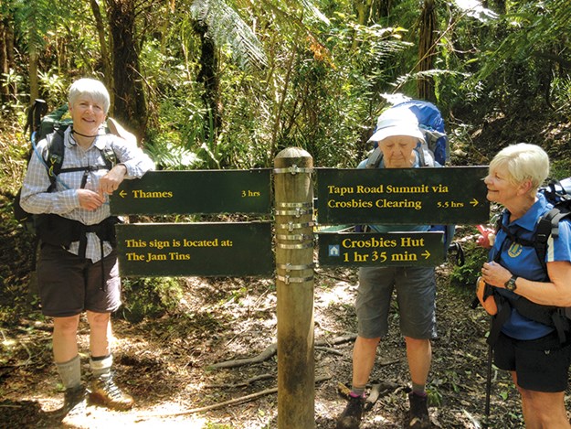 |
A brief pause on the trail to Crosbies Hut |
The 10-bed Crosbies Hut and five camping sites (bookings are essential) are located on a cleared ridge. Views of the Coromandel Ranges, including Table Mountain and Castle Rock, were spread before us. Forest green ridges undulated and distant hazy ones resembled grey rolling waves. Brighter patches between dips might have been the sea.
Boards relate the history of Crosbies Settlement, named after settlers Thomas and Agnes Crosbie, who farmed there from 1880.
They sold their block in 1917, and by 1926 the area was abandoned. Despite further farming attempts, the bush reclaimed the cleared land by the 1960s.
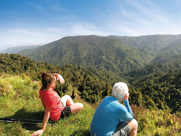 |
Looking out over the crater en route from Crosbies Hut |
It became part of the Coromandel Forest Park, established in 1970.
A memorial rock with a metal plaque bearing the names of Urban Höglin and Heidi Paakkonen, two Swedish tourists who went missing in the area in 1989, is a short distance from the basic hut.
Hikers need to be self-sufficient as there’s no cooking equipment or electricity. Mattresses lie side-by-side on two levels. Toilets are compostable.
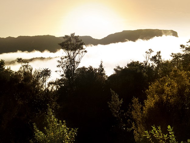 |
Low cloud-enveloped Table Mountain seen from Crosbies Hut |
From my top bunk next to a window, I fell asleep watching the tiny, twinkling lights of Whitianga and woke to low cloud obliterating everything, except Table Mountain and Castle Rock jutting from them.
Retracing our steps, we walked a one-hour (return) side track to a crater lookout. I gazed in the warming sunshine at forever views of a green world. How much of it was unexplored?
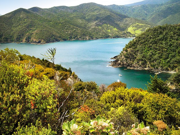 |
Looking out east from the Coromandel Coastal Walkway |
Coromandel Coastal Walkway
Coromandel Coastal Walkway links the east and west coast peninsula roads. It was a centuries-old bridle path used by Māori and European settlers. Located on Coromandel Peninsula’s tip, I walked it on a day trip from Papa Aroha Holiday Park, around 15 minutes’ drive south of Colville.
Gravel roads from Colville lead to Port Jackson onto Fletcher Bay, situated at the west end of the walkway, and to Port Charles and Stony Bay, the road we took. Isolated, it twisted, climbed, descended and narrowed among rugged bush… glad I wasn’t driving.
Nearly an hour after leaving Papa Aroha, 34km away, we reached the bay’s DOC camping ground and a sign, ‘Coromandel Coastal Walkway parking’. It was early January; there were more green buildings concealing long-drops than there were tents. Walkway signs were lacking, but luckily a fellow walker knew where it started. Crossing a concrete ford over a river, we headed right, up a grassy incline to the entrance overlooking the bay.
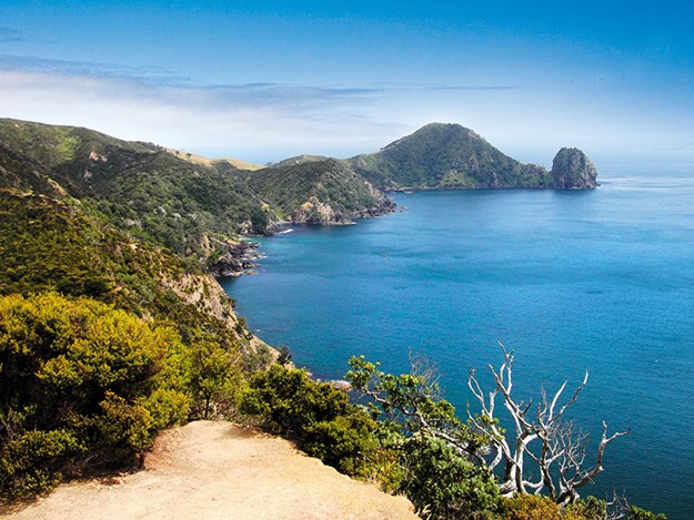 |
The sweeping view out west is just as stunning |
A short, steep dirt path twisting up Henry’s Hill through lush native forest had me puffing. From there the path undulated and walking was easy. A canopy of mānuka, perhaps kānuka, covered in white flowers gave the appearance of sprinkled snow among the verdant greenery where fantail flitted and tūī sang.
Above Shag Bay, I spotted a launch and diver’s bubbles, with further glimpses of the coastline along the way. An hour in, we climbed a five-minute side track to a lookout. Bush-clad land dropped to where never-ending, blotchy-blue sea lapped; distant Great Barrier and Cuvier Islands were hazy. Beautiful.
Poley Bay, signposted an hour’s walk from there, took 30 minutes; a steep descent to a peek of sea between rock cliffs. What followed was a calf-aching, heart-pumping, sharp ascent, taking around 30 minutes, to rolling farmland. Within sight of an old, corrugated iron shepherd’s hut we enjoyed expansive views of the peninsula.
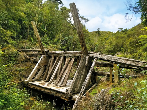 |
The dam at Dancing Camp campsite |
Walking downwards, across open farmland towards a black sand beach, we then ascended, following orange painted posts, to spot Fletcher Bay below. About two-and-a-half hours after starting, covering around 10.2km, we reached the sandy bay and DOC campsite.
Long-drops were plentiful; a sign advised tap water required boiling. We picnicked beneath a pōhutukawa and black clouds.
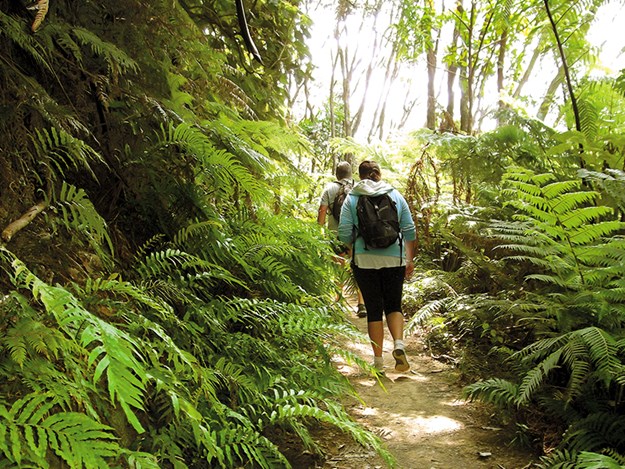 |
Taking the path away from Stony Bay on the Coromandel Coastal Walkway |
Returning to the shepherd’s hut, we decided to take the mountain bike track/ old stock route back to Stony Bay. What a mistake! The trail led relentlessly up farmland hills. Battling the wind, each time I thought I had reached the top I found another rise around the bend.
Were we even on the track? There was no signage, just infrequent red triangles. Spectacular coastal views disappeared as I was enveloped in damp, low-lying cloud. Finally, reaching the top, we followed a road-width, steeply descending rocky path sheltered in picturesque ferns and forest. Biking it would be terrifying.
We emerged at Waterwheel Flat onto flat farmland where the grey remains of a chimney stood in a field, and reached Stony Bay from the rear. Walking approximately 17.5km, it took around six hours, including our lunch stop.
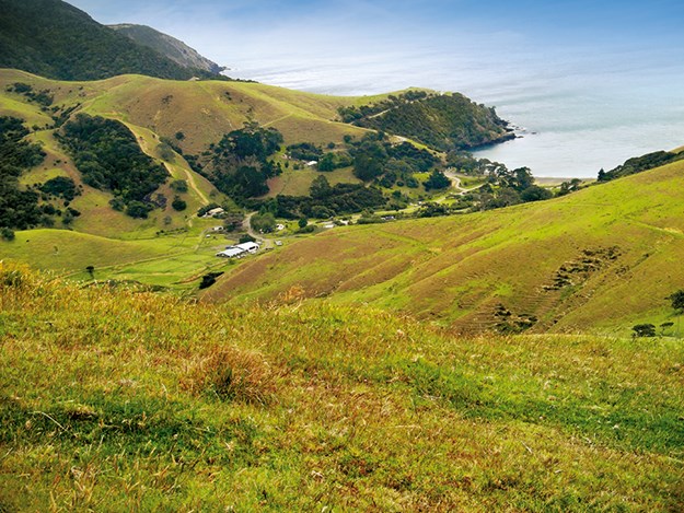 |
Fletcher Bay, at the western end of the Coastal Walkway |
At little cost, and with a moderate level of fitness, these trails are a great way to see the vastness and beauty of Coromandel Peninsula’s landscapes. You’re also likely to have much of it to yourself; I saw barely anyone else on the tracks even though Pinnacles Hut was near full. And of course, you can also learn a little of the region’s history along the way. Go bush!
For more visit doc.govt.nz and search:
- Coromandel Coastal Walkway
- Pinnacles Hut
- Crosbies Hut
- Kauaeranga Valley
- Kahikatea campsite
- Stony Bay campsite
- Fletcher Bay campsite
Getting to the walkway
If windy, gravel roads are offputting then book a shuttle from Colville for drop off at Stony Bay and pick-up at Fletcher Bay (only walking one way) (See coromandeldiscovery. co.nz) and stay in a coastal camping ground on the west of the Peninsula:
Campsites
- Papa Aroha Holiday Park: papaaroha.co.nz
- Anglers Lodge: anglers.co.nz
- Colville: otautubaycamp.co.nz

