PEAKING PIRONGIA
While there are plenty of shorter walks around Pirongia Forest Park, Eleanor Hughes chose a multi-day hike up the mount to really explore this beautiful area in the Waikato.
Lying just 13km north-west of Te Awamutu is the historic township of Pirongia. Originally named Alexandra, this former military post now serves as base camp for Mount Pirongia and its stunning sea and rural views, fascinating caves and mighty trees. We had decided on a multi-day hike on Mount Pirongia, which required an overnight stay in DOC’s Pāhautea Hut. It was a slog, and we were certainly kept on our toes – but what an adventure!
Leaving our car at Kaniwhaniwha Reserve carpark on sealed Limeworks Loop Road, we crossed the road and began our tramp on the flat Nikau Walk. It left me wondering where the Nikau were as we followed the road-width track alongside Kaniwhaniwha Stream, paddocks on our left. Half an hour later we reached the signposted Tahuanui Track to traverse the Kaniwhaniwha DOC campsite, a large field. From there on, it was uphill to Tirohanga Track.
ASCENDING THE TAHUANUI TRACK
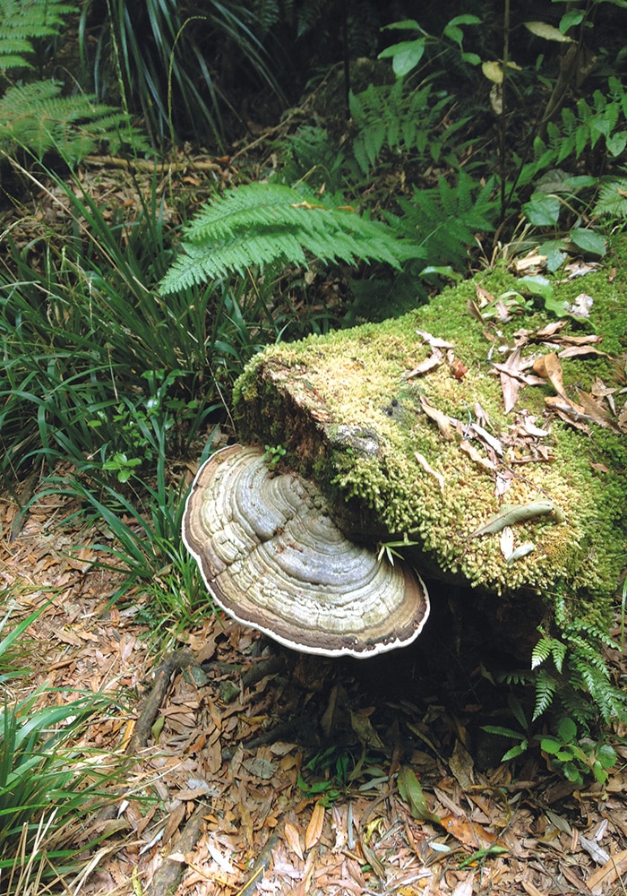
There wasn’t a breath of wind in the dense forest as we hiked below a canopy of towering trees. Looking where I stepped instead of the trail markers sent me off trail a few times; just as well there were two of us to call each other back when those red triangles were spotted again! It was an amazing experience: birds trilled; a fantail flittered closely for a short time; swooping wood pigeons broke the stillness. White blobs of bracket fungi growing high on tree trunks caught my eye; another fungi, a shelf-like semi-circle, was a rainbow pattern of hues – greyish green to cream, to fawn, then chocolate hemmed by white.
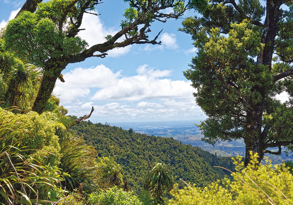
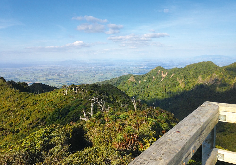
Higher on the slopes, I gazed out at a shimmering Tasman Sea, the sun glancing off it as it broke through grey clouds. Near the intersection with the Tirohanga Track, the vegetation became shorter and more diverse; moss hung from branches, horopito leaves tinged with red broke the greenery. Dracophyllum, Dr. Seuss-looking trees sprouting mad hairdos, were numerous. Where we were taller than the trees, we waded through knee-high fern, bromeliad-looking plants and tussock-type grass and looked beyond densely covered ridges across a green rural patchwork disappearing into the horizon.
On the route, I learned more about the endangered dactylanthus taylorii – known in English as the wood rose, and in Māori as te pua o te rēinga – New Zealand’s only indigenous fully parasitic flowering plant. All I could see was a sign on a wire cage, which sat over empty dirt. The cage was there to protect the once-common plant, which grows below ground, from possums. Only seen when it flowers in late summer, the flowers’ nectar attracts the native, short-tailed bat. Currently regarded as being in serious decline, dactylanthus is now the subject of a DoC recovery plan.
SUMMIT REACHED
Fifteen minutes after joining the Tirohanga Track via the walking boardwalk and stairs, we reached the summit, 959m above sea level. I climbed the ladder to the lookout to take in a 360° view of jutting and rolling ranges, densely forested. Tiny dots of cars, like white ants, moved between multi-coloured pastures. The track to Pāhautea Hut, our sleeping quarters for the night, was a narrow line between what looked like some impenetrable trees.
PĀHAUTEA HUT
We reached the 20-bed hut 25 minutes later, passing empty dog kennels used by DOC for teams hunting wild goats, a helicopter pad, camping platforms and camping shelter. The 10.7km had taken us 51⁄2 hours.
As we were hiking on weekdays, we only had to share the hut with two other people. The tables’ surfaces are like information boards. I read of an 1877 ascent which told of extremely dense vegetation that was difficult to penetrate; ridgetop trees only a few feet high with branches spreading horizontally just above the ground. In some places the way forward could only be made by crawling on all fours under the vegetation; in other areas only by walking on the tops of closely interlaced branches.
THE LEGEND OF PIRONGIA
According to the legend on the Pāhautea Hut wall, the fairy people of Pirongia – the Patupaiarehe o Pirongia – lived on Hihikiwi, a peak I can see from the hut window and a short walk away. Whanawhana, a Patupaiarehe chief captured Tawhai-tu, wife of Ruarangi, while she was digging kumara from their home on the bank of the Waipa, and took her to Hihikiwi. Her husband found her, but a spell had been cast; Whanawhana would play music on his pūtōrino and she would come, returning to her husband the next morning. To break the spell Ruarangi and Tawhai-tu painted themselves with kōkōwai ochre, and cooked food made over steam ovens in front of a specially built smaller house also covered with ochre and chanted karakia. That night Whanawhana appeared, but was repelled by the kōkōwai and food. Grieving, he returned to Hihikiwi. It is said that Ruarangi and Tawhai-tu’s descendants live by the banks of the Waipa to this day, recognisable by the reddish-copper colour in their hair.
WALKS AND WANDERS
Kaniwhaniwha Caves Walk, taking around two and a half hours, is a 7km return from Kaniwhaniwha Reserve carpark on a flat trail via the Nikau Walk. Be sure to take a torch.
The Kahikatea Tree Walk is 12 km return from the carpark, passing by the Kaniwhaniwha Caves and undulates from there. Don’t cross the swingbridge but continue straight on, along the streamside. The signpost to the tree is slightly obscured beyond the bridge. This is an easy day walk for older children, and would take around four and a half hours including a visit to the caves.
Pirongia Forest Park was set up in the early 1970s with tracks built to open up new areas and create loops. Prior to this the main track was the Tirohanga Track and a few rough hunting trails. By all accounts, we were very lucky not to have encountered any mud, as the area is a very wet spot with poor drainage, and even in summer it can be a mud bath: be warned!
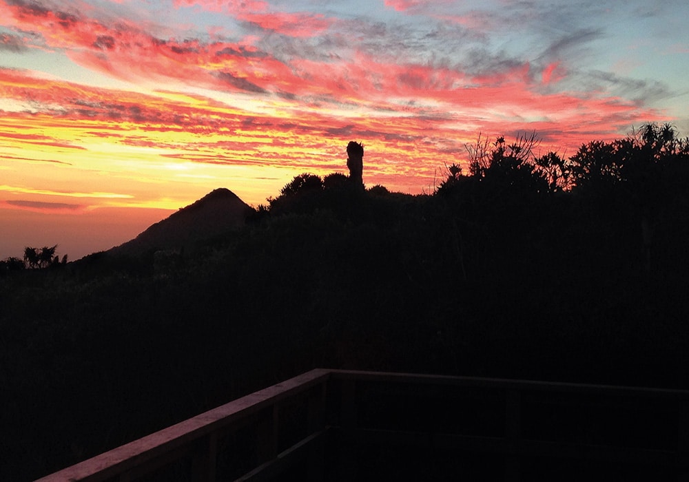
Beyond Hiwikiwi Peak, seen from the hut and a short walk away, is Kawhia harbour, to the north Aotea and Raglan harbours. Pirongia is the largest volcano in a 65km line of others; Kakepuku, Te Kawa, Tokanui and Waikeria, known as the ‘Alexandra Lineament’. A tomtit rested on a branch outside the hut as I ate my dehydrated dinner and the sun slowly set orange across the horizon, silhouetting jutting ranges. All that could be seen when darkness descended was a small patch of twinkling lights, an unknown Waikato town.
DESCENDING ON BELL TRACK
At 7.30 the next morning, the dim Bell Track was atmospheric; mist hung low as we trod the boardwalk amongst short, twisted trees from which moss hung. Some of the trees in the area are pāhautea, New Zealand’s only true conifer, some of which are 600-700 years old. Thankfully the mud was sparse, and when we did encounter it, it was just shallow enough not to trickle
into the top of my boots. Forty minutes from the hut we reached The Cone, 945 metres above sea level. I’m sure the views are fantastic…but on our day, they were obscured by fog.
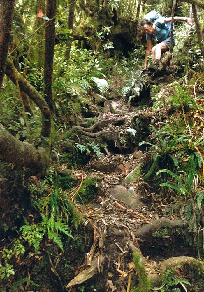
We descended quite steeply, scrambling down over rocks and roots. Lower down, thick vegetation and fallen trees littered the trail making it indiscernible in places. It felt like nobody had been before us. We walked between gaps in trees that looked like a path searching for those red triangles, backtracked, then bush-crashed a little more. It was like a treasure hunt, where we were only able to move on when the clue was found.
At Central Clearing Campsite, reached after four and a half hours, a sign told us the carpark is another four to six hours away. So we stopped to eat near some goat hunters’ bivouacs.
SIDE TRIPS
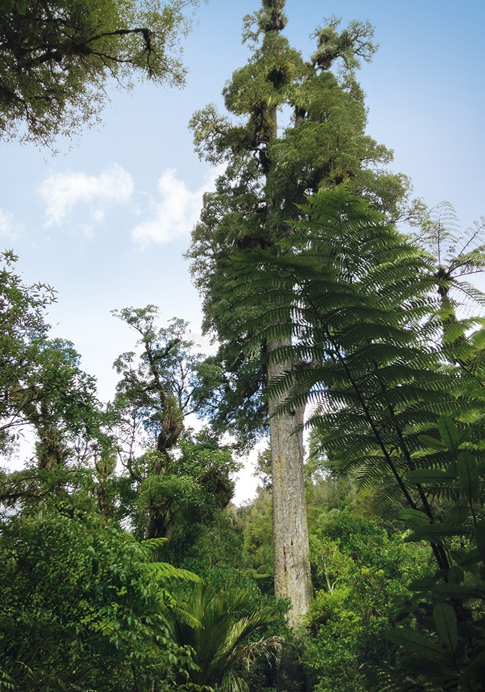
The trail continued to gently descend. Saucer-sized fungi grew on trunks; blue fungi, white underneath, curled and twisted like dry, stiff flannels. Suddenly a gun sound broke the silence. Possibly it was a tui, although I wondered if it may have been a kōkako – they are being re-established in the area. Two hours from the campsite, we reached Blue Bill Stream, where we crossed a blue swingbridge and took the trail to a 66.5m high Kahikatea tree. The tree is estimated to be 400-500 years old and the tallest recorded native tree in the country.
An hour’s walking streamside, the track rising more than I wanted it to after six and a half hours of hiking, we arrived at the turning to the Kaniwhaniwha Caves. The only known limestone cave in the
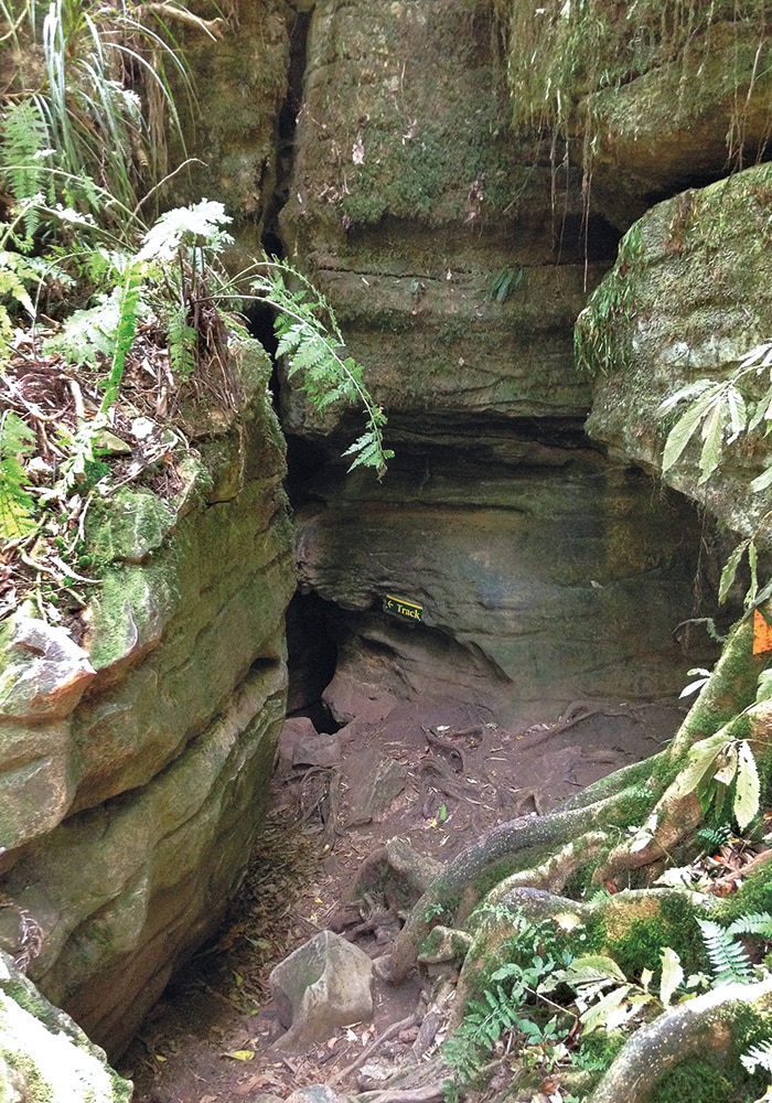
Pirongia Forest Park, it’s less than five minutes off Bell Track. Stairs led down to the 30m cave, where I was met with total darkness within a few steps. In torchlight, the ground slushy underfoot, I squeezed through a high passage little more than my width wide in places. It turned, straightened and turned again, lightening near the end where climbing a 2.4m ladder I emerged – only to spot my backpack where I had left it at the turnoff ten minutes earlier.
The Nikau Walk Loop, a picturesque, flat path lined with Nikau and fern, was barely five minutes away and we were soon back on the track we had walked from the carpark the day before. Eight and a half hours later, with an 18.5km walk under our belt, we arrived back at the car. It had sometimes been a battle between mind and body but it was certainly an adventure!
MORE INFORMATION
For freedom camping options in the Pirongia area: nzmca.org.nz
For information on trails to Pāhautea Hut, (including Hihikiwi Track – the shortest option at 6.4km one way, or the Tirohanga and Mahaukura Tracks, a 17km round trip beginning on the Mangakara Nature Walk), hut bookings and DOC Kaniwhaniwha campsite bookings: doc.govt.nz

