The South Island is famous for its towering mountain ranges, sweeping plains, picturesque lakes and majestic fjords. Many beauty spots are justifiably well-known and, amazing though they are to visit, are often crowded with visitors.
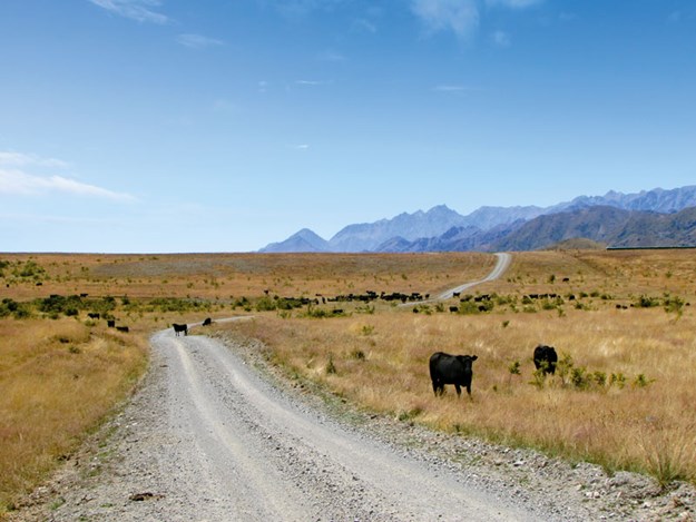 |
Molesworth is New Zealand’s largest farm |
When hubby Malcolm first suggested visiting some high country stations, I was a little anxious – after all, a glance at the map showed nothing but empty spaces. Some online research reassured me it was possible, in fact desirable, to drive through these remote stations and see for ourselves the little-known, wide expanses of wilderness that make up these gigantic farms.
Mighty Molesworth
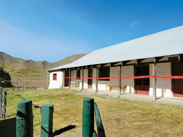 |
The historic Acheron Accommodation House is getting a facelift |
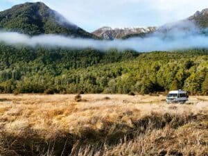
Molesworth Station is open to the public over summer, and the 207km journey from Hanmer Springs to Blenheim through the station makes a great alternative route for campervans and vehicles under seven metres.
There are camping spots at the Acheron Accommodation House and Molesworth Cob Cottage, so there are options to break the trip and explore some of the walks along the route, or just park and admire the views.
The main road through Molesworth is the Acheron Road – other roads are 4WD only. Because our bus was too long, we left it parked at the NZMCA Park at Hanmer Springs and explored by car as a day trip. From Hanmer Springs the Clarence Valley Road leads north.
Cut into the side of a vertigo-inducing, steep hillside, this goes over Jacks Pass and into the station. At over 180,000 hectares, Molesworth is New Zealand’s largest farm and is administered by the Department of Conservation, with Landcorp Farming responsible for the station’s 10,000 head of beef cattle.
Driving through the station, it is hard to believe that 70 years ago the area was abandoned, the land untenable because of the destruction caused by thousands of sheep and millions of rabbits. Luckily, rabbit control, re-sowing and conservation practices have turned Molesworth around – now visitors can be awed by the beauty of the landscape.
A welcome sight
The Acheron Accommodation House, built in 1862 as an overnight stop for stockmen and travellers, is the oldest building at Molesworth. Of cob construction, it has a roof of beech rafters, thatched with tussock.
I had been looking forward to seeing the historic buildings on the station and was sad to see that they had been damaged by the 2016 earthquake. However, despite red tape, the Accommodation House still looks picturesque and was no doubt a welcome sight for early travellers.
(Renovation of the house has recently begun, with contractors planning to retain as much as is possible of the original fabric of the building. Hopefully this summer’s visitors will be able to safely admire the house, inside and out.)
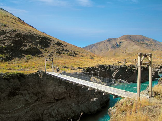 |
The Lower Acheron Suspension Bridge |
The Accommodation House marks the start of 59km of road leading to the Molesworth Cob Cottage at the northern boundary of the station. This section of road can be driven in two hours but we took much longer as we lingered – to read information panels, at shelters, at suspension bridges and at every spot that called to be photographed.
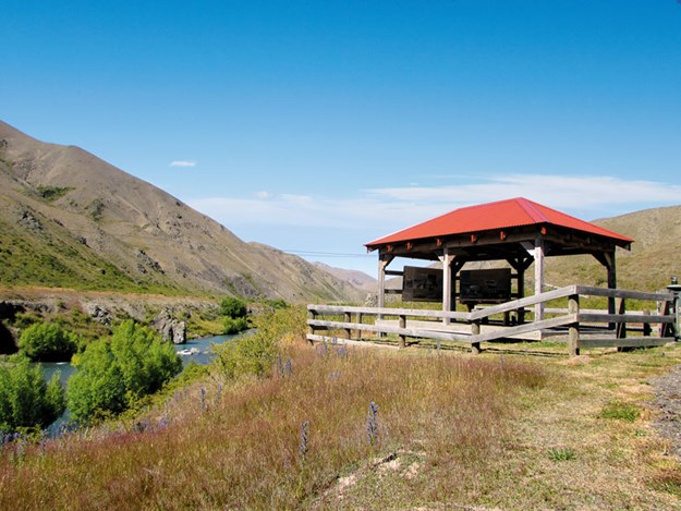 |
Roadside shelters provide information panels |
Our first stops were by the river, where wooden suspension bridges span clear, fast-flowing water. On this quiet day, with only birds for company, it’s hard to imagine that once 15,000 sheep were driven over the river where the Lower Acheron Suspension Bridge now stands.
Further on we admired Pig Trough Suspension Bridge, named for the wild pigs living in a nearby gully. Both these bridges are relatively new, replacing earlier bridges washed away by floods.
Murder at Molesworth
Near the confluence of the Severn and Acheron Rivers is an area still called Red Gate, though the gate is long gone. A signboard tells the sad tale of Ivanhoe Augarde. The young man wrote a letter to his sweetheart and entrusted its delivery to a worker called German Charlie. Unfortunately, Charlie read the letter to other men as he travelled north.
When Ivanhoe discovered that he’d been the subject of ridicule he set off in pursuit of Charlie and killed him. He then returned to the Red Gate, where he turned the gun on himself. The tale is memorialised in the name of nearby Mount Augarde.
Lakes, Valleys and Mountains
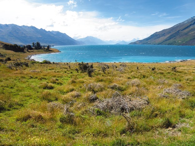 |
Lake Wakatipu |
Our next station visit took us to Walter Peak, on the shores of Lake Wakatipu. Walter Peak is primarily a sheep station, founded in 1860 and still going strong. It runs around 18,000 sheep and 800 beef cows.
Small compared to Molesworth, the station still covers more than 25,000 hectares. There is no through route – the drive is around 90km each way, starting form a small turn-off on the Te Anau-Mossburn Highway, SH9.
With our usual number of photo stops, explorations and a relaxing break at Walter Peak Station, it took six hours for the round-trip. Mavora Lakes was our first stop. Situated in a mountainous landscape, surrounded by tussock grassland and beech forests, it is a magical place and was used by Sir Peter Jackson when filming The Lord of the Rings.
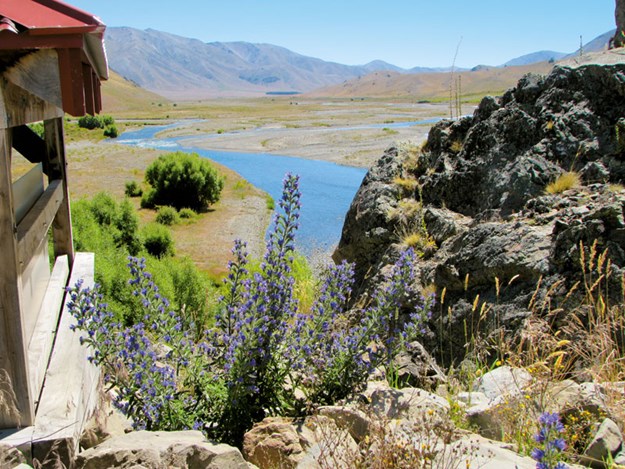 |
There are photo-worthy spots aplenty in Molesworth |
The forests of South Mavora Lake became ‘Fangorn Forest’, while the Mararoa River became the ‘Silverlode’. Enthusiastic trampers can trek the 50km Mavora-Greenstone walkway starting here, but we just wandered around the lakeside and adjacent bush, imagining hobbits and elves behind every tree.
There is a DOC camping ground at the lakes, accessible to motorhomes and caravans, and the area is popular with those who love the outdoors. Many activities that are not normally allowed in national parks are permitted here, including 4WD driving (on tracks), hunting, water sports, horse trekking, trout fishing and mountain biking.
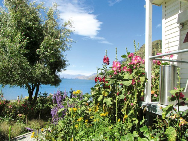 |
A glimpse of Lake Wakatipu at Walter Peak |
It’s a great base for the drive to Lake Wakatipu. The road from Mavora Lakes to Walter Peak leads straight towards the horizon, with the high Eyre and Thomson mountain ranges on each side.
There are a couple of fords to negotiate and some narrow bridges that have fords beside them – so heavy vehicles can use the route. Suddenly, and unexpectedly, the valley was revealed to be a plateau. A lower valley appeared and the road dipped steeply into it.
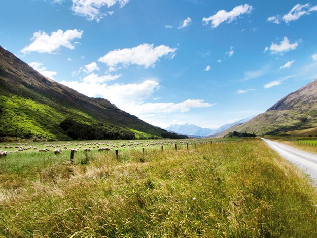 |
The road to Walter Peak Station |
Then it was on as before until we reached the shores of Lake Wakatipu, where there were views up the lake towards Glenorchy and across towards Queenstown. The road then skirted past Mt Nicholas Station, finally arriving at the lakeside at Walter Peak Station.
Picturesque Peak
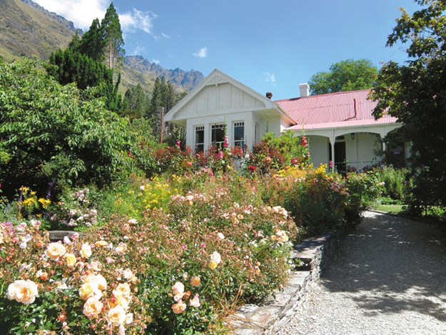 |
Walter Peak is rich in colonial history |
As a contrast to the empty, open drive, this felt like an oasis. There were old, white-painted buildings, including the Colonel’s Homestead – rebuilt on a grander scale after a fire in 1977–surrounded by English-style cottage gardens and lawns. There were jetties and a boat was pulled up on the beach.
There was also a hotel with a restaurant and a bar, where we gratefully ordered long cold drinks. On the drive we only passed one vehicle, a couple of cyclists and a posse of horse-trekkers, but the station buildings were busy – a group of tourists had come across earlier by boat, the Earnslaw, from Queenstown.
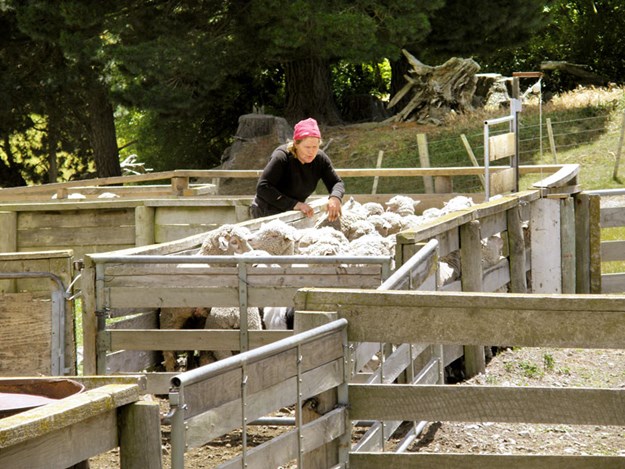 |
Shearing at Mesopotamia Station |
As we sat enjoying the view they made their way to the shearing shed for an agricultural show and we had the place to ourselves. In the distance the TSS Earnslaw could be seen making her way back from Queenstown, across the blue waters of the lake.
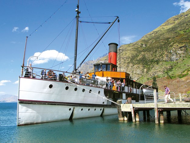 |
Coal-fired passenger ship the TSS Earnslaw |
Built in 1912, the picturesque Earnslaw is the last remaining coal-fired passenger vessel in the southern hemisphere. When the boat arrived to pick up the tourists for their return trip to Queenstown we decided it was time we left Walter Peak Station too, as it was now late afternoon and we had the return journey ahead.
The road to ‘Nowhere’
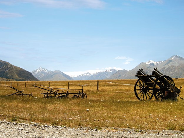 |
Mesopotamia is one of the country’s oldest high country stations |
A later road trip took us to the curiously named Mesopotamia Station. We were exploring the Peel Forest area, near Geraldine, and realised that the station was only about an hour further on.
Mesopotamia means ‘the land between two rivers’, and originally referred to the area between the Tigris and Euphrates, in present-day Syria and Iraq. Mesopotamia Station was named by Samuel Butler, the English writer who established it in 1860, and it’s one of the country’s oldest high country stations.
Because the area is so isolated, Butler called the satirical novel he wrote there Erewhon – ‘nowhere’ spelled backwards. Our drive took us alongside the braided Rangitata River, and through the valley between the Rangitata and Forest Creek rivers.
At 6000 hectares, Mesopotamia is a comparatively small station but was equally as scenic as Molesworth and Walter Peak. The station has been owned by the Prouting family since 1945 and runs 11,000 sheep, 3000 deer and 500 cattle.
We pass several herds of deer, the stags proudly sporting massive antlers, but it’s sheep that are the main attraction. We saw sheep wandering in the road, sheep in paddocks and sheep being penned and shorn in a woolshed.
Mesopotamia wool is still baled with the stencilled candlestick logo used since the 1860s. We stopped at the end of the road to take photos at the station’s outbuildings. Mesopotamia certainly is in the middle of nowhere, a wide valley with a backdrop of snowy mountains.
As the crow flies, Fox Glacier is probably as close as Geraldine; just the impenetrable Southern Alps between us! But that’s the lure of these remote stations on less-travelled roads: New Zealand at its wildest and most picturesque.
Further Information
- Information about Molesworth Station, including a downloadable brochure, can be found at doc.govt.nz.
- The Acheron Road through Molesworth Station isn’t suitable for caravans or buses over seven metres long. Small campervans will have no problem. We left our bus parked and used the car for our station road trips.
- Access to Molesworth Station is seasonal. This year the road will be open from 7am to 7pm from Labour Weekend to Easter Monday (or the second Sunday of April, whichever is the later date).
- Access by road to Walter Peak Station is from SH94. Details of the boat trip can be found at queenstownnz.co.nz.
- It is 50km from Peel Forest to Mesopotamia Station, along unsealed Rangitata Gorge Road. The station’s website is mesopotamia.co.nz.

