Lush valleys, tussock-clad high country, green and gold farmland; Jill Malcolm takes time to explore Central Otago’s glorious Teviot Valley.
On the road, you never know what (or who) is going to crop up. Auckland friends, Moira and Chris Blincoe were also travelling the South Island in their motorhome, and without any communication or arrangement, we pulled into the Central Otago hamlet of Millers Flat at precisely the same moment.
We were driving north from Gore, and they had just driven in from Lake Onslow. Without this coincidence, we might never have stayed to explore the Teviot Valley. The four of us stayed two nights in the delightful Millers Flat Campground and exchanged traveller’s tales parked up in that cheerful riverside setting. Thw Clutha/Mata-au River charged past us on its long journey from Lake Wānaka to the sea.
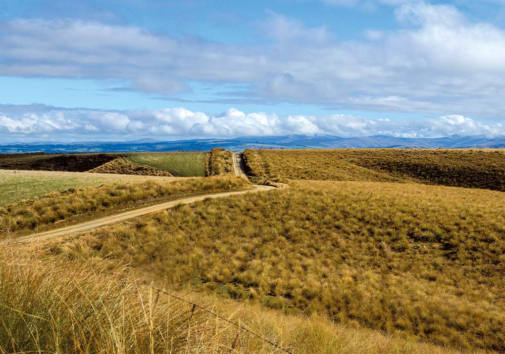
The Blincoes, who are well-known photographers, had just returned from the man-made lake high in the hills about 30km away from Millers Flat. They described the sprinkle of little fishing cribs at the lake’s edge where there’s nothing else, and the layer upon layer of folded hills covered in golden tussock, which had made their drive along the rough winding road worthwhile.
Lake Onslow was created with the intention to be New Zealand’s largest-ever hydro supply but under the current government, the project is dead in
the water.
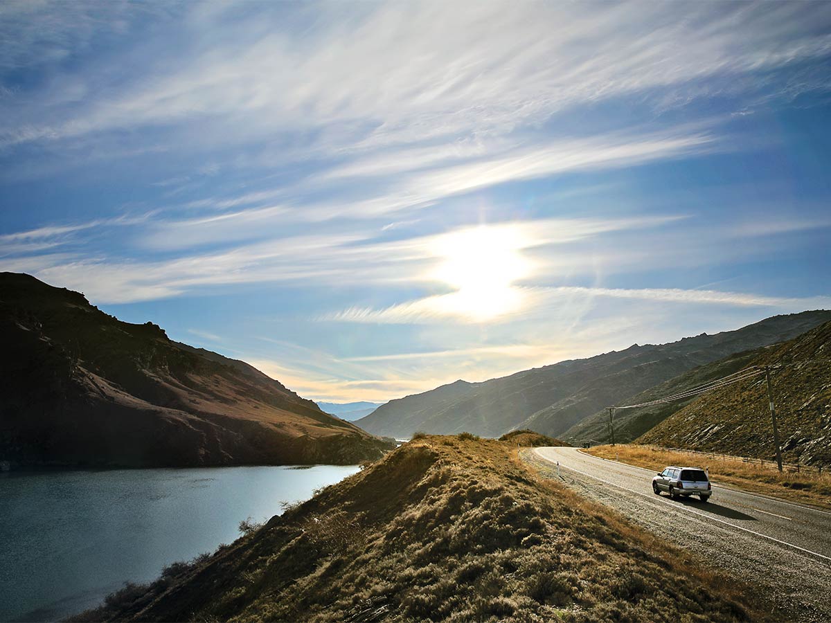
By day, we explored the bountiful Teviot Valley, which stretches from Beaumont in the south to Coal Creek in the north, along the course of the South Island’s longest and New Zealand’s most voluminous, river, the Clutha/Mata-au. It arises near Lake Wānaka and enters the Pacific Ocean on the coast southeast of Balclutha.
In the Teviot Valley, a mild, temperate climate marks a transition from drier, warmer inland Central Otago to cooler, coastal climes and its riches centre around sheep farming the abundance of fruit that thrives in the fertile soils. The valley is a patchwork of pip and stone orchards divided by rows of poplar trees, which at that time of the year, were festooned with golden foliage. The tips of the trees glowed in the sunlight like lighted candles.
One hundred and sixty-one years ago, it was a different type of harvest that brought prosperity to the valley. In 1862, payable gold was discovered in the schist gravels at the junction of the Clutha/Mata-au and Teviot Rivers and during the boom that lasted 20 years, they yielded the largest gold hauls in Central Otago.
Every era leaves its mark and eight kilometres downstream from Millers Flat, at Horseshoe Bend, is a remnant of the gold-digging days in two poignant marble headstones that symbolise the isolation and loneliness of those times. In 1865, the body of a young man was discovered nearby. It was identified as that of Charles Alms who had fallen in the river at Mutton Town Creek, way upstream. His body was buried in an unmarked grave until later a miner named William Rigny fenced it with rough manuka poles and fashioned a wooden headstone that he inscribed with the words “Somebody’s Darling lies buried here.” William suspected that ‘in the end, my lot will be the same’. It was a self-fulfilling prophecy because when he died in 2012, he was buried alongside.
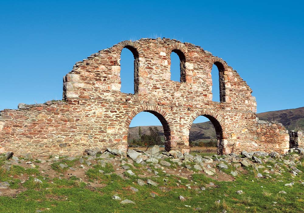
It wasn’t just the yellow metal that brought prosperity to the valley. Large-scale sheep farming also brought good fortune. In a paddock not far from Millers Flat stand arched stone walls, which look more like the ruins of a monastery than those of the huge woolshed (circa 1870), that once served the vast Teviot Sheep Station straddling the Mata-au. It was the largest woolshed in the southern hemisphere, and its roof is said to have once been atop an English railway station before being shipped to New Zealand. The woolshed burned down in 1924.
Back in Millers, we had a delightful experience at Faigan’s, a rural café that had been installed in the old general store built in the late 1800s. It was a surprise in such a place to come across the café with its interesting interior and welcoming ambience. It also housed a large collection of memorabilia from the early 1900s. Mark Jessop, the entertaining restaurateur, hauled out an Otago Directory from 1838 and indicated that my supposed forebears, who had settled not far away in the 1900s, could well have been the same who owed the store a sum of money. He calculated that with inflation and interest, the amount would now add up to around $40,000 and suggested I should make good the debt. I struck a deal.
“How about I pay for the coffee?” I said.
Nothing stays the same. I have just learned that the iconic Faigan’s Café has closed its doors and is up for sale. This will be a significant loss to the hundreds of cyclists who found it a welcoming watering hole as they pedalled along the famous Otago Clutha Gold Cycle Trail. However, sustenance can still be had at the Tavern on the other side of the river.
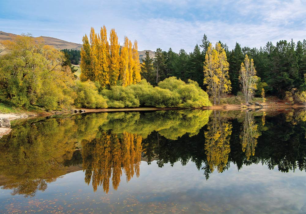
In the past, other enterprises suffered a similar fate. In 1918, an Otago gold mining identity, ‘Big’ John Ewing scooped out an enormous hole on the riverbank just north of Millers Flat, convinced that there were rich pickings of alluvial gold in the old Clutha riverbed. Several years later and 23 metres deep, there was still no pay dirt. When Big John died in 1922, the mining operations were abandoned. Water gradually filled the hole and was used in an irrigation scheme before that too was revoked. Now the lovely Pinder’s Pond, surrounded by willow and poplar trees, is a recreation reserve and a freedom parking area for motorhomes and caravans.
Through all these ups and downs the swift, emerald-green Mata-au River keeps on rolling. When the first settlers arrived at the valley crossing, its capacious swirling water severely limited transport. The creation of safe crossings is a big part of the Teviot’s history. Punts did the job more or less but were not at all safe. Then, in 1899, at Millers Flat, a sturdy steel bridge was opened and is still in use. Its four eye-catching, bowstring arches are painted in the original colour of sky blue. Further south in the Teviot valley, was another bridge, 12 years younger. The Beaumont Bridge was single lane and the country’s first truss bridge made of New Zealand iron. At its opening, it was pronounced “a lasting monument of the undoubted excellence of New Zealand workmanship”.
When we drove to Beaumont in May 2023, the old bridge was in the last stage of being replaced. We called into the iconic brick Beaumont Hotel, which has never lost its 85-year-old, back-country character. For a long time, the hills and valleys around Beaumont have long been noted as bountiful huntin’ shootin’, fishin’ grounds. Attesting to this, the walls of the pub are hung with trophies of gigantic trout, tusked Captain Cooker pigs, and deer antlers. A handsome stag head, mounted over one of the antique fireplaces, followed me around with his dead eyes.
In the dim lighting, we sipped lagers and munched on battered blue cod, engaged by the warmth and the cheerful banter of relaxed camaraderie, and the colourful tales from this part of Otago where the river rules the way of life.
Things to do
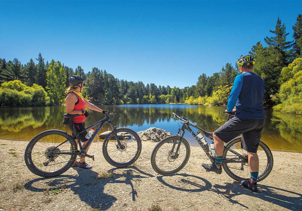
The Clutha Gold Cycle Trail has recently been extended to Waihola. The trail covers 135km of a changing landscape from hills and rocky outcrops to the rolling countryside of the fertile Teviot Valley. Most of the way it follows the course of the Clutha. This trail is graded as ‘Easy’, Grade 1 to 2 but still requires a bit of training if you’re going the whole way. For the most part, this is a wide, undulating trail and there are three old railway tunnels to cycle through.
The Teviot Valley is known for fruit, berry, and vegetable growing. Pip and stone fruit predominate but berries are also grown commercially. In the growing months, market gardens produce an extravaganza of vegetables and fruit – sold at the gate, or through the Otago Farmers’ Market in Dunedin.
While you’re in Roxburgh, check out the legendary Jimmy’s pies. They are famous throughout the lower South Island. Made from an old family recipe, Jimmy’s have been making meat pies for 50 years or more and now make 20 different varieties.
Places to stay
Beaumont Hotel
Beaumont Hotel offers a campground where RVs can park (at the rear of the hotel, Beaumont Highway, off State Highway 8). There are also cabins available for cyclists.
Millers Flat Holiday Park
This lovely relaxed campground is the one we most enjoyed on our travels around the South Island for its cheerful, relaxed atmosphere and sunny situation right beside the Clutha River. There’s a camp shop and roomy site options for tents, caravans, and motorhomes. The ablution blocks are clean and the laundry and kitchen are user-friendly.
Pinders Pond
This spacious freedom camping area by the man-made pond has a significant local history. Set among trees that also shelter the pond the cool water of the pond is great for swimming and kayaking.