 |
|
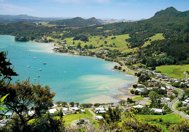
Whangarei Heads from Mount Aubrey
|
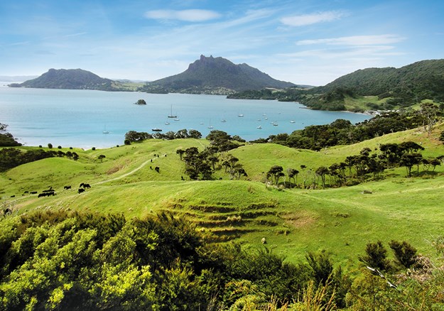
I arrived at Taurikura, in Whangarei Heads, in the dark, so it wasn’t until morning that I discovered the impressive scenery surrounding me. Like fingers, rock spires poked from bush-clad Mount Manaia, towering north of the peaceful, blue-water bay. Dwellings nestled between the water’s edge and the mountain’s foot. Slightly west, at the end of the point and perhaps half the size of Mount Manaia, Mount Aubrey looked flat on the top. Our plan was to walk both mountains in a day, and venture further the next to conquer more of the peaks at Whangarei Heads.
 |
|
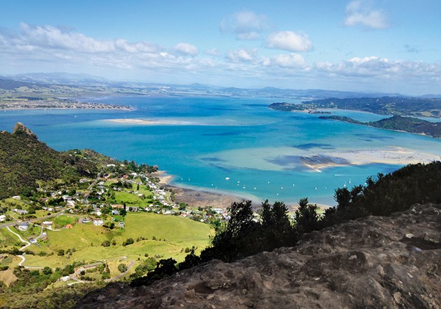
View from the top of the Mount Manaia Trail
|
MOUNT MANAIA
Starting from the Manaia Club lower carpark, the trail up Mount Manaia took two hours return at a leisurely pace … unlike that of the Whangarei Heads School Summit Club, who were making their way down. Their fastest member ran to the top, 420 metres above sea level, in 19 minutes.
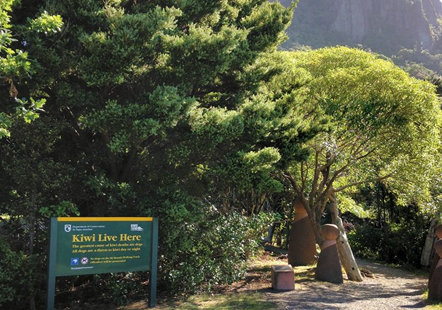
At the start of the trail, I read of the area’s early settler life, with the first buildings going up in the mid-1800s. It sounded a busy place, with farming, kauri logging, gum digging and later, limestone and clay quarrying. The facts on the volcanic formation of Mount Manaia are not as interesting as the Maori account of its origin. According to legend, the tallest spire is Manaia, the ancestor who connects all Northland tribes. The smaller towers are his wife and children, apparently all cursed and turned to stone by Paeko, their slave, who is the lower rock, thrown from the top by an angry Manaia.
The bush trail is uphill all the way to the summit, steeper in some places, and with lots of stairs, some man-made, others made by nature – rocks and roots. Don’t let this put you off. Lots of primary school children walked it the same day as I did and I heard no complaining. It’s a pretty, shaded trail, with views of the sea, Taurikura Bay and Bream Head between the foliage, which includes large kauri trees, punga and nikau palms. Towering boulders make walls alongside the track, especially nearer the top, and we were serenaded with birdsong along the way.
 |
|
From left: Mount Aubrey, Mount Manaia and Urquharts Bay from Te Whara Track
|
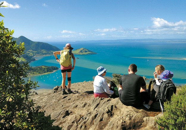
Walking with someone who knew the trail well, close to the summit I was led off the boardwalk along a short trail to a rocky ledge. The views were spectacular, of far-below Taurikura Bay, distant Urquharts Bay, Bream Head towering beyond and the sea a medley of aquamarine and blues. Further around, Marsden Point Refinery was a blot on the landscape, a stretch of white sandy coast sweeping away from it into the distance. The trail that led there isn’t signposted, but can be seen if you look carefully along the right-hand side of the boardwalk heading towards the summit.
Back on the main track, Manaia, stark and thin, loomed ahead as we approached. Stairs lead to a rocky lookout at his foot. Peering over the edge, far below, I saw the tide was out in Whangarei Harbour. White specks of boats dotted bays, white dwellings clustered coastal areas, green fingers of land poked out into the patchwork-blue sea and in the distance dark hills flowed like waves.
 |
|
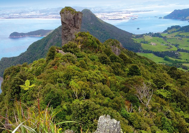
The view from Bream Head Summit, reached via an unformed track off Te Whara Track
|
MOUNT AUBREY
A round trip up Mount Aubrey, beginning from the Reotahi Reserve carpark at the end of Beach Road, took me about 1¾ hours. The open trail took us along the flat Reotahi Coastline Walkway (part of Te Araroa Walkway), passing by the foundations of what was once a meat freezing works. Straight across the water from there was the refinery, close enough to see containers, cranes and tanks clearly.
 |
|
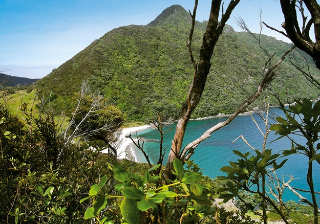
Smugglers Bay
|
A signpost marked ‘Mount Aubrey Summit and Tiller Park’ pointed us to a roughly 1.4km trail off the coastal walkway and we climbed up, up, up through bush. A number of rests were required on shaded steps along the way. The track wound around boulders, tree roots wandered over steps, tui shrilled, and at a break between the foliage there was distant Mount Manaia, straight ahead. I looked down on the twisting coastline road we’d driven to Taurikura the night before. Dappled blue water was fringed with white ripples along the beaches, yachts and launches sat at anchor, settlements hemmed by bush looked deserted.
Once we reached the summit, it was all downhill through bush to Tiller Park. We turned left to follow Reotahi Road down to Reotahi Bay, part of Reotahi Marine Reserve, on Beach Road. A tractor and trailer awaited the return of a boat in front of a boat shed with a water-taxi sign attached to it. The few homes along the waterfront, which faced the refinery across the water, were shut up.
 |
|
Taurikura from the lookout off the boardwalk, on the Mount Manaia Trail
|
BUSBY HEAD TRACK
The start of the easy, 3km Busby Head Track lies at the end of Urquharts Bay Road, reached by continuing east along Whangarei Heads Road from Taurikura.
We walked the loop in an anti-clockwise direction, coming across Bream Head Gun Battery. When it was operational from 1942 to 1943, the view across the harbour would have been quite different. Today, it looks straight out to where the refinery lies. The Battery Observation Post, a short distance away, is a concrete room nestled behind huge boulders, looking much like a bird hide. A narrow window peeps above the boulders, to survey the harbour. Several other small buildings lie in the vicinity, blending into the rocky surrounds. The complex was designed to look like a farmhouse with outbuildings to confuse the enemy, who never arrived.
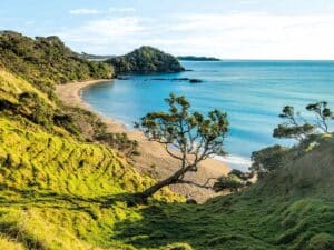
From here the track traverses the bushy coastline to the point of Busby Head and continues around. Turquoise water, mirrorstill, lay at the base of Mt Lion, which rises ruggedly from it. The rock pinnacle of Te Whara, the highest peak in the area, loomed beyond, and in the foreground a patch of white sand is the first view of Smugglers Bay. On arrival, the beach had me squinting – it was so blindingly bright. Deserted, it was a perfect, ‘get away from it all’ picnic spot.
An undulating path took us over farmland to return to Urquharts Bay, where a swim was in order.
OTHER WALKS
Another two walks on Whangarei Heads ridges require high levels of fitness, due to their many steps.
TRACK 1: TE WHARA TRACK
This 7.5km trail follows in the footsteps of Manaia and his descendants, and took me from the white sands of Ocean Beach to Urquharts Bay along the ridgeline of Bream Head Scenic Reserve. The majority of it uphill, involving quite a number of stairs, it took 6½ hours.
We came across the remains of Naval Post No. 7. This WWII radar station, the antenna rusted away, looks out over the sea. In the bush, signs pointed to the concrete foundations of a power house, laundry, ablution area, mess and quarters for the naval staff once stationed there.
Views of Ocean Beach were numerous along the way. A short, narrow, rocky trail off the track, with a sign warning that it wasn’t formed or marked and had steep drop-offs, leads to Bream Head/Te Whara Summit, 476m above sea-level. It’s a narrow, almost vertical rock, with a few hand grooves to help the short climb up, where an almost sheer drop lies on the other side. The 360° views were spectacular from the top: a green patchwork of bush and farmland, settlements dotted in valleys, and the coastline like a seeping, dark stain encroaching into the sea.
Back on Te Whara track we enjoyed a more undulating walk. Nature made pretty scenes: fallen boulders formed arches to walk through; roots spread like snakes across the path; young trees grew straight, reaching for the light; old ones had wandering branches; rengarenga lilies bloomed white among the many greenhued ferns.
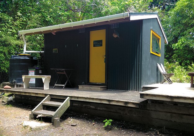
A side track took us down 807 steps to Peach Cove. I counted them on the return (the only way, except by boat, to get in and out of the cove) to take my mind off the steepness and never-ending-ness! At the end of the trail, a secluded DOC hut sits in a serene bush setting where a pohutukawa grows on a gigantic boulder. A short distance away is the small, sandy beach.
Downhill prevailed on the rest of the Te Whara Track, with views of both sides of the head – Ocean Beach and the harbour. Nearing its end, we caught sight of the white sands and turquoise waters of Smugglers Cove, nestled at the far end by Busby Head. On the opposite side lay Urquharts Bay. Descending 1200 steps brought us to farmland, where a short walk led us past staring cows to Urquharts Bay.
 |
|
Peach Cove Hut
|
TRACK 2: PEACH COVE TRACK AND TE WHARA LOOP
Two shorter walks, but still requiring high fitness, start from Peach Cove carpark, around 1km from Ocean Beach. Peach Cove track, to the cove and back, takes about four hours from there. Or, you can walk a loop of the Te Whara Track by following Peach Cove track to its intersection with Te Whara. Then head on to Ocean Beach, where Ocean Beach Road leads back to the carpark. The loop will also take around four hours.
Whether you’re after a short walk, or a more strenuous option, you won’t be disappointed in the numerous, stunning, panoramic views you’ll find walking the tips of Whangarei Heads.
 |
|
The start of the Mount Manaia Trail
|
Places to stay:
Manaia Baptist Camp is a beautiful spot on the water’s edge with campervans permitted. See: regentcommunitytrust.org
Other camping spots:
Reotahi Reserve Carpark, Manaia Walkway carpark, Ocean Beach carpark and Park Over Properties (POPs). See: nzmca.org.nz
Track maps:
discoverwhangareiheads.nz

