Northland is New Zealand’s northernmost region, and is the only region in New Zealand to straddle two coasts. It encompasses Cape Reinga and Ninety Mile Beach, together with numerous inlets, three harbours, and the broad reaches of Doubtless Bay.
The significance of the Northland’s natural beauty, cultural values, and important Mãori and European history combines to create a holiday paradise. Visitors will be captivated with the variety of activities on offer in this region of dizzying diversity.
Cape Reinga
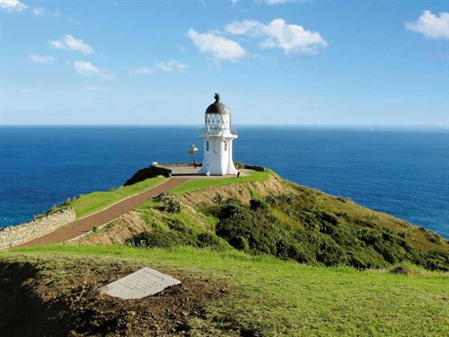
Cape Reinga and its iconic lighthouse sit at the top of Aupouri Peninsula, at what is widely thought to be the northernmost tip of New Zealand. In fact, the Surville Cliffs, 30 kilometres east, have the honour (by a very small margin) of being the north of the North Island, and therefore the ‘top’ of the country.
Cape Reinga is an area of great significance to Maori, by whom it is named Te Reinga (The Underworld) or Te Rerenga Wairua (The Leaping Off Place of the Spirits). It is here, according to Maori legend, that the spirits of the dead leap from an ancient pohutukawa tree into the churning sea below to begin their return journey across the ocean to their original birthplace, Hawaiki.
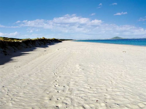
The Aupori Peninsula is a tombolo – a cluster of gravel rocks that forms an island. That island is now tied by a narrow isthmus of sediment to the rest of the North Island, but its legacy remains in an ecological estate of unique significance, including major wetlands, vast sand dunes, island sanctuaries, and the beginning of the erroneously-named, 88-kilometre stretch of creamy-white sand known as Ninety Mile Beach.
The region contains many endangered or threated species. It is now incorporated into Te Paki – a 25,000ha Department of Conservation (DOC) administered estate comprising. Te Paki includes more than 1000 sites of archeological importance, many of which can be accessed from the Te Paki Coastal Track, a four-day walk from Kapowairua (Spirits Bay) on the east coast, past Cape Reinga to the township of Ahipara on the west coast.
However, adrenaline junkies are still catered for within this park. The magnificent Te Paki Sand Dunes are the ideal place for thrill seekers to sandboard, alone or as part of a group using equipment hired from local tourism operators. Surf beaches can also be found along the length of Ninety Mile Beach, with some of the best known breaks to be found at Ahipara. Mountain biking and 4WD activities exist within the Mokaikai Reserve, while fishers will find abundant opportunities on the estuaries and around the coastline.
Among the many things of interest in this estate are the interpretive panels and pou (posts) which form the Ara Pou Trail, telling the story of the region. And at Cape Reinga, the remarkable map drawn by our earliest explorer, the navigator Kupe, who mapped the islands of New Zealand around 950AD, is incorporated into a plaque at the gateway to the lighthouse walkway.
Things to see and do
Te Kao Store features in the Lonely Planet Guide as famous for its towering ice creams. The store once sold 55,040 scoops of Tip Top ice cream in one year.
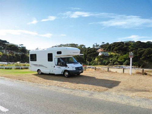
Paua: Collect the keys from the store at Te Kao if you wish to park overnight adjacent to the now-defunct fish factory.
Te Hapua is the country’s northernmost settlement on the western side of Parengarenga Harbour and home to a distinctive Ratana church.
Parengarenga Harbour: extending inland for more than 10 kilometres, the harbour is spectacularly fringed with the brilliant white silica sand of Kokota (The Sandspit).
Rangaunu Harbour is a habitat of international significance and home to around 10,000 birds of approximately 70 species.
Places to eat and drink
Waitiki Landing: the northernmost café in New Zealand, with a tree-covered camping ground next door featuring some powered sites.
Lake Ngataki is near Ninety Mile Beach. Overnight stays are permitted on the grass verge.
Houhora Tavern: soak up the atmosphere at this famous watering hole.
Steeds Butchery: Waiharara’s fifth-generation butchery is famous for its sausages.
Gumdiggers Park: see what life was like in the days of gumdiggers, located three kilometres off SH1 from Waiharara, 25km north of Kaitaia.
Awanui to Karikari Peninsula
State Highway One branches at the historical river port of Awanui, offering travellers the opportunity to travel east to Karikari Peninsula or south and west to Kaitaia and coastal Ahipara, near the foot of Ninety Mile Beach.
After the narrow confines of the northernmost tip of New Zealand, the variety of choices suddenly available to the traveller by the Far North can be bewildering. So much is on offer here, from dense forests to sheltered harbours, fringed by family-friendly white sand beaches, to the dramatic stretch of Ninety Mile Beach.
The east coast is a holiday-maker’s paradise of broad bays, deep harbours, and picturesque inlets, dotted with dozens of small settlements, each with their own campgrounds.
It’s a well-paved road that leads from Awanui to the established holiday settlement of Karikari Peninsula, with Rangaunu Harbour on its northern flank and Doubtless Bay to the south. Karikari is a renowned holiday spot with white sandy beaches, perfect for a variety of activities including fishing, diving, and walking. Maitai Bay comprises two coves with scenic views of the Pacific Ocean and sheltered swimming.
History abounds in this region which is home to, and of special significance to, the Ngati Kahu tribe who favoured the peninsula for seasonal hunting and gathering. Puwheke at the northern end of Karikari Beach was an historical vantage point for Maori. There are three small pa sites on the reserve.
Nearby Lake Ohia shows the remnants of an ancient kauri forest drowned 30,000 years ago and then drained for farming and gumdigging. It is now classified as a gum wetland, the features of which can be seen by taking the 10-minute Lake Ohio Gumhole Reserve Walk.
Maitai Bay, located on the outer Karikari Peninsula, features long white sandy beaches and crystal clear water. There’s a scenic DOC campground nestled among mature pohutukawa, down two kilometres of metal road.
The two largest settlements are Whatuwhiwhi, situated on the south side of the northeastern part of the peninsula, and nearby Tokerau Beach, which lies at the northern end of the eastern side. Maitai Bay on the northeast coast and Rangiputa on the west coast are popular tourist destinations.
Things to see and do
Ancient Kauri Kingdom: visit Awanui’s multiple award-winning Ancient Kauri Kingdom for fine kauri products.
Lake Ohia: Gumhole Reserve Walk is a signposted walk with interpretative panels, looping through manuka scrub and a series of holes excavated by gumdiggers.
The Fig Tree Track: this loop track takes you to the highest point above Maitai Bay for scenic views across Karikari Peninsula and Puwheke, from Maitai Bay campsite to the summit of Paraawanui.
Karikari Bay Walk takes you to the long, dazzling white sandy beach.
Maitai Bay Headland Track: passing through farmland and manuka scrubland to Maitai Bay Headlands, the track offers scenic views of Waikato Bay and Maitai Bay.
Places to eat and drink
Karikari Estate is New Zealand’s northernmost winery and vineyard café, with an a la carte menu.
Matthew’s Vintage Collection is a great trip down memory lane, located five kilometres north of Taipa. Light refreshments are available.
Peppers Carrington Resort offers a touch of luxury and an 18-hole championship golf course.
Karikari Peninsula to Bay of Islands
Leaving the Karikari Peninsula, the road goes inland briefly before returning to the coast at the bottom of Tokerau Beach. From here it’s a short hop to lovely Taipa for restaurants, bars, cafés, and craft shops. Taipa is also home to one of the busiest bakeries in Northland.
Next comes the popular holiday havens of Cable Bay and Coopers Beach. This string of small resorts is known collectively as Taipa-Mangonui.
Mangonui means ‘big shark’ in Mãori, and this area was once a thriving whaling port, now famous for the cluster of historic buildings and its famous fish and chip shop. Dine on freshly caught fish in a heritage building jutting out over the water. Or stock up at the local Four Square store that also hangs over the water.
Butler Point is just 15 minutes down the road. This privately-owned 26ha estate has been developed into a unique tourist development during the past four decades. There’s a whaling museum, as well as the beautifully-restored Butler House, built in 1840.
The surrounding gardens are recognised as one of New Zealand’s Gardens of Significance. A grove of ancient pohutukawa contains the country’s largest – with a girth of 10.9 metres. Visitors are also welcome to sample and purchase macadamia nuts grown on the property.
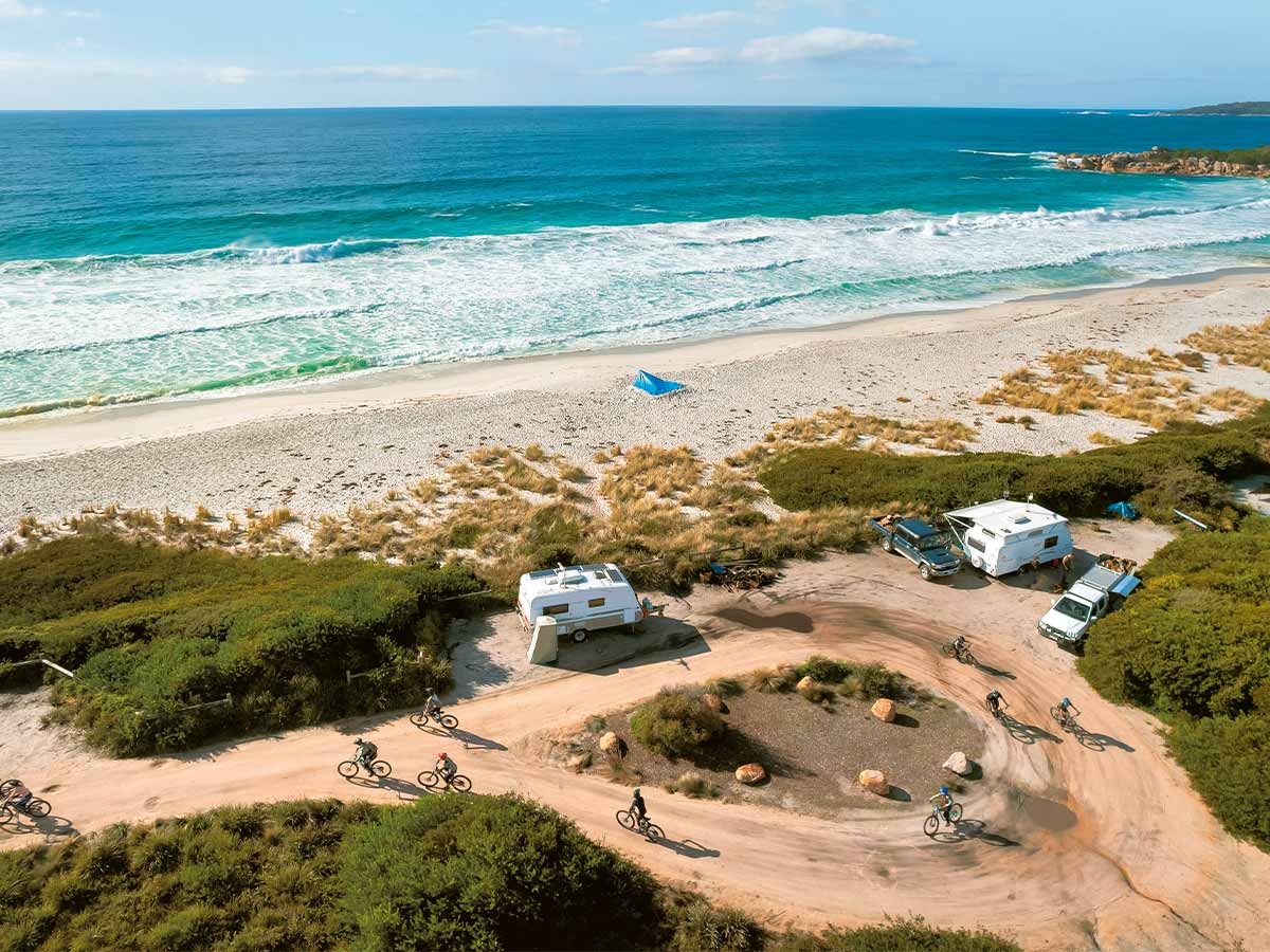
Numerous paved, but often winding, roads lead from SH10 to the coast and harbours where small campgrounds can frequently be found. Taupo Bay is one such place, while Whangaroa Harbour, with its excellent fishing lodge and motorcamp at the foot of the harbour, is deservedly popular. Tauranga Bay, just three kilometres from the main drag, is valued by RV lifestylers as a winter destination because of its excellent facilities, wild beach with fine pink sand, and mild climate.
Similarly the drive out to Matauri Bay (around 30 kilometres north of Kerikeri) is worthy of your time.
Across a narrow bridge of land is pebbly Putataua Bay, where the Reverend Samuel Marsden landed for the first time on 20 December, 1814, and was welcomed by the great Ngapuhi war chief, Hongi Hika. The pretty little wooden church on a rise is known as Samuel Marsden Memorial Church.
Matauri Bay offers some of the best fishing grounds in the North Island. Nearby, a sculpture by Kerikeri’s Chris Booth commemorates the sinking of the Rainbow Warrior.
Things to see and do
Mangonui Four Square: located on the waterfront in Mangonui Harbour, in a building that was erected on piles in 1907, the store has refrigerated produce display cabinets and additional services include a post office and banking facilities.
Mangonui Fish Shop: dine-in or take away some of the best fish and chips in New Zealand in this fully licensed restaurant.
Rainbow Warrior memorial and dive site: a highlight for divers, the sunken wreck of the Rainbow Warrior is accessible and is now home to masses of fish. Fill dive bottles and arrange a dive at the Matauri Bay Holiday Park store.
Places to eat and drink
Whangaroa Sport Fishing Club hosts frequent fishing tournaments and is great for dining and entertainment. Contact (09) 405 0399.

Waitangi, Paihia, Russell
The Bay of Islands, comprising 144 islands, has also been regarded as the birthplace of the nation since 1840, when Maori chiefs and British representatives of the Crown gathered to sign The Treaty of Waitangi.
Things to see and do
Te Waimate Mission House, built in 1832, is the site of the second signing of the treaty of Waitangi and is steeped in history – a must-visit.
Kelly Tarlton’s Shipwreck Museum, Paihia, is where the local sailing ship Tui displays all manner of underwater finds.
Water sports: swimming with dolphins, kayaking, or sailing – find out more about an on-water adventure at the local i-SITE.
On Maiki Hill stands a flagpole commemorating Hone Heke, the great Maori leader, and his protest after the signing of the Treaty of Waitangi.
Places to eat and drink
Bay of Islands Farmers’ Markets Paihia, Russell, and Waitangi farmers’ market are a great sources of food, craft, and locally-grown produce.
Russell to Warkworth
For many travellers, the spectacular coastal drive from Russell to Warkworth exemplifies the North Island at its sub-tropical best. Expect slow, sinewy roads, stunning views, and numerous charming coastal settlements that beckon you to bide a while.
Things to see and do
Whananaki North and South: these nostalgic villages, divided by the wide, curving estuary, offer an interesting and peaceful stop off.
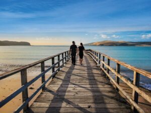
The longest footbridge: connecting the villages is a 395m-long footbridge, the longest in the Southern Hemisphere.
Motutara Farm: at the estuary’s north head, Motutara is said to be one of New Zealand’s most desirable camping grounds.
Coastal walkway: starting across the bridge at South Whananaki, this five-kilometre-long walkway winds through bush and farmland, with great views of the sea and the Poor Knights Islands.
Otamure Beach is popular with swimmers and surfers and offers great bush/beach walks and fishing.
Places to eat and drink
A small cookery next door to the Whananaki North general store serves hamburgers and fish ‘n’ chips, heavily sprinkled with lemon pepper and wrapped in yesterday’s newspaper.