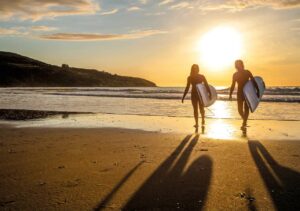
In 2017, I was tucked up in our campervan, reading Woman in the Wilderness, by Miriam Lancewood. Born in the Netherlands but married to a New Zealander, Miriam has spent many years camping in extreme isolation.
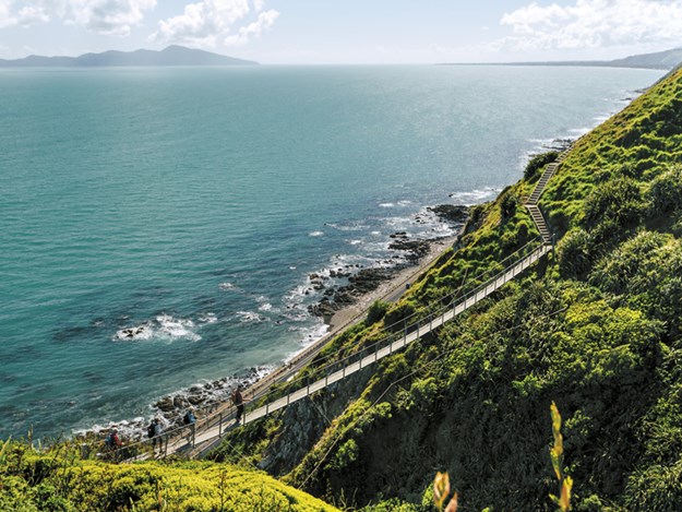 |
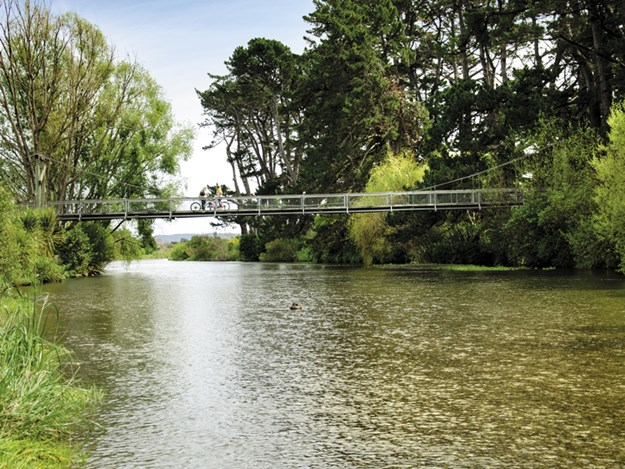
The Paekākāriki Escarpment Track |
I am relatively new to life on the road, but I, too, fancy myself an explorer like Miriam, even if my survival skills don’t extend to hunting with a slingshot and living in the wilds for months on end.
I was intrigued, however, when she and her husband embarked on a 3000km expedition, following a trail from one end of the country to the other, camping in tents and huts along the way. The trail was Te Araroa, and I decided right then that one day when I was feeling a little braver, I would walk that same track.
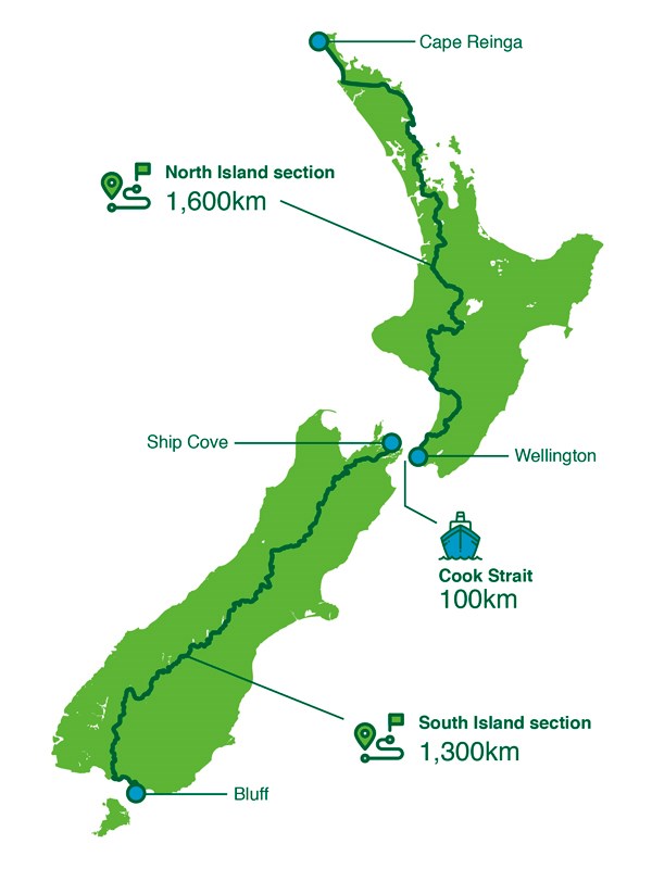 |
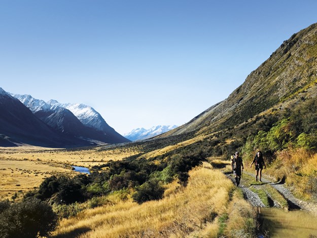
The Te Araroa trail runs the length of New Zealand |
Of course, the average person doesn’t have a few months to set aside to walk the length of the North and South Islands all in one go. But as I joyfully discovered the following year, you don’t have to. One of the great things about Te Araroa is that you can do chunks of it when it suits you.
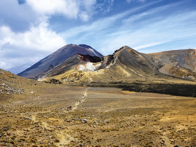 |
The Tongariro Alpine Crossing |
For example, the 42 Traverse and the Tongariro Alpine Crossing are included in the trail.
Since I became aware of this, hunting out these sections has been at the top of my to-do list whenever we arrive in a new area. There’s a long, long way to go yet, but we have still managed to tick off several from north to south.
North Shore coastal cliffs
I was delighted to stumble across the Te Araroa marker by chance when arriving at the beach front at Mairangi Bay and set out in anticipation of the glorious cliff-top views on the way to Murrays Bay. Unfortunately, due to storm damage and slips, the popular Crows Nest Rise walkway is currently under reconstruction, and I was partly redirected through the residential area. The good news is that work is scheduled to be completed by the end of the year, enabling walkers to enjoy the full beauty of this stunning coastal area once again.
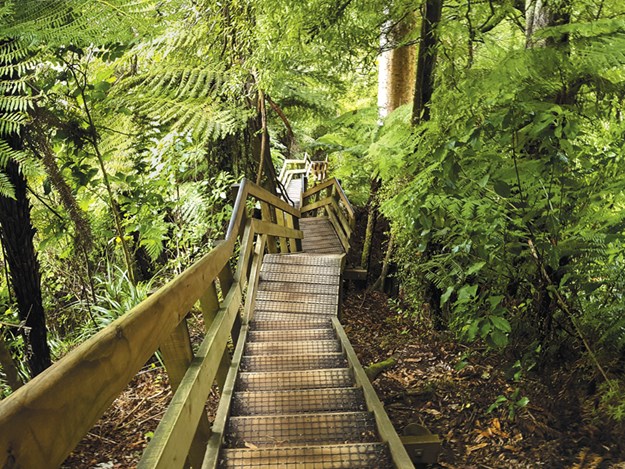
Waikato hills and streams
 |
A bold start to the H ākarimata Walkway section |
I won’t lie, the Hākarimata Track was a bit of a killer. I felt as though my heart was going to leap out of my chest. But the bush and views are worth every arduous hill and, boy, do you feel like you’ve achieved something. The main ridge track continues south to the Hākarimata Trig at 374m and then leads down towards the Mangarata Stream and the infamous ‘Summit Track’ with its 1349 steps.
 |
The Hākarimata Walkway is a punishing section of Te Araroa |
Fortunately, the lush, green bush and waterways are a distraction. If possible, I would recommend walking this track on a clear day, otherwise you may reach the top to find you can’t see in front of your nose through the thick Waikato fog.
Something for all on the Kāpiti Coast
 |
Not all the Te Araroa tracks are this easy |
A couple of planned hikes were foiled due to circumstances beyond our control. Well, sort of. The weather in the Tararua Ranges was diabolical, and any thoughts of hiking had to be largely put aside. But in the case of the Paekākāriki Escarpment Track, this was more me battling myself.
This popular section opened in 2016, to rave reviews, as a ‘less boring’ alternative to the original trail between Paekākāriki and Pukerua Bay. The scenery looks incredible, and I have had many opportunities to do it — but I need to work on my fear of heights first as it carries a warning for vertigo sufferers.
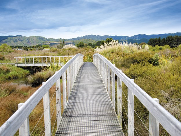
Fortunately, the rest of the Kāpiti Coast was a breeze. Ōtaki Gorge is a peaceful paradise, deep in the heart of the bush, and we walked most of the 22km stretches through Waikanae, Otaihanga, Paraparaumu and Raumati.
 |
The Waikanae-to-Otaihanga section takes you along both sides of the river |
For those who like a slightly easier contour and pace, the tracks here are all well-maintained and not too taxing. Walkers are treated to a variety of glorious scenic displays of flora and fauna, strolling along boardwalks and beaches, through bush and scientific reserves overflowing with native plantings.
Wellington turns on the 'wow'
Colonial Knob was another section of the trail I was keen to try while in Wellington. Few capital cities offer walks with such spectacular views as the section of Te Araroa from Porirua to the suburbs of Johnsonville or Khandallah.
When visibility is at its best, the views stretch as far across as Mount Taranaki in the north to the Kaikōura Ranges and Marlborough Sounds in the South Island. At 21km, this is one of the longer stretches we have done at once, but it was immensely rewarding.
Southern stunners
 |
Mavora Lakes |
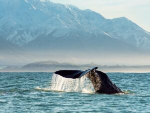
We started some of the trails in the South Island but will need to go back and complete them, as then we had our dog, Minnie, and on the whole, dogs are not permitted. About 60 per cent of Te Araroa crosses DOC land. Mavora Lakes is dog-friendly, however, and boasts several tracks featuring mountains, lakes, forest and tussock country.
Some sections are within Te Wāhipounamu, the South Westland New Zealand World Heritage area. This is where the track leaves Otago and enters Te Araroa’s most southern region. Despite having spent a large part of our time in Southland, we didn’t get to walk any of the hikes we’d planned, once again due to things beyond our control.
The Tihaka Beach stretch, which runs from Colac Bay to Riverton, is closed during September and October for lambing and, while we started the Foveaux Walk in Bluff, we soon ground to a halt when we found the track was closed off for earthworks. Still, there is plenty more time to conquer both those and many more kilometres along Te Araroa when we return. It’s become a much-loved obsession — and we’ve never been fitter.
Walk Te Araroa
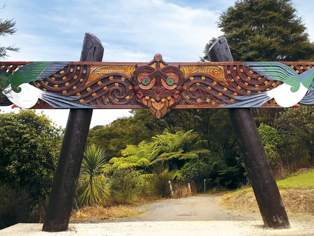
Te Araroa has no dedicated trail as such. It is a mixture of wilderness tracks, highways, farmland, beaches, rivers and everything in between, including towns and cities. It was the brainchild of Kiwi journalist Geoff Chapple, who called for a national trail in the 1990s after government departments had failed to create one. He plotted the route, negotiated with landowners and walked the whole track himself until it was finally ready to open in 2011.
As many as 80,000 people a year now pass through, almost three times as many as when the trail opened. Te Araroa means ‘the long pathway’. It’s the greatest New Zealand adventure there is — and should be on everyone’s bucket list in whatever capacity you
can manage.
More information on Te Araroa, including details of the trail in its entirety from Cape Reinga to Bluff, is available online at teararoa.org.nz