 |
|
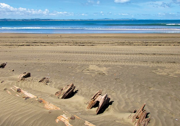
Shipwreck remains at Pouto
|
The weather was forecast to be good for a few days, so we stocked up our bus and headed west from Whangarei – first stop the Kai Iwi Lakes. These rain-fed, freshwater lakes are part of a 538-hectare recreational reserve, 35km north-west of Dargaville, and are popular with campers, fishermen and those who enjoy water sports.
There are two campgrounds on the shores of Lake Taharoa, the largest of the Kai Iwi Lakes. One is called Pine Beach – though the pines have been removed in recent years – and the other is at Promenade Point. We didn’t plan to stay overnight, so parked overlooking Marina Bay and set off to walk around the lake. There are tracks around all three of the lakes, and side paths lead to Lake Waikare and Lake Kai Iwi from the Lake Taharoa track. On a hot afternoon we thought the 8km loop would give us enough exercise, so stuck to the main track.
We started our stroll at the boat ramp, where a group were launching jet skis. Visitors can enjoy a whole range of water activities on Lake Taharoa and Lake Waikare, including waka ama, kayaking, sailing, windsurfing, water skiing, fishing and swimming. However, motorised craft are not allowed on Lake Kai Iwi.
 |
|
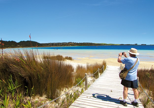
Lake Taharoa, Kai Iwi Lakes
|
Lake Taharoa is New Zealand’s third largest dune lake and the country’s deepest. The lakes were formed 1.8 million years ago when rain fell in depressions of sand that had impermeable ironstone pans beneath them. There are no inlets or outlets so the depth in the lakes can vary, as can the water temperature; extremes range from 12C to 21C.
Kai Iwi Lakes have unique biodiversity and are home to many native species, some endangered. Bird life includes the North Island brown kiwi, white-faced heron, paradise shelduck, grey teal and the Australasian bittern. Rainbow trout were introduced in the 1960s.
Kai Iwi means ‘food for the people’ and early Maori settlers in the area enjoyed catching fish and eels in the lakes. During times of war, injured warriors recuperated at the lakeside. Later kauri gum diggers built huts in the area, however this industry died out in the 1920s, leaving little trace.
There were plenty of campers at Pine Beach, enjoying the shallow waters fronting the campground, the children’s playground, and generally relaxing. One family were unloading bikes as the loop tracks are suitable for cycling as well as walking.
Our path continued beside crystal-clear water and golden sandy beaches, giving the lake a tropical look. There were few walkers on the track as we passed the aptly named Sandy Bay and continued past Deep Water Cove to the strangely named Sin Bin area and on to Promenade Point. The campground here has fewer facilities than Pine Beach and is described as a relaxed kiwiana experience.
We arrived back at our bus after taking just over two hours to walk the Lake Taharoa loop. We stayed for a while longer, and then headed into Dargaville.
 |
|
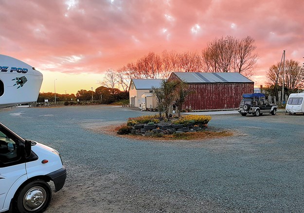
Sunset at the Dargaville NZMCA Park
|
HISTORIC DARGAVILLE
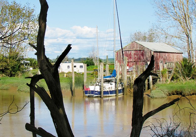
We always enjoy staying at the NZMCA Park, which is situated picturesquely at the junction of the Kaihu and Wairoa rivers. We spent happy hour – actually close to two hours – chatting with other motorhomers in one of the historic boatsheds that once belonged to Thompson Boat Builders.
 |
|
The NZMCA Park beside the Kaihu River
|
Swedish-born Erik Thompson was the first of three generations of boat builders to produce craft here. Hundreds of launches, sailing boats and whalers were constructed from kauri over the years, the most famous being the whaleboats constructed for Ernest Shackleton’s 1907-1909 Antarctic expedition. Full-scale drawings of these were discovered sketched out in pencil on the boatshed’s loft floor.
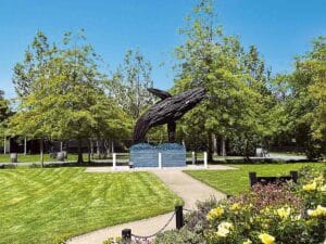
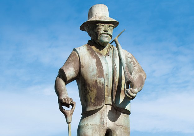
Earlier we’d strolled along Dargaville’s waterfront from the band rotunda, past the Boating Club and through the Riverside Gardens. Prominent at the junction of Parenga Street and Hokianga Road is a statue erected as a tribute to the area’s early gum diggers, who came mainly from Dalmatia (now Croatia).
 |
|
Dargaville honours the memory of its gum diggers
|
There’s a brochure available at the information centre that details a 5km walking trail around Dargaville’s historic buildings. We just looked at some of the sites, including the ‘petticoat houses’, six identical cottages built for workers at the Dairy Company. They were built with fireplaces but you had to pay extra for a chimney!
 |
|
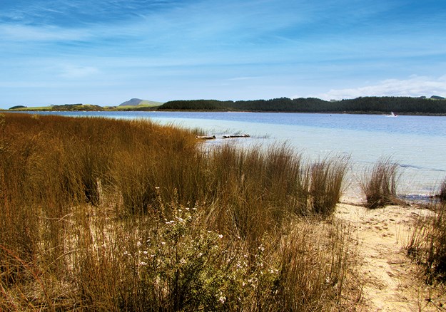
Lake Taharoa with Maunganui Bluff in the distance
|
The following day we went to discover more local history at the Dargaville Museum. There’s a wealth of information here about early European pioneers, especially the gum diggers. Another section of the museum is dedicated to shipwrecks, as the Pouto Peninsula and Kaipara Harbour entrance were notorious for shifting shoals and a dangerous bar.
 |
|
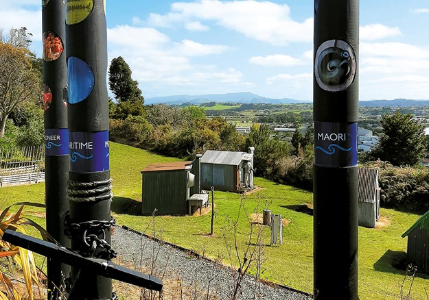
Reconstructed gum diggers’ huts at Dargaville Museum
|
Among the flotsam and jetsam displayed are portholes, anchors and substantial parts of ships and boats dug up from the sands of the area. These range from a punt used from the 1880s to the 1950s, an American ship built in 1870, and the Mathieu, wrecked in 1885.
PLACE OF HIDDEN TREASURES
From Dargaville we drove south on the Pouto Peninsula. This 55km long spit stretches from Dargaville to Pouto Point, separating the Kaipara Harbour from the Tasman Sea. Described as one of Northland’s best-kept secrets, the peninsula is off the beaten tourist track. Visitors and bach owners enjoy a quiet spot for fishing – Pouto means float for a fishing net – though tourist information describes it as ‘the place of hidden treasures’.
 |
|
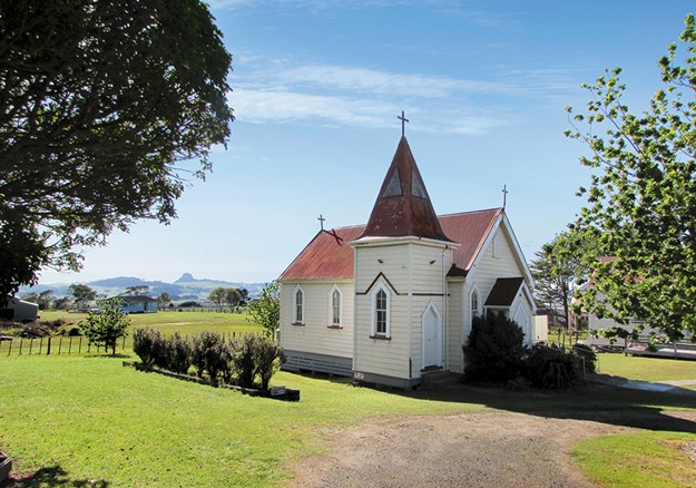
Te Kopuru Church with Maungaraho Rock on the horizon
|
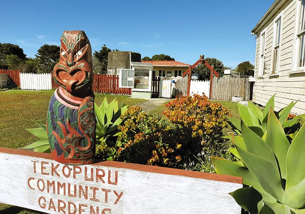
Our first stop along the road was the little settlement of Te Kopuru. Once a thriving town with sawmills and a shipbuilding industry, in its heyday Te Kopuru had a population of 3000. It had banks, shops, a post office, church, library and cinema, but when the kauri was all gone the town’s prosperity dwindled. Now Te Kopuru has only a school, a post office/ store, a pretty wooden church and a community veggie garden.
 |
|
The community veggie garden in the tiny settlement of Te Kopuru
|
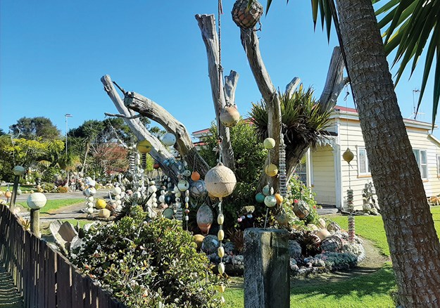
It also has what must be Te Kopuru’s most photographed spot. Near the church on the main street there’s an old villa that has its garden decorated with hundreds of fishing floats and buoys. As well as the floats there are old ropes, fishing nets, sails, shells, whale bones and structures made from all kinds of things thrown up by the tide. It’s worth stopping in Te Kopuru just to gaze at this whimsical place.
 |
|
Hundreds of floats and buoys decorate this garden in Te Kopuru
|
The road down the peninsula is sealed until the turn for Kellys Bay. From here the road to Pouto Point is gravelled, as is Kellys Bay Road. We took a short detour to the little community and parked on the grass beside the beach. While we enjoyed our morning tea we watched flocks of terns, oyster-catchers, stilts and gulls advance towards us as the incoming tide gave them wet feet. There’s a campground at the end of the road with some powered sites and lots of room for self-contained campers. Facilities are minimal here with long drop toilets and solar showers, but the beach is safe for children and is a good spot for catching flounder.
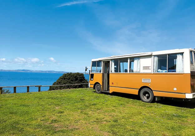
Finally we arrived at Pouto Point and parked beside the hall at the tiny campground. We signed in across the road and settled down to enjoy stunning views across the Kaipara Harbour. It’s always been hard for boats to enter the harbour, as evidenced by the remains of wrecks we’d seen at the Dargaville Museum. Maori history tells how the captain of the waka Mahuhu drowned when his ship was wrecked at the entrance. Both Cook and Tasman sailed by, leaving Marion du Fresne to be the first European explorer to identify the entrance, though it was 1836 before the first European sailors made their way into the harbour.
 |
|
A fine view of the Kaipara Harbour at Pouto campground
|
Although the entrance was known as ‘the graveyard’ (there have been 113 recorded shipwrecks), the harbour offered ease of access to lucrative kauri. Early charts were misleading, and sandbars shifted constantly, but many sailing captains took the risk and entered. By 1884 there was a lighthouse, a signal station and custom house at Pouto. (In fact, the Marine Hall at the campground is the old custom house, New Zealand’s first.)
It’s a 7km walk out to Pouto lighthouse (disused since 1952 and now maintained by Heritage New Zealand) followed by an energetic 10-15 minute climb up steep dunes, but we opted for a stroll along the beach. We were delighted to come across the remains of a boat’s ribs protruding from the sand; another of the ‘graveyard’s’ wrecks coming to light, to be either recovered or reburied by the shifting sands.
FURTHER INFORMATION
- Details about the camping grounds at Kai Iwi Lakes can be found at: kaiiwicamp.nz. There are limited power sites at Palm Beach and it is vital to book sites in both camps in advance in summer and on holiday weekends.
- The NZMCA Park is at 2 River Road, Dargaville. Overnight parking is also available at Dargaville Museum, $15 per night, $12 for NZMCA members.
- Phone 09 4390781 or 0274 509473 to book at Kellys Bay Reserve Campground.
- Pouto Marine Hall Campground is at 16 Signal Station Road, Pouto.
- At Kai Iwi Lakes the Lake Taharoa track is an easy 8km, Lake Waikare and Lake Kai Iwi are both 4km. There is also a walk along the beach from Kai Iwi to Maunganui Blu , 1.5 hours one way.
Find motorhomes, caravans and RVs for sale in NZ

