Turn east to Turangi or west for Stratford… but why not stay awhile in Taumarunui? Eleanor Hughes explores.
Taumarunui had been somewhere I’d often driven through late at night to get to Mount Ruapehu’s ski fields. It’s one of those towns that travellers often drive through, to head east to Turangi, or west for the literary delights of Stratford. This time, however, I stopped for a while in Ruapehu’s largest town, and discovered a variety of attractions that kept me busy for three days – and I could easily have stayed longer.
Forgotten World Adventures
Famous in this part of town for being a fantastic way to explore some of New Zealand’s exquisite landscapes, Forgotten World Adventures offers a number of guided tours by air, boat and rail, from a half day to four days in length. I learned the area’s history on their Republic 20 tour, around a 10-hour excursion.
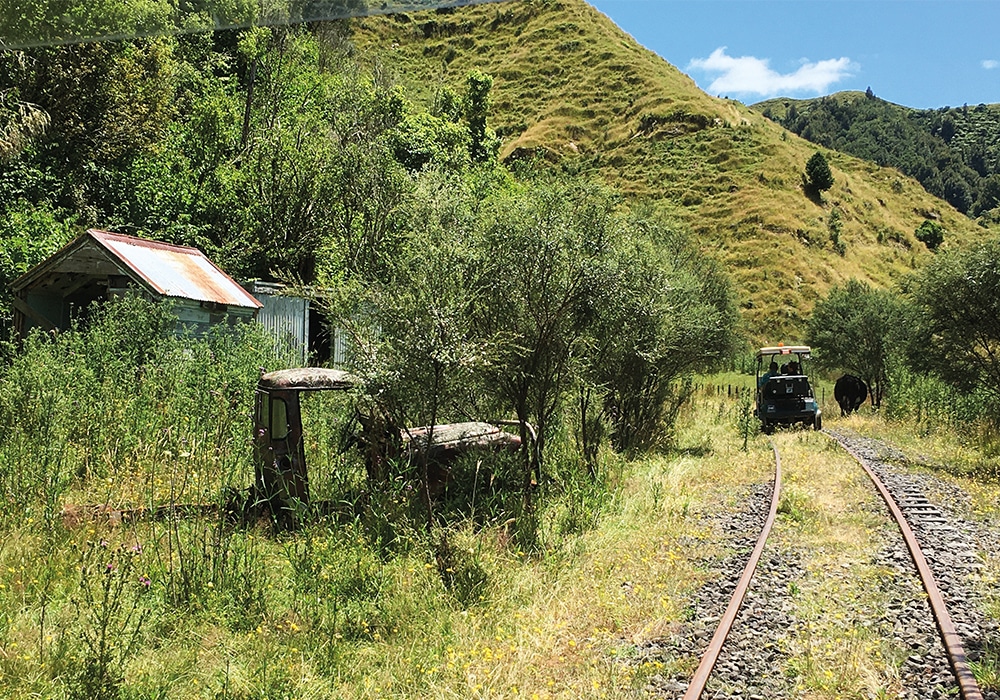
Departing Taumarunui at 7.30am on a shuttle to Okahukura, we drove a converted golf cart along the old Stratford to Okahukura railway line to Whangamomona, a distance of 82km. The line was authorised by the Railways Authorisation Actin 1900, with the first piece of land turned on 28 March 1901 (if only decisions were made at that speed these days!). At an average speed of 22km/h, enjoying the countryside aromas and rolling hill vistas dotted with dilapidated and weathered buildings, we traversed 20 tunnels. Stops included the tiny settlement of Matiere, once home to sawmills and railway workers, and Ohura, 50km northwest of Taumarunui, where coal mines underpinned the town’s economy in the 1930s for 40 years.
A kilometre out of Tunnel 15, Ruapehu and Ngāuruhoe stunned in the distance. Lunching at Tokirima’s disused station, I could just see the red postbox outside New Zealand’s smallest Post Office and Savings Bank in the distance. At Heao, where the railway line connected after 30 years of construction, 4000 gathered for its opening. Now only concrete steps and a short platform remain, a ramp on the other side where stock would load onto the trains. Railway line construction statistics are noted – 142km, 98 bridges, 24 tunnels, 260,000 railway sleepers, costing £2.5m (NZ$2.91m) in the 1930s.
Whangamōmona is a charismatic town that’s seen as one of the jewels of the Forgotten World Highway. Rich in history, the town was declared ‘The Republic of Whangamōmona’ in 1989 by residents, who held their own elections, after protests about boundary changes which classified the township as being in Manawatū/Whanganui instead of Taranaki. These days, the famous Republic Day is held biennially in January and is popular with visitors – in no small part because previous elections have included a sheep, teddy bear, cockatoo and a goat.
From Whangamōmona station I walked to the town’s main street and the 1912-built hotel. Heritage Trail signs tell the history of some of the wooden buildings – many dating from the early 1900s. Shuttling back to Taumarunui via SH43, the Forgotten World Highway gave us yet another different perspective of the area. On occasion I looked down on, or we ran parallel to, the rail track we’d travelled as we heard some of the many stories of the area and its inhabitants.
Bradley’s Garden
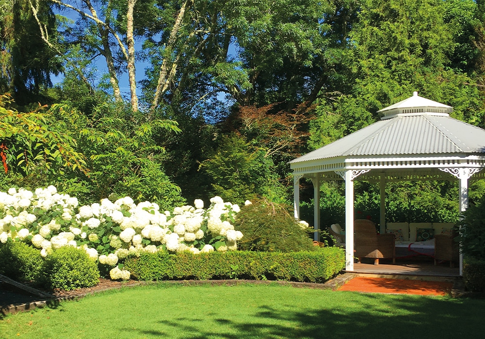
Bradley’s Garden, open year-round, is situated on Totaranui Drive around five minutes’ drive from Taumarunui off SH43. Awarded five stars by the New Zealand Gardens Trust, it is a Garden of National Significance and it’s easy to while away a couple of hours here. We enjoyed a delicious Devonshire tea in the white gazebo, a carpet of grass spread before it surrounded by boxed hedge, white hydrangeas, flax and ferns with cabbage trees, red-leafed maples, punga and larger trees adding height. Picture-perfect.
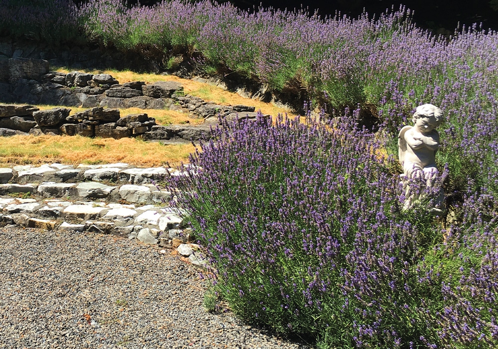
Afterwards Melana, the garden’s creator, guided us through the spectacular settings that now occupy what was once four farm paddocks. Olive trees provided shade forming a cathedral aisle along a gravel path; an amphitheatre at the base of a lavender-lined path surprised; stone stairs leading from a wooden bridge crossing a pond to the conifer-enclosed Italian garden were built from Melana’s memory of time spent at her grandparents’ Croatian home. Every turn revealed something different – a door, a cottage garden, a giant chess set… There’s also a nine-hole mini putt golf course on grass fairways. Recently the grounds became a park over property for self-contained vehicles. Our nights in this rural setting were peaceful, woken by birds in the morning, serenaded to sleep by distant, croaking frogs in a valley below the gardens.
Lauren’s Lavender Farm
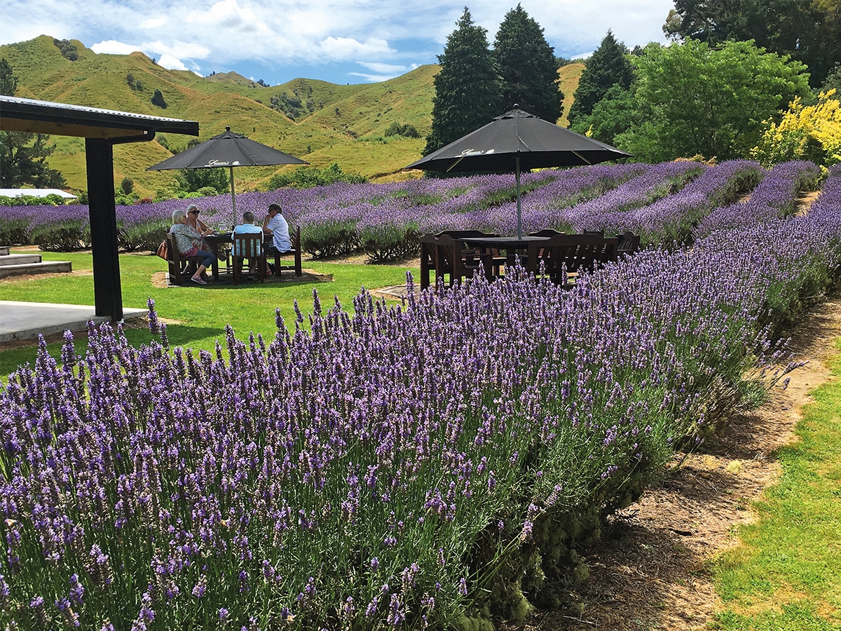
The more than 8,500 lavender plants at Lauren’s Lavender Farm are in bloom from around Christmas Day to early February when the flowers start dying off and they are harvested. We sat on the café’s covered deck gazing out over the beautiful fields, silvereye and sparrow pecking at buds. On SH43, the premises are open from October until mid-May (best to check ahead), with a shop selling all things lavender – soaps, candles, creams, balms, scrubs, bodywash, essential oils… It’s also a tranquil, picturesque spot for an autumn morning or afternoon tea.
Ohinetonga Scenic Reserve
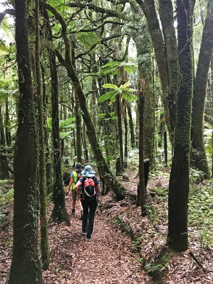
Around 20 minutes from Taumarunui, near the town of Owhango on SH4, Ohinetonga Scenic Reserve offers a walk through a podocarp forest, which changes distinctly along the way. Tawa stand tall at its highest point, rimu, totara, rewarewa, black miro, matai and tangles of supplejack vines further down, with ferns lower still below natives. Around autumn, fungus sprouts, with turkey tail, bracket, lion mane and the blue mushroom, the endemic werewere-kōkako, able to be seen.
The car park is situated by a concrete bridge crossing the Whakapapa River and a great lookout for whio ducks riding the water. Once a 3km loop, a slip in 2018 has closed part of the trail. It’s best walked taking the track on the right-hand side of the bridge to the lagoon and continuing across the road onto the Tawa Track to the Boat Hole. Around 3.5 hours return, the easy, undulating trail takes in a short sandy section of riverbank where a neat swimming hole is located, about a 10 minute walk from the carpark.
Mid-summer, cicadas are in full chorus; prepare yourself for a sound that’s surely above decibel limits!
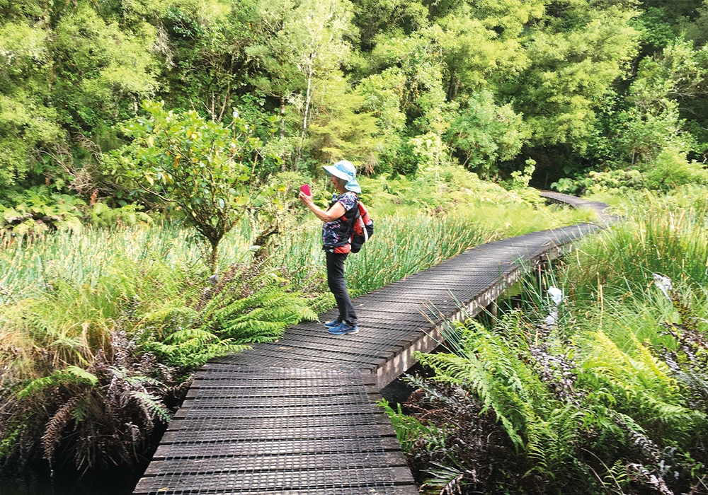
I was dwarfed by an estimated 600-year old tawa before descending to a boardwalk crossing a lagoon enclosed by forest. The water’s stillness was broken by a fleeing Weweia dabchick, one of about 2,000 in the country. Back in the forest, kererū flapped loudly overhead, a robin was spotted, the odd fantail flitted alongside and a long-tailed cuckoo called ‘shreee shree’. Home to 300-400 North Island brown kiwi, the scenic reserve is also a habitat for the long-tailed bat who live in the crevices formed by the twisting branches of tawa. Apparently they can sometimes be seen at dusk from Owhango’s tennis court.
Kakahi glow worms
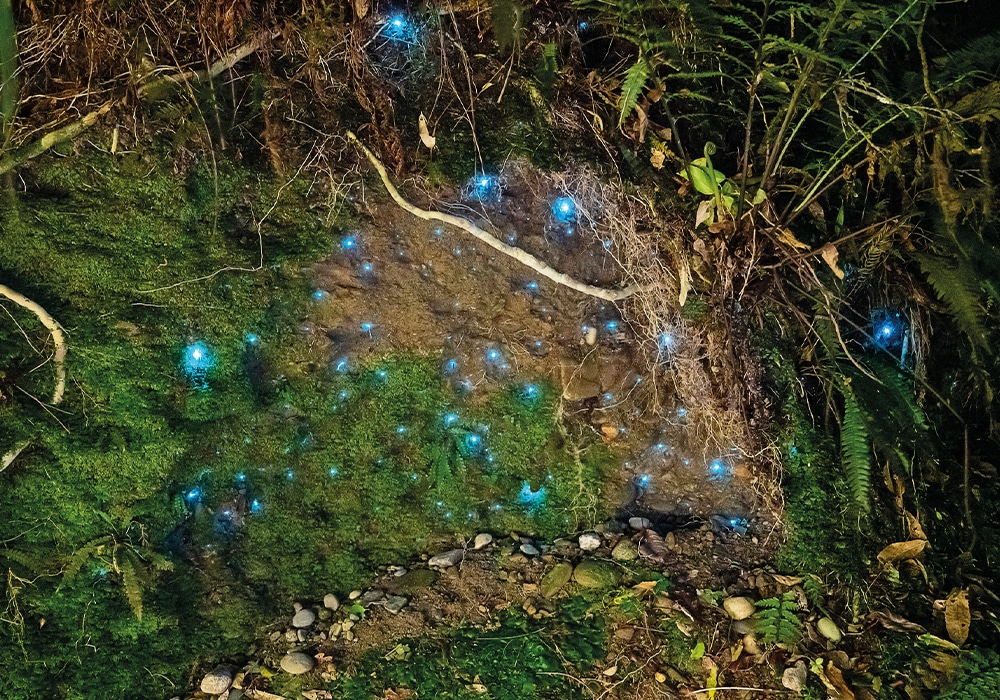
For a free display of glow worms, head to Kakahi, fifteen minutes south of Taumarunui off SH4. This small settlement consists of a smattering of wooden buildings and a general store. Continuing along Te Rena Road, take the right fork where a sign reading ‘Piwai Street’ points left. From there it’s a dirt road, lined with grass higher than the car and nothing else able to be seen– eerie in the dark. The road narrows slightly between dirt cliffs, a cutting that was meant to be for a railway line. Too dark to drive without lights to view the glowworms, we drove through and parked at an opening at the end of the dead-end road, around five minutes from Kakahi, and walked back. Magical! On either side, glowworms shone constellation-like among shrub-like foliage growing on cliff sides; morepork called; stars shone in the thin strip of night sky overhead. Take a torch, it’s pitch black.
Riverbank Trail
In Cherry Grove Domain, Taumarunui, the Whanganui River meets the Ongarue River. Park at the end of the domain and walk into town along the Ongarue River side – on the right when facing the confluence. Boards riverside give glimpses into river happenings in the early 1900s. One is located close to where Makere, a 92ft houseboat or floating hotel, was built and later moored on the Whanganui River. Another is nearby a terminus used when a river boat service ran from Whanganui to Taumarunui between 1904 and 1928.
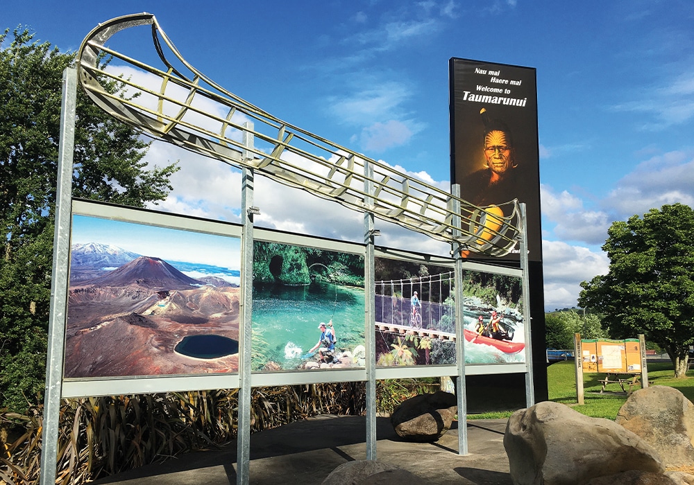
Crossing the concrete bridge over the Ongarue, we reached the King Tawhiao sign and metal waka at Taumarunui’s northern end. The king sought refuge in the area following the 1860s Waikato Land Wars and apparently threw his top hat on a map of the North Island to show the area he claimed. Europeans were unwelcome, venturing at their peril up until the 1880s. Māori called the King Country Te Rohe Pōtae – the district of the hat. A map there shows the Stratford to Taumarunui Heritage Trail, which follows the Whanganui River on SH43. There are 33 points of interest along the way, including river boat landings, disused coal mine, saddles and waterfalls, flour mill, boarding house and historic settlements. Crossing SH4, I took the Te Peka Reserve walking track opposite, which led upwards through bush to a lookout over the grid-like town. Returning to the domain the same way, all up it took around 90 minutes on a predominantly flat walk.
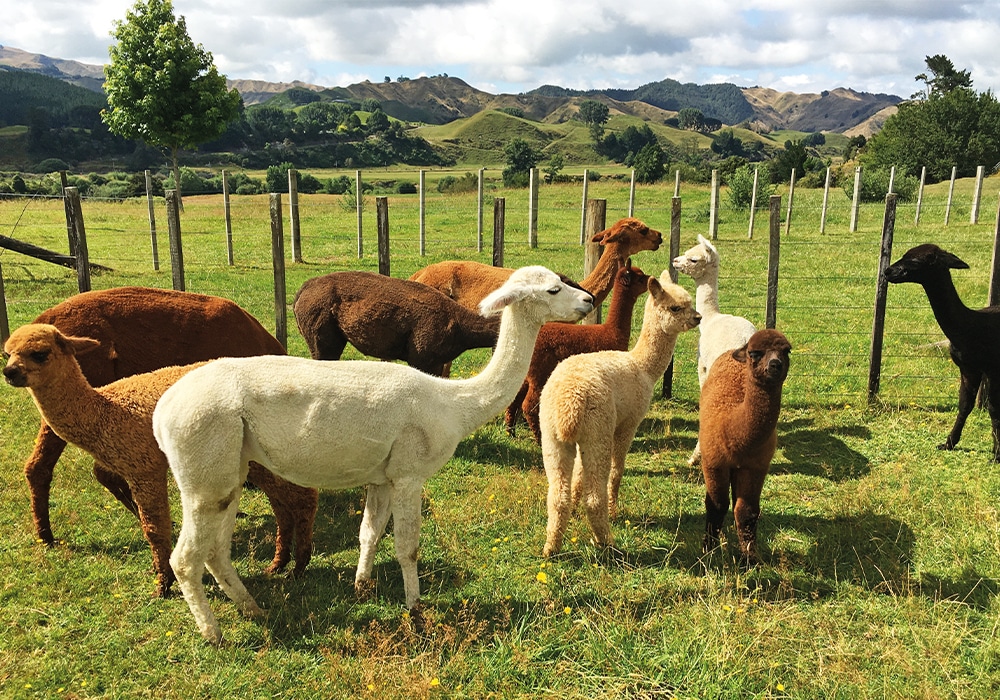
Nevalea alpacas
Located on SH4, about 15 minutes’ drive from Taumarunui, Nevalea Alpacas is home to nearly 1,000 alpaca and New Zealand’s largest alpaca farm. Leading a very well-behaved alpaca named Orion, who barely came up to my hip, on a gentle walk around the farm on the Ultimate Alpaca Experience, I met cute, stocky, baby alpaca. Born after a gestation of 11½ months, they were a month or so old and stood as high as their mums’ shoulders. Older ones nuzzled my cheek as I fed them grain and peered over my shoulder to get a selfie. Soft to touch, their fleeces range from white, a range of brown hues – milk chocolate, toffee, dark chocolate – and black. These gorgeous creatures are extremely docile and friendly… I wanted to take one home! With most of the garments made on site, the shop is stocked with beanies, jumpers, gloves, socks, scarves and baby garments made from alpaca fleece, which we’re told is 30% warmer than sheep’s wool.
For more info
Activity options: forgottenworldadventures.co.nz. Research first before heading there as trips are seasonal; the line is also occasionally used for other purposes.
Ohinetonga Scenic Reserve: doc.govt.nz
Camping options: https://www.nzmca.org.nz/
