In the Ureweras, Eleanor Hughes is captivated by the mystical atmosphere, and glimpses of the lake.
The gravel road to get there had always put me off, but finally I bit the bullet and got brave. And it wasn’t so bad. Taking it slowly, it took just under two hours to reach Lake Waikaremoana Holiday Park from Murupara, a distance of around 75km. I might have done it slightly faster if the signage had been better – at times I wondered if I was going the right way. It was worth it though.
Te Urewera Visitor Centre looks out over the eastern side of the lake, just before the entrance to the holiday park. There was local information, including a leaflet on 18 short walks ranging from 30 minutes to 6 hours, and walkable from the park or slightly further afield. You can also hire rods, and row boats from here that are moored on Lake Waikareiti, an hour’s walk from Aniwaniwa Stream road bridge – about 3 or 4 kilometres from the park by road. The centre is also an iwi meeting place.
Lake Waikaremoana Great Walk
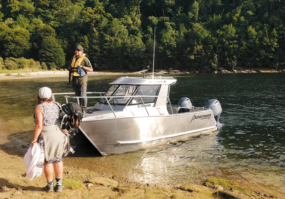
We stopped in to confirm our next day’s water taxi booking to the start of the Lake Waikaremoana Great Walk. We planned to hike over four days, staying in basic DOC huts. These have compostable toilets, bunk beds with mattresses, kitchen benches with sinks and cold running water, and seating. Hikers need to take in food, gas burners and all cooking and sleeping equipment.
Day one
We accessed the Lake Waikaremoana Great Walk, a 46km hike skirting the western side of the lake, from Onepoto Bay shelter. The 9.2km drive from the campground, on gravel, took 25 minutes. A sign on the side of the road points out the Great Walk. Follow this for Onepoto Bay Shelter and the water taxi. Parking in the carpark, we had to hunt for the sign to the boat ramp, which ended up being perhaps a 100-metre walk from the shelter, to catch the water taxi.
The 20-minute boat ride took us across the middle of the lake, with a spectacular view of the Panekire Bluff (which we would be climbing on day three), into the northern arm. We were dropped at a small beach just south of Whanganui Hut. This is around 4km from Hopuruahine Landing, where the Great Walk officially starts/finishes. There is parking at the landing, so walkers could drive here and begin their hike, about a 30–40-minute drive from the holiday park. They could then get a water taxi back to south of Whanganui Hut, once finished, and walk back out to the Hopuruahine Landing.
Advised by others, we walked from south to north, the opposite way to what most people do. This meant we didn’t have to climb the steeper Panekire Bluff side, and instead came down it. We also wouldn’t have to rush for a water taxi deadline, being able to walk out to Onepoto Bay Shelter at our leisure.
The tree-lined trail followed the shoreline for around an hour, passing through Tapuaenui campsite. There is a shelter here, and it would be a good spot for lunch, if you wanted a day walk from Hopuruahine Landing – a return trip of around 14km on flat trail.
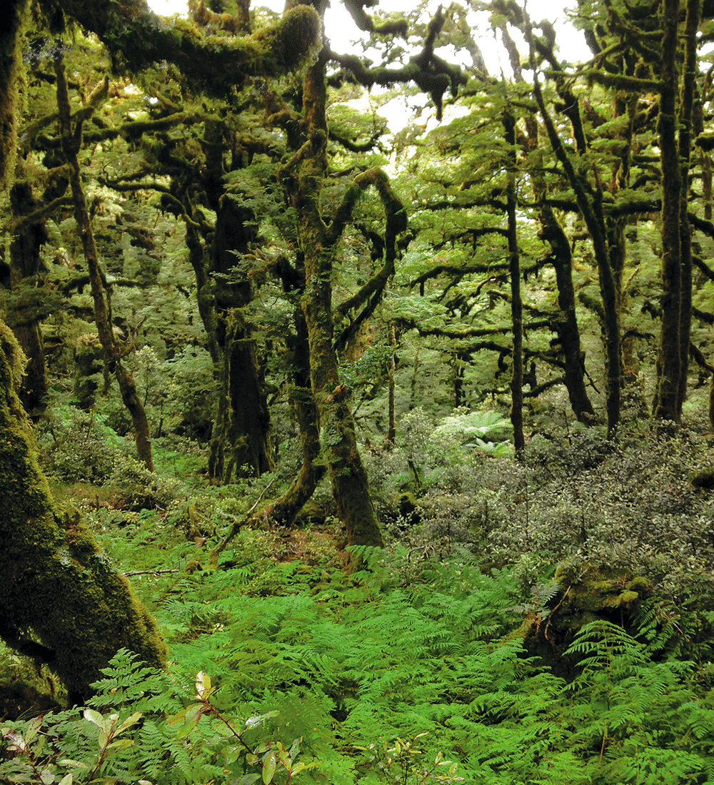
Ascending Pukehou Ridge, a rise of about 100 metres, and then descending, we arrived at the newish, 40-bunk Waiharuru Hut. From our drop-off, the roughly 5.5km took about 2¾ hours. It was a great lunch stop. We continued along a trail looking as if it was sprinkled with tan, gold and brown confetti, the fallen leaves of beech trees. Valley floors were punga draped; moss covered rocks and sawn trunks; black, buttressed trunks towered above us. Streams and rivers were crossed and the shoreline skirted again.
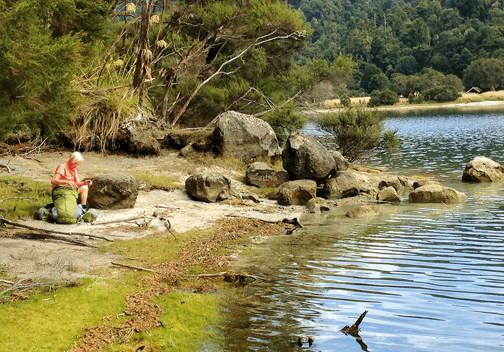
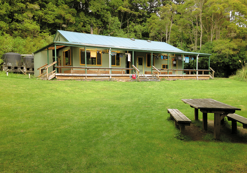
We reached Marauiti Hut at 2.30pm, taking 5½ hours to hike about 11.5km. The 25-bed hut was painted pastel green inside, reminding me of a 1960s bach. It has seen better days but does the job. Sited on the lakefront, it’s a perfect place to spend the afternoon. The water was rather chilly, even in mid-February, but I took a quick dip to wash off the grime and sweat of a long hike. Huts don’t have electricity, so it’s an early-ish night once darkness descends.
Day two: Marauiti Hut to Waiopaoa Hut
Our second day started through a forest of drooping rimu, and led to the crystal-clear lakeside where a narrow, yellow-sand beach made a good morning tea stop. The water reflected the surrounding bush. Again thick with fallen beech leaves, which also carpeted punga valleys, the trail brought us above the lake. Between branches and leaves, the view of teal water was stunning.
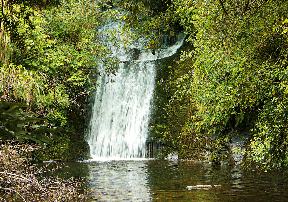
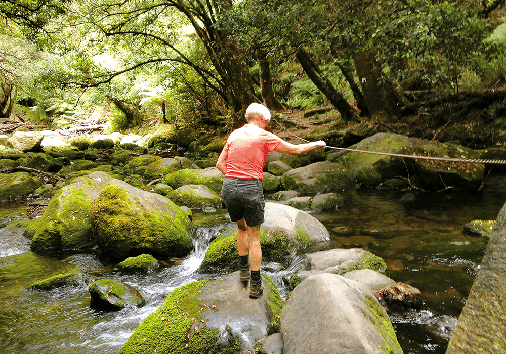
By early afternoon we reached a sidetrack to Korokoro Falls. The one-hour return walk (we dumped our packs in the bush so we didn’t have to carry them) was picturesque: green-carpeted rocks, a variety of ferns spreading below high trees whose roots wandered snake-like. It followed a tumbling river, crossed by walking across large boulders with a wire at hand-height to keep our balance. We viewed the 22-metre Korokoro Falls from opposite its crest. The water fell in sheets, throwing up mist which settled on my arms and face.
Twelve kilometres to Waiopaoa Hut, plus the walk to Korokoro Falls, took us 6½ hours. Set perhaps 50 metres back from the lakeside, the hut has 30 beds in two rooms, and looked near-new. The sandy beach was inviting, the water warmer than the day before and refreshing, but going deeper I found the bottom was covered in thick weed, which was a little off-putting. Pesky sandflies necessitated covering up as much as possible in the late afternoon/evening.
Day three: to Panekire Hut
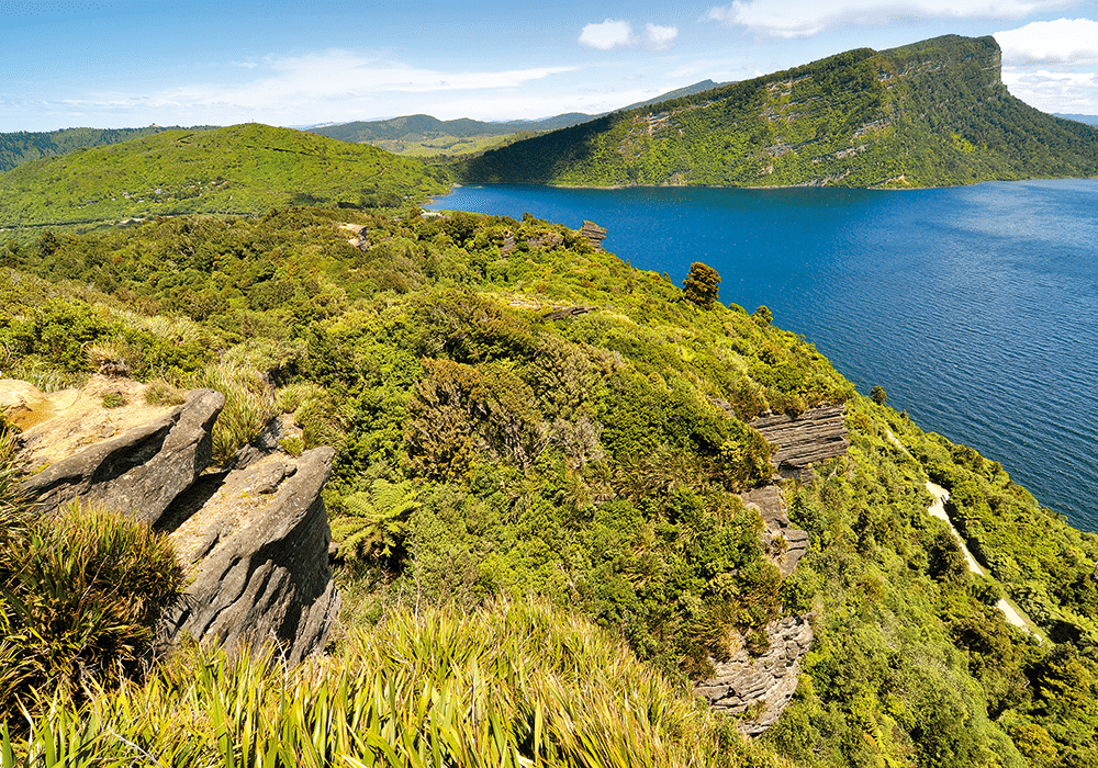
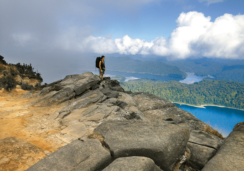
Next morning saw us tackling Panekire Bluff. It was straight uphill, a little undulation then more up, up, up. Reaching a brow we entered dim, verdant forest, branches like old, withered arms stretching and twisting. Magical. I felt as if I was one of the first to ever walk through the area. Views glimpsed through foliage showed a glass-like lake, reflecting deep-green, creased hills. The temperature cooled the higher we got; the distant brown hills bathed in sun looked inviting. The 8km to Panekire Hut, which stands at 1180 metres, took 3¼ hours.
It was a long afternoon spent enjoying the spectacular lake view. To the left the water shone silvery grey, to the right it was blue. Panekire Hut is well-worn, sleeping 36 in two bunkrooms. You don’t want to arrive too late or you might end up having to sleep in the third level of bunks, almost coffin-like below the corrugated iron roof.
Walkers could continue on the trail and complete the Great Walk instead of staying at the hut, but it would make for a 17km day, taking around 7½ hours.
Day four: to Onepoto Landing
It took us 4¼ hours, the next day, to walk from Panekire to Onepoto Landing, a distance of 9km. The mostly downhill walk offered striking views high above the lake and wandered through trees looking like giant bonsai, wrapped in skeins of moss. A five-minute trail to a lookout off the main track, not signposted but obvious, is worth doing. It leads to a rocky cliff where you can sit, take in the views and get some great photos. Stretched out far below, sparkling blue water spreads between fingers of bush-covered land twisting and turning to form inlets. Various other lookouts, just a step off the track, gave more dramatic views before we descended, leaving ancient forest behind to walk through areas where tree roots were like daddy long-legs, raised above the ground. It looked as if the trees would be capable of walking off.
At the end of the trail, 10 minutes before reaching Onepoto Landing, there is a short, 10-minute track to Lake Kiriopukae. This easy bush walk leads to what is more a waterhole than a lake. Large boulders, strewn across the flat, grassy area near the water’s edge, reminded me of ruins. Walking here from Onepoto Landing would take around 40 minutes return.
Onepoto Landing has a shelter with information on the Māori legend of Lake Waikaremoana’s formation, as well as the geological version. A timeline details occupation of the lake dating back to the 1500s, the formation of Te Urewera National Park, the track’s construction in 1963, and power schemes. A map of the Great Walk gives distances and times.
Loath to leave this beautiful, remote area, we found a way down to the lake’s edge for one last dip in its waters before the long, gravel drive back to civilisation.
More Information
- Lake Waikaremoana Holiday Park: doc.govt.nz
- Water taxi bookings: ngaituhoe.iwi.nz
- Hut bookings and information on the Great Walk: doc.govt.nz
- Lake Waikaremoana short walks: doc.govt.nz
- Freedom camping: nzmca.org.nz