One of the many joys of touring in an RV is the expectation and frisson of excitement I feel when we turn onto a road I’ve never travelled before.
And so, when a man called Ben said, “Have a go at the road to the coast, mate. It’s beaut out there,” I was willing to take him at his word.
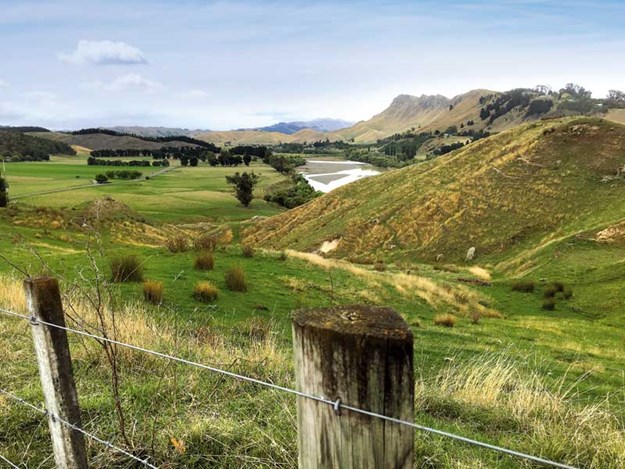 |
A view from the road over the wide Tuki Tuki valley and the hogsback of Te Mata Peak |
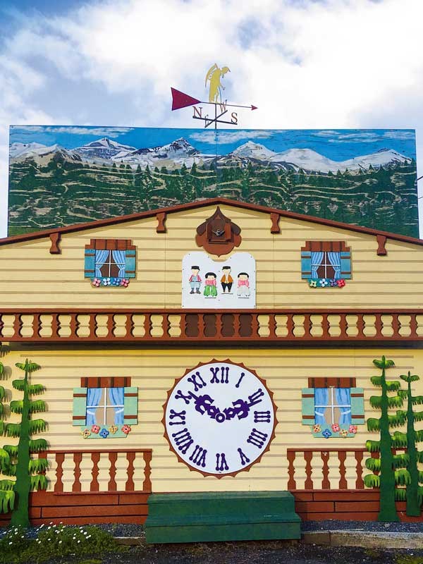 |
The Clock Shop in Waipawa |
It wasn’t hard to find the Clock Shop in the middle of Waipawa. Its fascinating façade depicts a cuckoo clock. I am sorry we didn’t stop there. Apparently, as well as doing repairs, it has a great collection of clocks and watches.
Instead we drove past and in the gauzy afternoon light turned onto Ben’s road-less-travelled which would lead us through the hills to the beachside hamlet of Kairakau.
It was a less than glorious day.
On either side of the valley, foggy rain blurred the rounded rumps of low hills. We were driving slowly behind a beat-up ute. Four soggy farm dogs peered at us from the tray.
Back country beef and sheep farming is still the life stream of this district of southern Hawke’s Bay, which is dissected by the Tukituki River flowing from the Ruahine Ranges to tip into the sea at Haumoana.
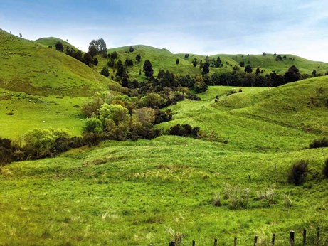 |
Typical Hawke’s Bay countryside |
Vast areas of land, expansive woolsheds and lavish homesteads attest to the prosperity of the huge stations that defined this coastal country in the good old days. Many have now been broken into smaller holdings.
If we’d turned left at Patangata and driven Middle Road we would have followed an old Maori route along the river. Instead we crossed its shingle bed on what was once the longest concrete bridge in the southern hemisphere and headed towards Kairakau Beach.
There is a small black-painted tavern at Patangata and not much else. A pair of bleached deer antlers is pinned to one of its eaves. At weekends, it’s apparently a lively meeting ground for town and country, but on that drizzly day it looked forlorn and deserted.
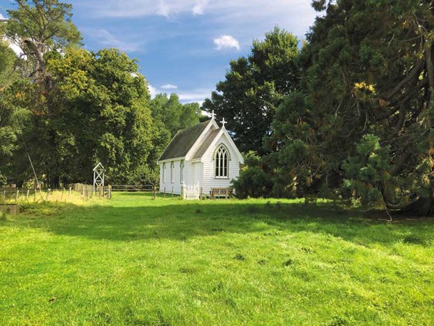 |
The fully restored Mangakuri Station church (1887) |
A little further brought us to Elsthorpe, a tiny settlement of around 200 souls with a church and school. Hugging its boundaries are stands of lofty native trees that are remnants of the podocarp forest that covered the area before tree fellers set to with their axes.
The best discovery of this part of the drive was along a shingle side road where, across a field of lilies that skirted the Mangakuri Station homestead, we found a charming little gothic church (1887).
The bell in a separate belfry once called the farmhands working this vast estate to Sunday prayer. The church has been re-piled and restored and is reportedly still occasionally used.
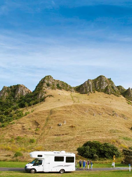 |
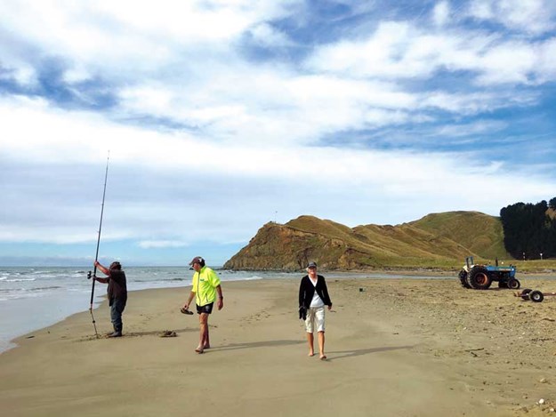
The great cliffs at Karaikau dwarf everything beneath them |
Towards the coast the ridges and rumples of the land rise higher and higher into big, bold country that reduced us to the size of beetles. And at the coast they culminate in great upthrusted cliffs that overshadow a cluster of baches on the flat terrain at the edge of a long lagoon.
A small campground was crowded with the caravans of weekend fishermen but
a little further along the estuary there’s a freedom camping area close to the beach and overlooking the bay.
 |
Kairakau Beach in a benign mood |
The drizzle had turned to serious rain. Water cascaded off the awning to form puddles the colour of hot chocolate. We couldn’t imagine that next day we would wake up and walk along the sea-wrinkled sand in sunlight.
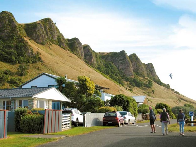 |
Bluffs loom over holiday homes at Kairakau |
The sky was cloudless and so brightly blue it looked solid. Kairakau is a beach with character. The driftwood piled against the banks of mink-grey sand indicated that it’s less hospitable in wild weather.
We continued our drive, retracing our steps to Elsthorpe and then turning onto Kahuranaki Road as it unravelled through pretty, rolling countryside shrouded in trees, and then skirted the base of Mount Kahuranaki, whose great bulk, in contrast, was completely naked.
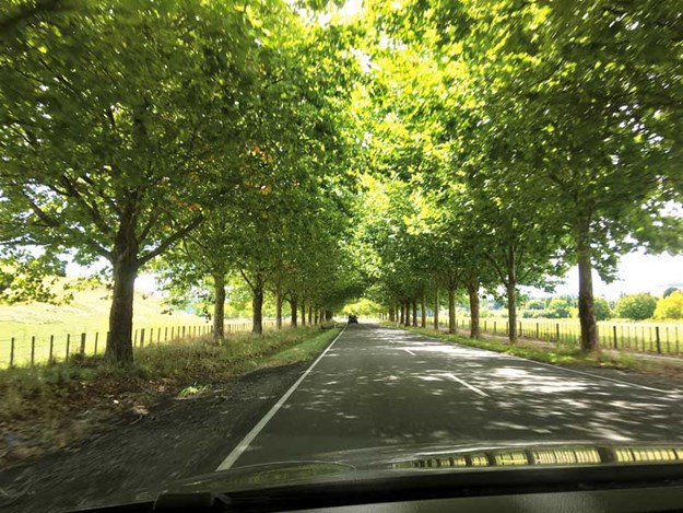 |
Driving through an avenue of oak trees at the foot of Te Mata Peak |
Kahuranaki is the highest summit in Hawke’s Bay, towering over coastal peaks, including its neighbours, Te Mata Peak and Mount Erin. But Te Mata’s ‘Hogs Back’ ridges make a grander gesture as they fall to the Tuki Tuki Valley in a dramatic sweep.
Red Bridge, for it once was, leaps the river at this point but we determined to continue following its course on its eastern bank to Haumoana. Just before Red Bridge was a quirky little cafe in what looked at first to be a rusting shipping container.
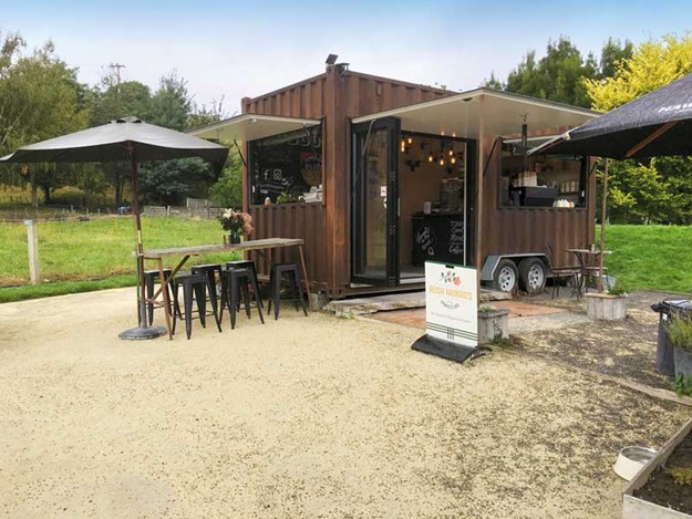 |
A shipping container houses the quirky Red Bridge Coffee |
Red Bridge Coffee turned out be quite a classy joint. The coffee was excellent and manager Melissa Campbell sells interesting snacks like cakes made by Ash Scott organics, and Doctor Feelgood Frozen Pops.
At first the narrow Tuki Tuki Road snakes north beside the river, affording long-range views over the valley and distant vineyards, and then rolls on through some classical Hawke’s Bay countryside.
On the flanks of hills, poplars stood in stiff battalions, willows wept in the gullies, and clumps of exotic trees obscured the farmhouses tucked away in the folds of the landscape. The hilltops were still burnished from the long summer.
And then we reached the Heretaunga Plains. For me this was no longer a road-less-travelled. When I grew up in Hawke’s Bay, our farm was bordered by the Tukituki River’s stop bank. I rode my horses beside the river and, in summer, swam in its slimy waterholes.
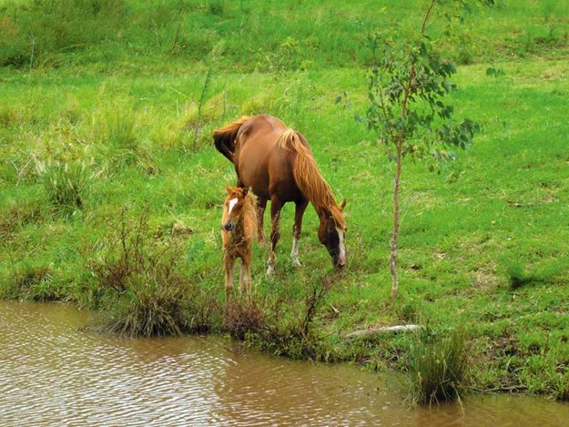 |
Pleasant country scenes enliven the drive |
Near the estuary, close to where it merges with the Pacific Ocean, the river is crossed by Black Bridge (because it once was). In a fit of nostalgia I made Bill pull up on the side of the road and I walked along the concrete replacement and hung over the rail.
Low channels of water were sliding lazily along the river’s stony bed towards the sea. Up from my memory swam a vision of wild-eyed cows that desperately struggled for buoyancy as they were swept down-river and out to sea in one of the Tukituki’s churning flood waters. My father told me most of them swam back to shore.
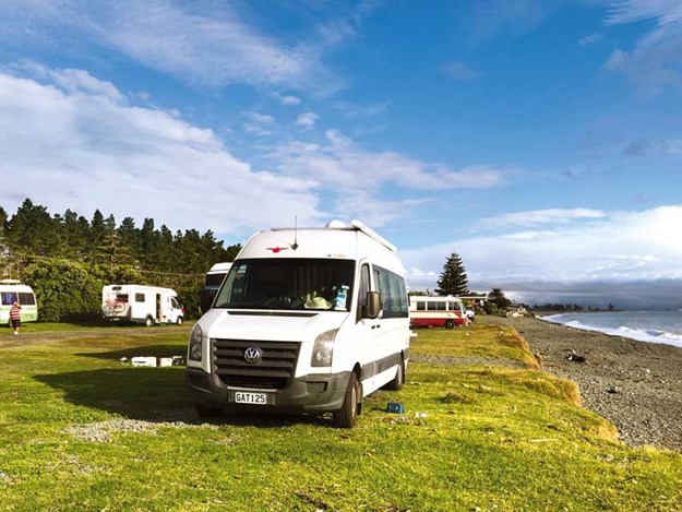 |
The free camping area at Haumoana Beach |
I’ve always hoped so. We parked for the night in the large free camping area on Haumoana’s sea-battered shore and dined on fish and chips bought from Cape View Takeaway next to a small pub known as Gannets. Ben was right about the drive. It was beaut out there.