Pamela Wade leaves the rat race far behind as she traverses the Pacific Coast Highway out of Gisborne, finding tiny treasures and some breathtaking landscapes.
A dozen each of horses and cattle, a lone bull, several handfuls of sheep, six turkeys, five peacocks, four pigs, a scattering of chickens and ducks, a rooster, a cat, a couple of dogs, a dead seal and a goat in a coat. That was the tally for loose animals encountered on just one day’s drive along the Pacific Coast Highway that loops around East Cape. For those who see this as a hazard rather than a diverting novelty, there are plenty of ‘Wandering Stock’ warning signs along the road, which is not one most people would be tempted to speed on anyway. The 484-kilometre round trip is winding, narrow and frequently hilly, features that do not seem to hamper the hulking logging trucks that dominate here. So, loose livestock, a long and challenging road, and big trucks – why would you want to drive this route?
The scenery, that’s why. Tairāwhiti is probably the most remote part of the country accessible by road. As such it feels like a step back in time to simpler days where nature dominates, sun and tide ruling the lives of those who live here. Though it was one of the first parts of Aotearoa to see people, its inconvenient geography meant that it was largely ignored by European colonists, so the Māori way of life was able to continue relatively undiluted for centuries. Even today it feels refreshingly different: simpler, more colourful, friendlier.

Into The Countryside
Heading north out of Gisborne on SH2, wine country dominates, with rows of vines stretching away on both sides, as neatly cultivated as the close-cropped green paddocks of horses, sheep and cattle. Following the courses of several rivers, the road winds through bush-clad hills, and it’s good to take a break from all the corners at the historic Tauranga Bridge in the Waioeka Gorge. The sole remaining timber harp suspension bridge in the country, it was built in 1922, and is an impressively solid structure that still bounces underfoot. Along a pleasant loop walk from here, taking about two hours, there are panels describing the very real challenges facing returned servicemen from WWI, trying to make a living from farming.
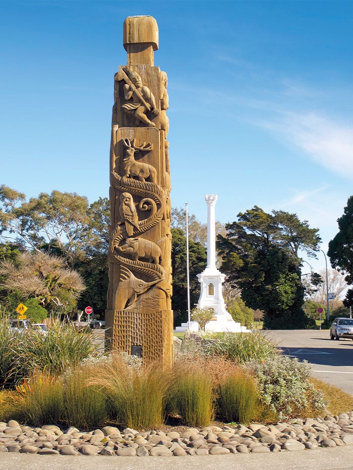
Now into kiwifruit country, the next stop is the attractive little town of Ōpōtiki, sitting on the edge of the Bay of Plenty and one of the few in Aotearoa where Māori dominate the population. Colourful carved pou decorate the streets, and the peaceful-looking St Stephens Church is the location of an horrific and fateful encounter between its missionary minister and Hauhau extremists in 1865. Less chilling is the little museum, despite its unexpected stuffed brown bear.
To The Edge
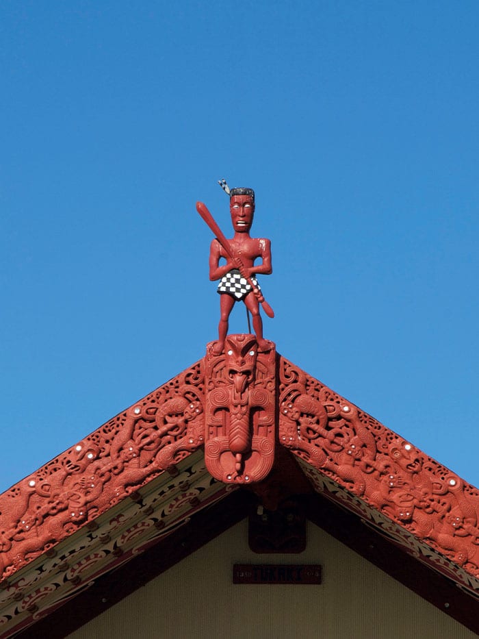
The Pacific Coast Highway now leads out of town around the edge of the Cape. It winds along the coast, past inviting sandy beaches where dotterels dart about, and through fields of maize. Out to the left is the sinister shape of Whakaari White Island, a plume of steam from its volcanic vent trailing away downwind. The road is quiet, so you can hear skylarks and sheep. Each little settlement has its marae, with an impressively decorated gateway and wharenui. Look out for the chequerboard shorts on the tekoteko at Te Kaha. Horses now become more dominant than cars, grazing loose at the side of the road, or pattering along unshod, ridden bareback by men in gumboots and bush-shirts. One stands dozing in someone’s front yard, saddle hung over the fence, its rider presumably visiting inside. Quad bikes are popular, splashing through rivers, ignoring the long bridges.
Raukokore is an obligatory stop, for its picturesque little church. Isolated beside its pōhutukawa tree on a rocky promontory, it’s propped up against gales by timber buttresses. The coloured light from the altar window has fallen on the pale kauri floors and pews here for over 100 years. It’s bright and welcoming, to both people and selected beasts – a fishy smell rises from penguins allowed to nest under the floor, beneath the baptismal font, but it’s requested that the door be kept shut to deter marauding possums.
Waihau Bay comes next, where local man Taika Waititi’s much-loved movie Boy was filmed, and fans will recognise some of the locations. Cape Runaway is notable too, for being where the waka Tainui and Arawa first landed from Hawaiki. Cutting inland across the tip of the Cape, passing the lovely cascade of Waihirere Falls, a short walk from the road, the sea begins again at the unprepossessingly named Hicks Bay. A little settlement of houses is dwarfed by the long stretch of empty sand edging this lovely bay. Here or nearby Te Araroa are good places to break the journey, guaranteeing a quiet night and super-fresh fish at the takeaway.
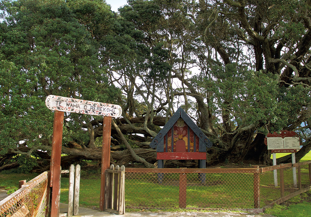
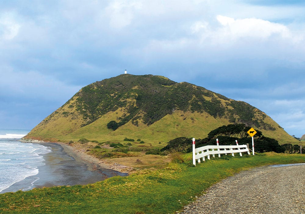
Te Araroa is famous for Te Waha o Rerekohu, its huge, ancient and sprawling pōhutukawa, the world’s biggest and probably, at 600 years, its oldest. Notable too for its novelty is the stern ‘No horses’ sign at the entrance to the playground. This is also where a side road leads away to New Zealand’s easternmost point, the actual East Cape, first to see the sun. The road is one lane, only partly sealed, with horses and cattle grazing freely along it, and occasionally edges around bluffs, but the reward for negotiating it is… a long climb up about 800 steps. At the top, the real reward is to stand beneath the lighthouse and gaze out past East Island across that expanse of sea. It’s a genuine marvel that people make this trek in the pre-dawn dark to watch the day break, and thereafter boast about it forever.
Famous Tolaga Bay Wharf
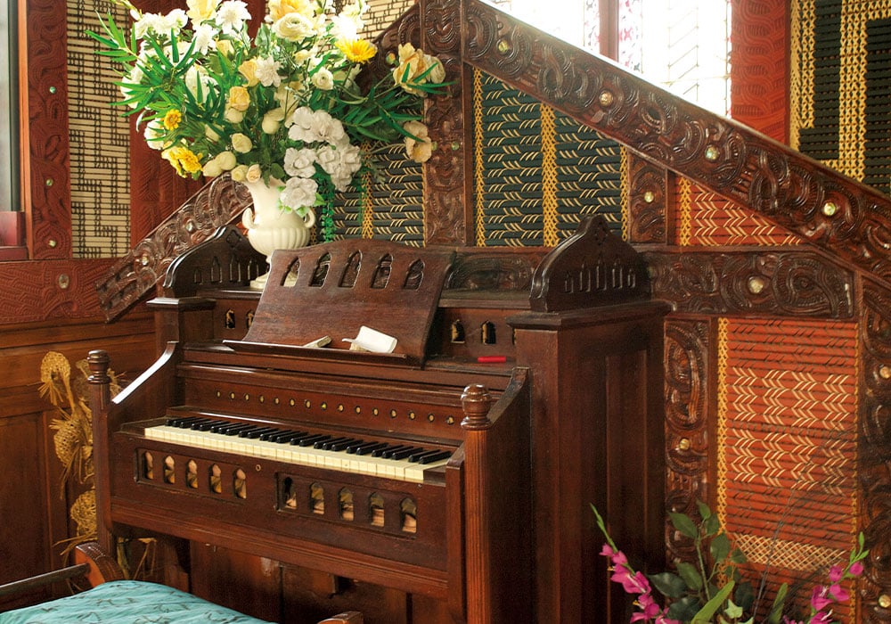
Back on the main road, the next treat is much more accessible. St Mary’s Church at Tikitiki sits on a hill above a sharp bend, and inside it’s a riot of Māori decoration, from the woven tukutuku panels on the roof to the candlesticks on the altar. Wherever you look, there is carving, painting and weaving, and it’s genuinely impressive. It’s also historic, with strong connections to Sir Āpirana Ngata, who encouraged the decoration as a way of preserving and promoting Māori art and craft.
The road now heads back towards Gisborne, the landscape dominated by the rugged Raukūmara Range, topped by Mt Hikurangi, which is sacred to Ngāti Porou. On the coastal side, though, there are many temptations for detours. Side roads lead down to peaceful beaches, like Anaura Bay and Waihau Bay. Right on the main road, though, is Tolaga Bay, with its famous 600 metre-long wharf. It’s well worth the half-hour walk to the end, if only to peer at the catches of the people inevitably fishing from it.
More eco-friendly is the reef paddle closer to Gisborne offered by Dive Tatapouri. Here, stingrays and eagle rays have been habituated to human contact, and it’s a genuine thrill to pull on waders and walk out at low tide to where they gather, hungrily waiting for a feed.
And that’s the end of the journey: Eastland, circumnavigated. It’s not the end of the interest, though. Tairāwhiti Gisborne itself has lots of treats, from lolling on a beanbag in its boutique cinema, to eating and drinking wonderfully well, to poking around its well-presented little museum. Then climb up past the WW2 gun emplacement to the top of Kaiti Hill for wonderful views in every direction, and choose where you’ll go next.