Heather Whelan spends a few crisp days on a coastline graced with parks, beaches and a remarkable garden.
The Pōhutukawa Coast must look magical in summer when the cliff tops and beaches are bright with red blossoms; even in winter, my partner Malcolm and I were entranced by the lovely views. The area is south-east of Auckland city, about 20km from Manukau. Around Whitford it’s horse country, with stud farms and stables tucked into the rolling countryside. Settled by Europeans in 1843, the village retains a historical charm. What was once the general store, built in 1910, is now The Stables, a country pub and restaurant. We were tempted to stop, but daylight hours are short in winter and we wanted to explore nearby Ayrlies Gardens.
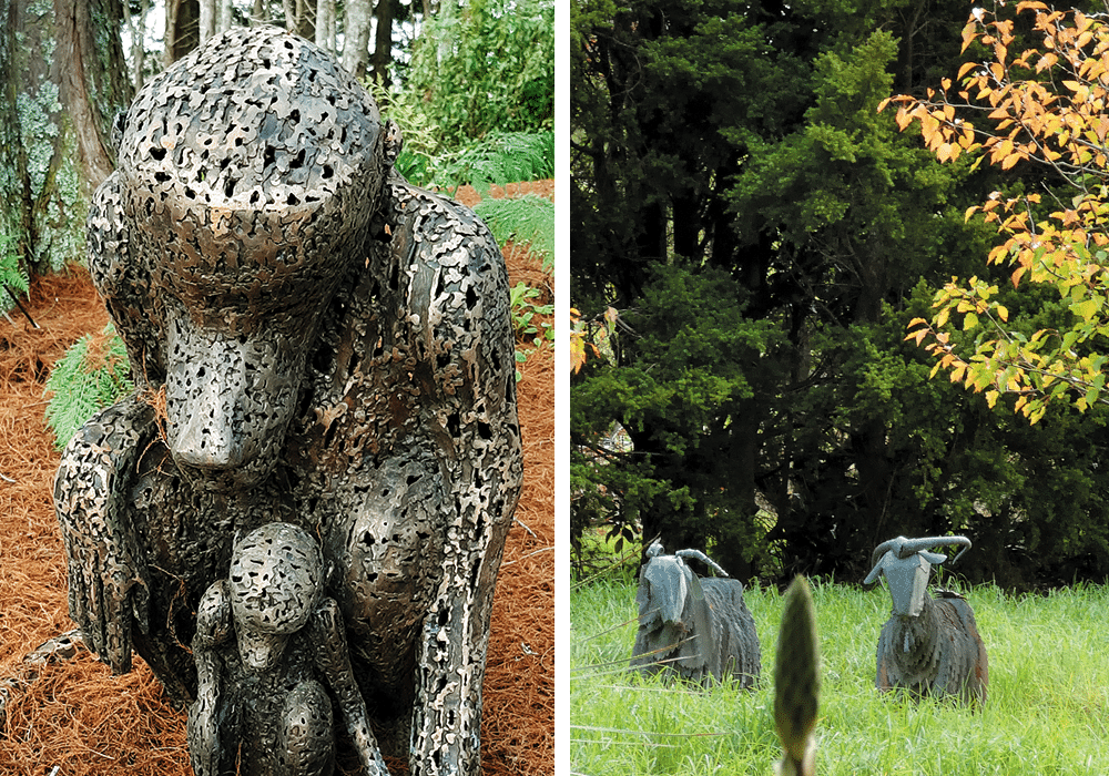
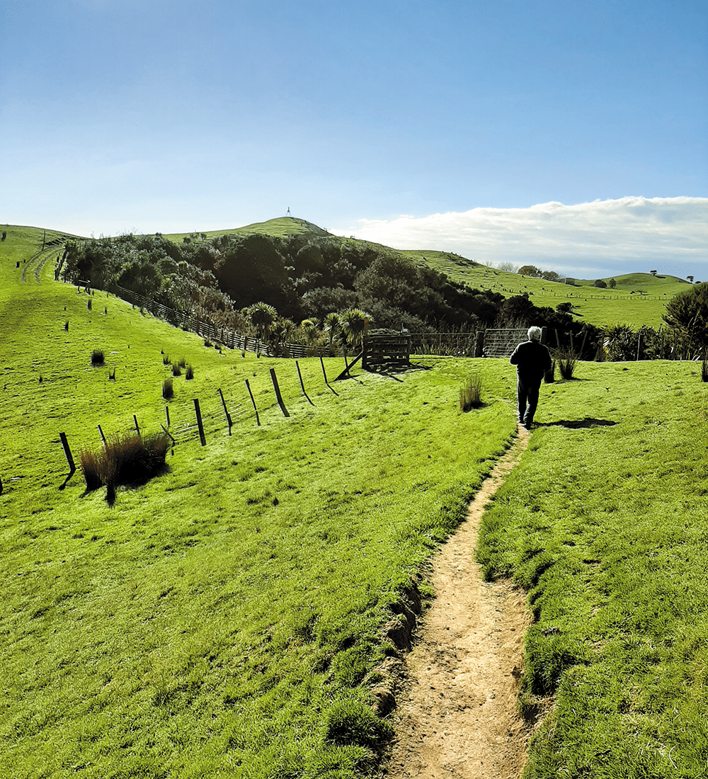
Ayrlies garden
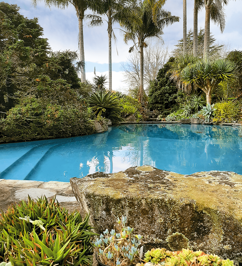
It’s hard to believe that in the 1960s, Ayrlies (named after the family farm in Scotland) was little more than a house in an empty paddock. Now the 4.8 hectares are a Garden of International Significance, created by the owners, Beverley and the late Malcolm McConnell. Surrounding the house are lawns with mature trees, ponds, waterfalls, rockeries, walkways and steps, arbours and plantings in profusion. Areas of subtropical plantings are contrasted elsewhere by old roses, clematis and perennials. Around every corner we found a surprise. There were sculptures that ranged from classical Greek to corrugated iron goats. There were swathes of early daffodils beneath the trees in one corner, while rhododendrons splashed bright colours in another. We took a break in the ‘Sitooterie’, which we learned is a Scottish phrase for a place to ‘sit oot’ and relax in. From here we had views down to the wetlands that border the estuary.
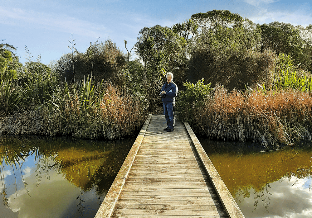
Since the millennium, the swamp flats at Ayrlies have been transformed into wetlands, with man-made lakes and more than 15,000 native seedlings planted. We followed the Gingko Track and spent another hour on the pathways and boardwalks that circle one of the lakes. There was plenty of aquatic birdlife, the black swans in particular looking majestic as they drifted across the water.
It was the network of waterways and wetlands that led to Māori settling in the area; the Turanga Creek gave access as far as Whitford. Later European settlers followed the same route – there was a passenger boat service and mail delivery from Auckland from 1848 until 1927.


Ōmana
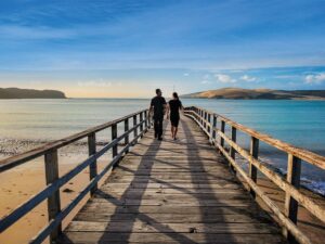
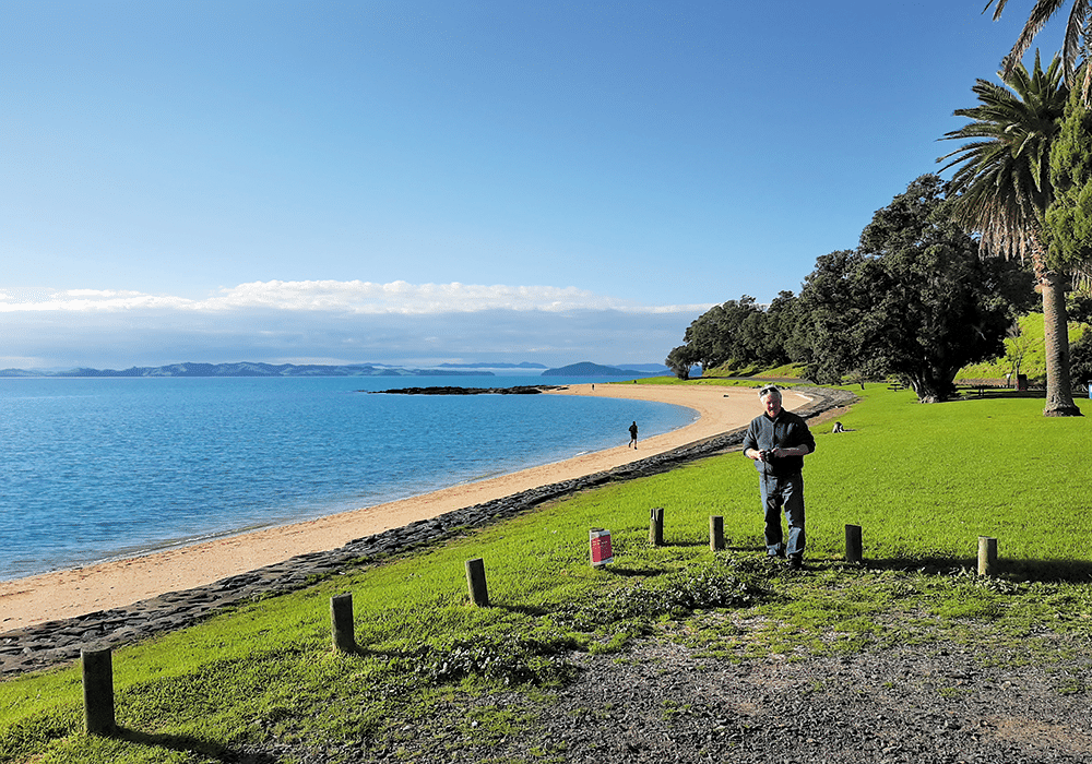
Luckily for us, roads have taken the place of water travel and we could easily drive to our overnight destination, Ōmana Regional Park near Maraetai. The park’s name derives from the pā, O-Manawatere, where Manawatere settled after his arrival from Hawaiki. A mission station and farm were established in 1837, and Ōmana was worked until 1970 when Auckland Regional Council purchased the land. There’s 40 hectares of parkland to explore here, from mangrove mudflats and sandy beaches to regenerating forest and open grassy areas. We parked at the cliff-top campground, where gaps in the pōhutukawa trees gave us views across the Hauraki Gulf to Rangitoto Island. A walkway runs from Beachlands to Maraetai, and there are other walks within the park. We just wandered along the cliff tops at sunset, enjoying the view.


Maraetai
Maraetai means ‘meeting place by the sea’, and it’s easy to see why people have been drawn to this beautiful area. Sandy Maraetai Beach, with views across to Waiheke and Ponui islands, was a great place to stop and admire the scene the following morning, before we continued on to another regional park, Duder, on the Whakakaiwhara Peninsula.
A walk through history
The peninsula has a long history, dating back to the arrival of the Tainui canoe in the 1300s. The peninsula and surrounding area was purchased by Thomas Duder in 1866, and the family farmed the land for the next 130 years until it was sold to Auckland Regional Council in 1994. The Duder family retained some property at Umupuia Beach, including the old homestead, ‘Rozel’, named after Jannette Duder’s childhood home in Guernsey. The residence was built after an accident with an explosive sent a large stump flying into the original cottage, destroying the dining room table. Mrs Duder, who had been inside the cottage, was placated by her husband offering to build a new home.
We walked the 4.3km Farm Loop Track, one of four walks at Duder. This took us steeply uphill and then through rolling farmland with great views of the Hauraki Gulf islands. Below us we could see sandy Umupuia Beach and the Duder homestead. As the Farm Track looped around, another track led to Whakakaiwhara Pā and the Tainui anchorage. The travellers from Hawaiki went ashore to gather food – hence the name Whakakaiwhara, which means to eat (kai) the edible bracts (whara) of the kiekie vine. We continued on our loop walk, looking across to where kauri was sent down the hillside to waiting ships at Malua Bay, and to the bird breeding areas of Duck Bay and the adjacent wetlands.
Clevedon and beyond
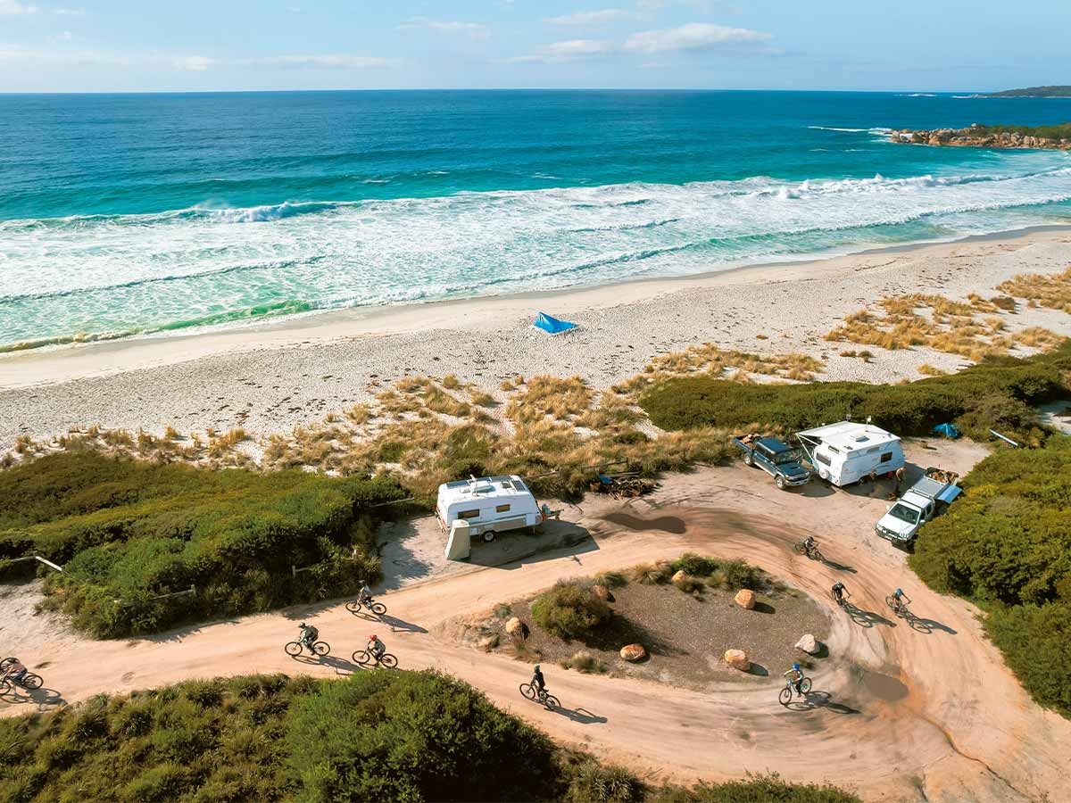
From Duder the road took us inland to Clevedon, established in 1866 and named after the English town. Clevedon is noted for the farmer’s market it holds every Sunday. Unfortunately we passed through on a weekday, so will have to return to check that out. For future reference we decided to visit two other regional parks further along the road – Waitawa and Tāpapakanga. All these parks have overnight camping for self-contained motorhomes, and we have obviously only scratched the surface of what the area has to offer.
Waitawa is about 10 minutes’ drive from Clevedon. Like Ōmana and Duder, the park has a variety of walks and beaches. The area was once a testing site for explosives used in mining and construction. Ships carrying the explosives docked at the wharf at the end of the road, now a favourite spot for fishermen.
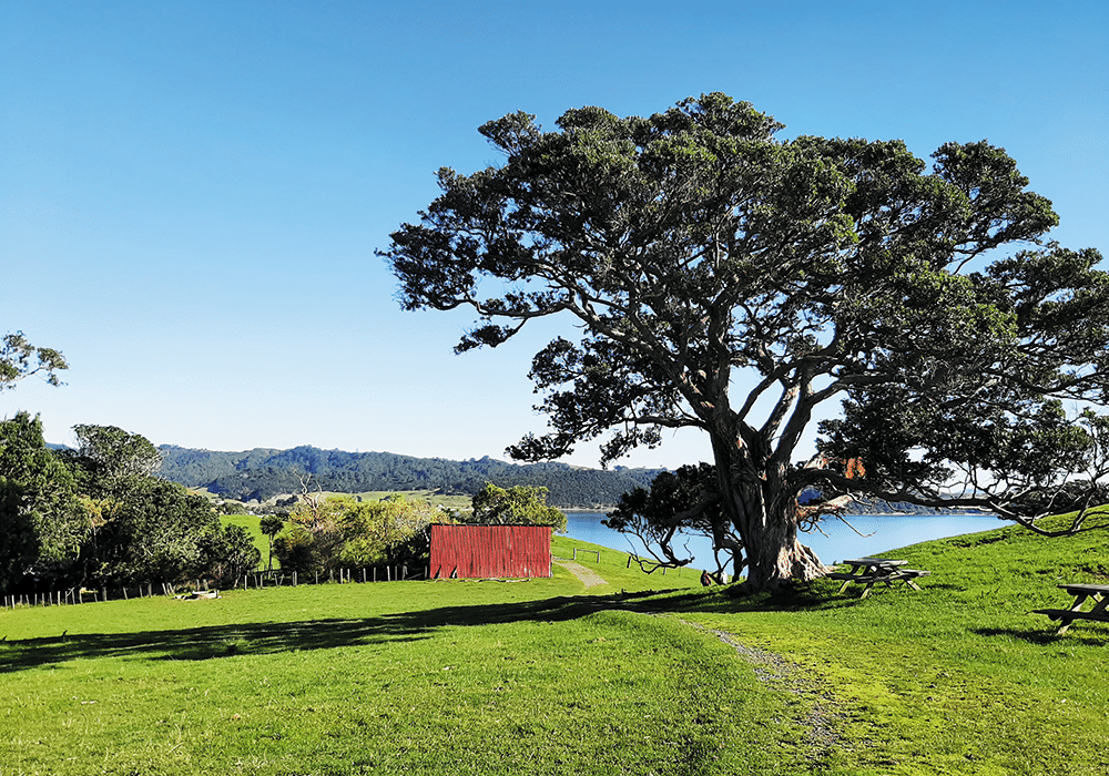

Like Duder, Tāpapakanga Regional Park was once a farm, owned by a settler family. James Ashby settled at Tāpapakanga Bay in 1899, and he and his wife raised 14 children in the cottage that stands just up from the beach. In 1990 the family sold the land to Auckland Regional Council for the creation of the park.
There’s a pā site along the beach – Māori have a long history here. To celebrate this, two pou whenua are installed at the park entrance. Unusually, some of the carving on the pou depicts James Ashby holding an axe. Local Māori worked in partnership with Ashby, selling timber to Auckland.
We’re definitely going to have to spend more time on this stretch of coastline, hopefully in summer when the pōhutukawa are blossoming.

More Information
- Booking, maps and information about Auckland Regional Parks: aucklandcouncil.govt.nz
- Other useful websites: pohutukawacoast.co.nz; ayrlies.co.nz; clevedonfarmersmarket.co.nz