 |
|
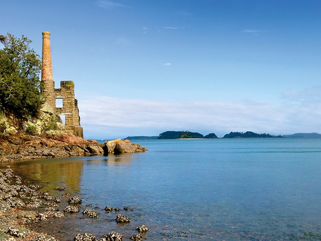
The copper mine engine house seen from Dispute Cove
|
Kawau Cruises’ Royal Mail Run Cruise is apparently the largest mail run by water in the Southern Hemisphere, but there were only five packages to deliver the day the catamaran headed from rainy, blustery Sandspit along the Matakana River and out into choppy Kawau Bay. The woman at Sandspit Wharf’s Kawau Island Information Centre told us the weather on Kawau can be totally different to Sandspit. I hoped she was right.
Kawau Island is 8km long and 5km wide, comprising approximately 5000 acres. All of it is in private ownership, except for 10 percent, which is owned by DOC.
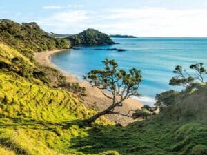
With no mail for quiet, serene Vivian Bay we just motored in for a look, arriving around half an hour after boarding. It was cool, but there was no rain. Dwellings were sparse, dotting the land above a whitish sand beach with a few peeking between bushes higher on the hill. Wharves at either end of the bay jutted out into the waters; anchored launches were empty.
 |
|
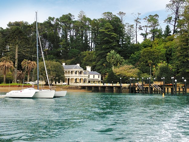
The elegant Mansion House
|
North Cove
Heading south, we cruised to North Cove, where numerous wharves protruded from the land like bones on a fish spine. Apparently there are close to 100 private wharves on the island, the only access to properties. With a resident population of around 80, North Cove, South Cove and Bon Accord Harbour are the most populous areas. The ‘roads’ on the island are dirt or shingle and run from Mansion House Bay to Schoolhouse Bay, and onto South Cove. We were told there are no cars; golf carts are the mode of transport.
A kitset table was delivered to the wharf at Camp Bentzon, which was almost camouflaged in North Cove’s bush. It’s a facility that can be booked by schools, youth groups, clubs, etc, providing a fitness trail, Burma trail, confidence course and boats for kayaking, sailing and rowing. From the wharves, a few single, rail-looking lines or steep steps led to homes perched on hillsides. All was quiet; boatsheds closed up, large two-storied homes mingling with basic-looking baches where curtains were closed at their two windows which looked out to sea.
Twenty minutes motoring from Vivian Bay the catamaran reached Mansion House Bay on the western side of the island. A few passengers disembarked. We stayed on-board to see more of the island.
School House Bay
Cruising back to Bon Accord Harbour we entered, heading for sheltered School House Bay, which has one of only two public wharves on Kawau. Buildings clustered the inlet, a few dotted the ridgeline. Locals disembarked, taking mail for one of the bay’s inhabitants. The old schoolhouse, now privately owned, was easily spotted with its turquoise roof. Our captain told us of a bad weather tragedy, when 12 of 15 children being rowed to school drowned. The school was closed not long after.
Bon Accord Harbour
Back out in Bon Accord Harbour we heard of long-ago warring Māori tribes and cannibalism on the island. Further into the enclosed harbour, a package was delivered to an anchored yacht, and a couple dropped off at the two-storey, steeply-roofed Lidgard House on the harbour’s northern side. Backdropped by bush, this grand-looking building can be rented from the Royal New Zealand Yacht Squadron and sits along from the white, two-storey Kawau Boating Club in Smelting House Bay.
Mansion House Bay
On the return to Mansion House Bay we learned of Mansion House’s history. Once the one-storey, 10-room residence of the island’s mine superintendent, Governor George Grey purchased it in 1862 and went on to enlarge it. Exotic trees, including palms (recently poisoned) and an orchard were planted, farms were established and a dairy built so that the island was self-sufficient in the way of food. Grey had wallabies, antelope, monkeys, kookaburras, emus and peacocks imported to the island, as well as zebra, which supposedly pulled him, in a carriage, around the island.
We disembarked at the jetty leading to Mansion House around 11.45am. A traditional Kiwi barbecue lunch, with a choice of salmon or steak, is usually served on board for those who have pre-purchased it. Being mid-winter with few passengers, we were on a smaller boat so the meal was served at the café, which was opened for the occasion – it’s closed during winter. We took our own lunch so we had time to do one of the island’s walks.
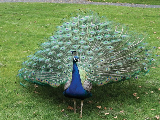
Peahens and peacocks greeted us, looking for food, as we headed along the wide, gravel path passing by closed-up Mansion House. A rotunda in the grounds, a short distance behind the house, is worth stopping at to read the information boards on Grey, Mansion House, and the island’s wildlife, vegetation and mining era.
 |
|
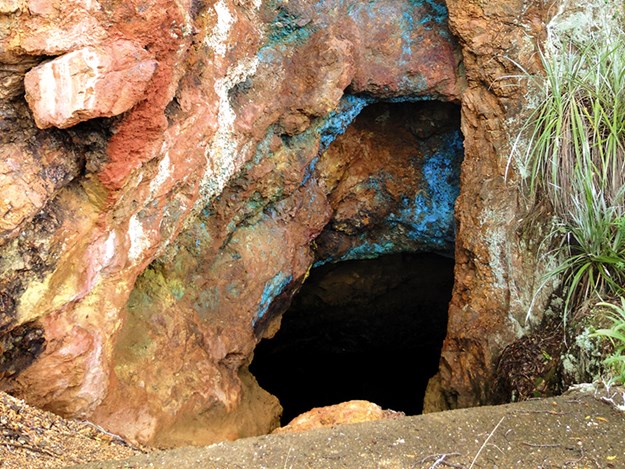
Copper sulphate on the shaft opening at the copper mine
|
The Walk to the Copper Mine
A murkily green lake lay near a gate where we began the walk to the historic copper mine. Not far along, a five-minute track leads to Ladys Bay, once a swimming spot for ladies only. From there, Momona Point, a headland with views back to Sandspit and Snells Beach, is a 20-minute walk away.
We headed uphill through pine forest fringed with punga on wide, sparsely gravelled dirt Sir George Grey Coach Road. I peeked into weta ‘hotels’, small wooden boxes with grooves cut out for weta to live in on the sides of trees. None were home. Coppermine Lookout gave a first glimpse of the copper mine and South Cove’s calm waters. Opposite the lookout, Redwood Track led back to Mansion House, via Two House Bay, a 45-minute walk where brick foundations marking the old dairy site and remains of two cottages, and a large Redwood, could be seen.
We continued on Sir George Grey Coach Road. A few metres along we passed, on the left, a dirt road that goes by the island’s cemetery and leads to Schoolhouse Bay, a 35-minute walk away.
The coach road was thickly covered with rusty-coloured pine needles further on; peaceful with barely a bird to be heard. It seemed we were the only ones walking the island. On the Coppermine Track, under a canopy of manuka, we thought we saw a wallaby. I did see a rat. Descending to Miners Bay, we came across some old mine workings and, with a torch, investigated a short tunnel. Rock walls were black, red, orange and a bluish-green, the colour of mould.
Miners Bay and the Copper Mine
The rock block remains of the copper mine engine house stand on the red and grey rocky seashore at Miners Bay. Walls are only partial but its red brick chimney looked new, perhaps restored. An old rusting boiler lay on its side outside a fencedo shaft where, at its opening, rocks looked as if they’d been graffitied with turquoise paint. But the vivid colour was natural, copper sulphate. Incredible.
Orange and yellow kayaks were drawn up on the beach near distant South Cove wharf, where houses dotted the ridge line and the sun glinted off a roof. Cormorants perched in trees looked like white paper caught in the branches.
On seawards rock faces I found one coated emerald green – maybe copper chloride, my companion informed me.
 |
|
Peacocks can often be found roaming around the Mansion House
|
Returning to Mansion House Bay
With the tide out, we crunched our way northwards along the colourful, thickly layered pebble beach of Dispute Cove heading back to Mansion House Bay. We climbed to the flat section above the beach at Dispute Cove where a village and school once stood. From Miners Track, used by long-ago miners to reach the copper mine, we looked down into the cove’s clear turquoise waters and then followed the bush track back to Coppermine Lookout. Ladys Bay Track can be taken from here, and it would have given us a chance to see Ladys Bay, but we didn’t discover this until afterwards. Instead we returned to Mansion House via the coach road. Two hours after leaving, we were back with 10 minutes to spare for the 2pm ferry.
Mansion House, supposedly closed from June until the end of August, had opened. There wasn’t enough time to buy a ticket and tour it but I took a quick peek in. The smell of furniture polish lingered in a dim room with dark wooden floors and richly decorated with Victorian-style, red velvet sofas and wooden furniture. A staircase led up… We should have stayed and caught the 4.30pm ferry.
 |
|
Leaving South Cove’s public wharf
|
The Return Cruise
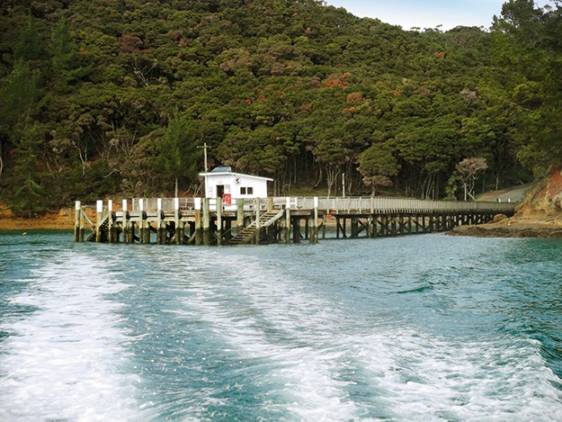
Back on board we cruised to South Cove, passing by sandy Ladys Bay and the copper mine engine house. The captain informed us that copper was discovered on Kawau in 1844, after manganese mining began. Shafts go underground 60 feet and into the hills, the engine house built to pump water from the mines. Around 300 people lived on Kawau during the copper mining era, which ended about 1855 when it became too difficult to extract the copper ore, most of it being below sea level.
The last of the mail was left on a trolley at South Cove’s public wharf. No-one was in sight; most homes or baches nestled further into the cove. Leaving the blue skies of peaceful, green Kawau Island behind, we headed back to grey-looking Sandspit. Indeed the weather had been different; Kawau has its own micro-climate. We didn’t see a drop of rain.
- For a brochure on the island: doc.govt.nz
- The Royal Mail Run Cruise departs from Sandspit Wharf, near Warkworth (approximately 1 hour’s drive north of Auckland) daily at 10.30am.: kawaucruises.co.nz
- Ferries to the island operate daily: kawaucruises.co.nz
- For water taxis: kawaucruises.co.nz or haurakiexpress.co.nz Nearby camping facilities are available at Sandspit Holiday Park: sandspitholidaypark.co.nz
- For Auckland Regional Park camping grounds at Tawharanui, 1181 Takatu Road, Tawharanui Peninsula see: aucklandcouncil.govt.nz/parks
- For freedom camping at Snells Beach West and Snells Beach East see: nzmca.org.nz
Find motorhomes, caravans and RVs for sale in NZ

